-
Hello, please take a minute to check out our awesome content, contributed by the wonderful members of our community. We hope you'll add your own thoughts and opinions by making a free account!
You are using an out of date browser. It may not display this or other websites correctly.
You should upgrade or use an alternative browser.
You should upgrade or use an alternative browser.
Pattern November 2022
- Thread starter RBR71
- Start date
- Status
- Not open for further replies.
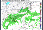
Finished up the big rain event with 2.63” of rain! Not bad
Drizzle Snizzle
Member
that's more rain than I've seen in the last 2 months combined !Finished up the big rain event with 2.63” of rain! Not bad
Brent
Member
Avalanche
Member
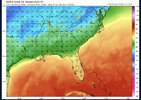
Yes, as Mother Nature is programmed to know where I-85 is.I swear these models have to be programmed to know where I-85 is.
Avalanche
Member
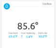
Its soupy out there.Dewpoints near 70 in Charlotte and Atlanta. This is nuts !
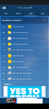
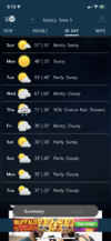
I feel you!Winter is comingView attachment 123492
Sky86
Member
I'm assuming the EURO didn't have this solution?
Sent from my iPhone using Tapatalk
Drizzle Snizzle
Member
Those are some way average below temps even for Dubuque standards. Average high next Saturday is 47 in Dubuque.I feel you! View attachment 123495
LickWx
Member
Yeah, it seems our highs are either 20 degrees above or 20 degrees below normal, nothing in betweenThose are some way average below temps even for Dubuque standards. Average high next Saturday is 47 in Dubuque.
Iceagewhereartthou
Member
Man, just had to turn the AC back on. Had the windows open but it's way too muggy out there on top of getting up to 76 in the house this afternoon. Can't wait for the first front Tuesday night!
BHS1975
Member
Man, just had to turn the AC back on. Had the windows open but it's way too muggy out there on top of getting up to 76 in the house this afternoon. Can't wait for the first front Tuesday night!
Yeah really. It's like the muggies can show up anytime these days.
Sent from my iPhone using Tapatalk
If WX South is correct, that’s something you could see a lot this winterYeah, it seems our highs are either 20 degrees above or 20 degrees below normal, nothing in between
Usmeagle2005
Member
I’m just wondering how we went up a degree from the 7 pm observation of 70 to 71 at the 8 pm observation.?? weird day of weather. Dews going up I guess.
J1C1111
Member
Always
Had to turn our ac on today to. Feels like August out there. Front can't get here fast enough.Man, just had to turn the AC back on. Had the windows open but it's way too muggy out there on top of getting up to 76 in the house this afternoon. Can't wait for the first front Tuesday night!
Brent
Member
If WX South is correct, that’s something you could see a lot this winter
Its a staple of La Nina tbh which apparently we can't get rid of. Been like that here so far... This upcoming cold snap is the first one that lasts more than a day or two
D
Deleted member 609
Guest
Agreed. It really has been something that’s been missing these last couple of years.Its a staple of La Nina tbh which apparently we can't get rid of. Been like that here so far... This upcoming cold snap is the first one that lasts more than a day or two
- Joined
- Jan 23, 2021
- Messages
- 4,603
- Reaction score
- 15,199
- Location
- Lebanon Township, Durham County NC
LukeBarrette
im north of 90% of people on here so yeah
Meteorology Student
Member
2024 Supporter
2017-2023 Supporter
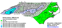
Ive seen it snow 2 inches on Nov 17th here in Randolph County. It was gone before sundown. Cant remember year late 90's early 2000s. So it has happened, accumulating snow pre-Thanksgiving. Had killer rates for like 90 minutes
- Joined
- Jan 23, 2021
- Messages
- 4,603
- Reaction score
- 15,199
- Location
- Lebanon Township, Durham County NC
BHS1975
Member
Yeap I remember that one. Stuck to the trees good.
Sent from my iPhone using Tapatalk
Brent
Member
NBAcentel
Member
Get ready for a legit, -EPO induced cold shot with CP flow as the pac jet speeds up/extends some. Pretty cold look. Sucky climo for snow, but I wouldn’t sleep, especially the high country. Problem is, these pattern have a tendency to retrograde to a +TNH/-WPO/-PNA over time as the block retrogrades. We’ll see. Need a consistently extended/sped up pac jet to
Keep it going like last jan. Don’t know if the subseasonal pattern supports that just yet
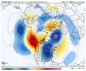
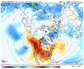
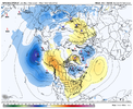
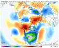
Keep it going like last jan. Don’t know if the subseasonal pattern supports that just yet


Darklordsuperstorm
Member
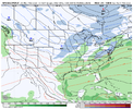
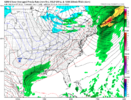
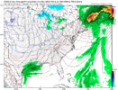
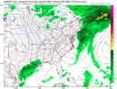
Give me this look in January or February ?View attachment 123513
View attachment 123514
View attachment 123515
Could certainly make this look work (at least for VA peeps), seems like a long shot however.
JHS
Member
The 12z GFS says that our last warm day for a while is Sat. Gets it a little warm days 15-16, but that would not be for long with a 1040+ MB high coming down into the US.
smast16
Member
And I a few miles East didn't even hit 2 tenths.
- Joined
- Jan 2, 2017
- Messages
- 1,566
- Reaction score
- 4,279
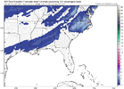
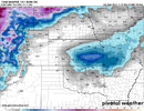
That's a helluva alot better than 80 and humid like today. Dam mosquitos back out!Sheesh cold as ice rain. The pattern is a cold one coming up .. anything can happen but it’s so early so the odds are stacked against many for getting winter precip .. obviously better chance the closer to the mountains you go .. still this would be impressive View attachment 123527View attachment 123528
- Joined
- Jan 5, 2017
- Messages
- 3,775
- Reaction score
- 5,985
Yep, that's downright hot. Good thing we have less daylight hours now.
80s today. Winter precip next week?
Beleive we hit 80 today at GSO. Wind has shifted to NE an very light for now. Will be whipping next 2 days out of NE, should be a true wind chill to real feel. Highs Sunday into early next week want get out of 40s at best.
ForsythSnow
Moderator
LukeBarrette
im north of 90% of people on here so yeah
Meteorology Student
Member
2024 Supporter
2017-2023 Supporter
Model watching is more fun when the models come out earlier that’s forsureWell this is a funny sight and a very cold rain that's something we'd expect to be saying in 2 months vs right now. Likely not going to happen or going to be close but the ensembles might be fun with this.View attachment 123532View attachment 123531
Usmeagle2005
Member
- Status
- Not open for further replies.


