-
Hello, please take a minute to check out our awesome content, contributed by the wonderful members of our community. We hope you'll add your own thoughts and opinions by making a free account!
You are using an out of date browser. It may not display this or other websites correctly.
You should upgrade or use an alternative browser.
You should upgrade or use an alternative browser.
Pattern November 2022
- Thread starter RBR71
- Start date
- Status
- Not open for further replies.
L
Logan Is An Idiot 02
Guest
Is it just me or the cold is starting the back off tremendously on the models? And it’s only for a very short period of time
Sent from my iPhone using Tapatalk
Sent from my iPhone using Tapatalk
It’s just you and Jesse and snowlover 78Is it just me or the cold is starting the back off tremendously on the models? And it’s only for a very short period of time
Sent from my iPhone using Tapatalk
At least we don't have to wade through the "wasting the good pattern too early" routine.Is it just me or the cold is starting the back off tremendously on the models? And it’s only for a very short period of time
Sent from my iPhone using Tapatalk
L
Logan Is An Idiot 02
Guest
At least we don't have to wade through the "wasting the good pattern too early" routine.
I agree. I just hope this isn’t a theme of winter. Models start off by showing a huge cold shot just to retrograde back west of the apps and mid south
Sent from my iPhone using Tapatalk
Isn't that usually our typical winter pattern? ?I agree. I just hope this isn’t a theme of winter. Models start off by showing a huge cold shot just to retrograde back west of the apps and mid south
Sent from my iPhone using Tapatalk
L
Logan Is An Idiot 02
Guest
Isn't that usually our typical winter pattern?
Has been for the last several years, January of this year being the only exception.
Sent from my iPhone using Tapatalk
6z GFS doesn't look very warm though the LR. I mean, it's not icebox or anything, but it doesn't look all that warm. The trough axis pretty much stays in the center of the country. My guess is that's what winter will feature a lot of, when it actually does get cold.
smast16
Member
Mid West Ice box of 22-23.6z GFS doesn't look very warm though the LR. I mean, it's not icebox or anything, but it doesn't look all that warm. The trough axis pretty much stays in the center of the country. My guess is that's what winter will feature a lot of, when it actually does get cold.
NBAcentel
Member
We’re wasting a great pattern on to early climo. Active southern stream with a mean longwave trough hanging around the central/eastern Us. This place would be balls on walls crazy if we had this look in January. It’s just southern stream after southern stream with northern stream confluence. Get ready for cold rains. Mountain areas (@Blue_Ridge_Escarpment )I’d watch next week for some wintry precip in the in-situ CAD fashion at the very least 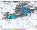

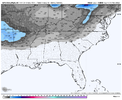


- Joined
- Jan 5, 2017
- Messages
- 3,775
- Reaction score
- 5,985
Yes, I agree. The mid-west and northeast are going to see a very harsh winter. It starts now and probably won't let up until May. The southeast will remain "normal" with periods of cold followed by nice warm-ups. I think this pattern coming up next week will repeat after a two week break, maybe in late December. So cool through Thanksgiving, then a two to three week warm-up (may hit 80 one more time in early December?), then cold for second half of December. This is for Atlanta. I think CAD will moderate NC's warm up. The jet stream is "loose", so when it does get cold, look out below! But when it gets warm, it will feel like spring.Mid West Ice box of 22-23.
HugeSnowStick
Member
Sorry, I highly doubt 80 in December,,,we'll see..Yes, I agree. The mid-west and northeast are going to see a very harsh winter. It starts now and probably won't let up until May. The southeast will remain "normal" with periods of cold followed by nice warm-ups. I think this pattern coming up next week will repeat after a two week break, maybe in late December. So cool through Thanksgiving, then a two to three week warm-up (may hit 80 one more time in early December?), then cold for second half of December. This is for Atlanta. I think CAD will moderate NC's warm up. The jet stream is "loose", so when it does get cold, look out below! But when it gets warm, it will feel like spring.
Early next week is setting up for some classic onset piedmont NC sleet w/ dry air right before precip onset. GFS shows mid 20s dews just before it rolls in.
Last edited:
accu35
Member
I really don’t stress over winter anymore, I’ve learn to just enjoy what we get and ride with it.
BufordWX
Member
olhausen
Member
Oh Really? Just kidding of course. I see flurries from time to time in November but this was the most snow I’ve ever seen in that month since living here in 2006. This was November 30th 2020. I personally don’t bother getting to worked up over snow until Early January. It’s always possible but very rare most seasons for the majority of us to get a good snow before January.If you think we’re going to see snow next week… you’re probably wrong. Times you shouldn’t get excited about snow is mid November .. it’s always possible but you should never expect anything but an ice cold rain when we are way out of our climo

olhausen
Member
- Joined
- Jan 5, 2017
- Messages
- 3,775
- Reaction score
- 5,985
I want to see you get enough snow to collapse that inflatable snow man. Pattern looks ripe for Nashville to score over the next few weeks.Oh Really? Just kidding of course. I see flurries from time to time in November but this was the most snow I’ve ever seen in that month since living here in 2006. This was November 30th 2020. I personally don’t bother getting to worked up over snow until Early January. It’s always possible but very rare most seasons for the majority of us to get a good snow before January.
View attachment 123579
Huntsville set daily high temperature records Monday and Tuesday, 82 and 86.
BufordWX
Member
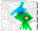
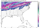
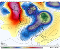
Euro coming onboard with some potential as well. Although it has temperatures 33-35 so not much wiggle room between snow and a cold rain.12z GFS is still pretty aggressive with Mondays system. It may be pretty close with how cold the temperature gets though.View attachment 123573
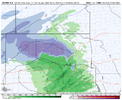
NBAcentel
Member
smast16
Member
At this rate I'm going to be lucky to get an Inch out of Nicole.
- Joined
- Jan 23, 2021
- Messages
- 4,603
- Reaction score
- 15,199
- Location
- Lebanon Township, Durham County NC
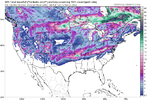
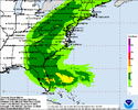
Euro was really close for realWe’re really trying to do something early View attachment 123582
Brent
Member
smast16
Member
This has a better chance to Dry up than sleet.Euro was really close for real
Brent
Member
Drizzle Snizzle
Member
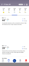
It seems to me like early in the season it's easier to get cold and wintry weather in places like Oklahoma than it is in a place further east like North Carolina.It is November right??View attachment 123591
L
Logan Is An Idiot 02
Guest
It seems to me like early in the season it's easier to get cold and wintry weather in places like Oklahoma than it is in a place further east like North Carolina.
Eh. It’s actually been like that for the whole winter the last several years other than January of this year
Sent from my iPhone using Tapatalk
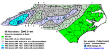
I recall seeing snow falling in NC before Thanksgiving in early 2000s-ish. Accumulation purely rate driven. Not heavy enough in Triad, but enough for maybe an inch or so in the sandhills/s piedmont because of heavier precip.
So yea it's possible in theory?
So yea it's possible in theory?
D
Deleted member 609
Guest
It snowed here pre Thanksgiving in 2013. I've still yet to see December snow though.I recall seeing snow falling in NC before Thanksgiving in early 2000s-ish. Accumulation purely rate driven. Not heavy enough in Triad, but enough for maybe an inch or so in the sandhills/s piedmont because of heavier precip.
So yea it's possible in theory?
Brent
Member
It snowed here pre Thanksgiving in 2013. I've still yet to see December snow though.
I haven't seen a December snow since I moved west in 2014. It did happen in November once in Dallas though
D
Deleted member 609
Guest
I've seen more snow in an hour in April here than all Decembers added together over the last 10 years. December snow is impossible.I haven't seen a December snow since I moved west in 2014. It did happen in November once in Dallas though
I always thought it was funny, you moved and missed the The Great White Tree Destroyer of ‘17.I haven't seen a December snow since I moved west in 2014. It did happen in November once in Dallas though
Brent
Member
I always thought it was funny, you moved and missed the The Great White Tree Destroyer of ‘17.
Yeah that one sucked for awhile
Then the last couple years here ? granted to be fair I'm in a better snow setup now
- Status
- Not open for further replies.

