Darklordsuperstorm
Member
So uh weatherbug has me getting a wintery mix next Thursday. ??

My point and click NWS forecast has a 30 percent chance of snow.at night followed by a 50 percent chance of rain and snow during the day.6z GFS for this coming Tuesday morning. I would take this with a grain of salt, but as we discussed, maybe a sleet shower to start our (SE folks) winter tracking...
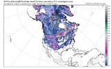
View attachment 123598
Yep, something for us to track. Even if (at best) it ends up being some flurries/sleet mix. **tracking winter events, to me, is 90% of the fun.My point and click NWS forecast has a 30 percent chance of snow.at night followed by a 50 percent chance of rain and snow during the day.
When they get a ground report, they'll change forecast and put it in there. Then boast of their accuracy. Everyone over this way(west of Triangle) deals with this continously. Wash rinse repeat.And, it looks like the rain/snow mention has been added for all the Blacksburg forecast zone. .....of course RAH is showing just rain, even for their NW areas.
Edit: So areas north and west of Charlotte are showing rain/snow mix. Excluding RAH forecast counties.
This system is losing support. The moisture is evaporating.... again. Need higher returns to saturate the column, but good luck.And, it looks like the rain/snow mention has been added for all the Blacksburg forecast zone. .....of course RAH is showing just rain, even for their NW areas.
Edit: So areas north and west of Charlotte are showing rain/snow mix. Excluding RAH forecast counties.

The jet stream is very wavy. Bringing the warmth when you're under the ridge. Alberta is recording all-time record lows and by huge margins. The troughs are going to be brutal.Through ten days, Charlotte is almost exactly 7º warmer than the warmest november of all time.


Except for the fact that the trough is no longer neg and has trended more and more pos. The thread would be dying a slow death.
If this was even just the middle of December we would be sounding the alarms left and right with this look. Tons of little pulses with the southern jet and perfect Great lakes ridging and 50/50 low forming a deep CAD. This is a picture perfect look for a winter storm if only it was about a month later.


Not trying to be that guy but + tilt isn't a bad thing if you are trying to run weak moist advection over top a marginal profileExcept for the fact that the trough is no longer neg and has trended more and more pos. The thread would be dying a slow death.
View attachment 123610
This right here. Negative tilt troughs are good at nothing but killing severe weather events and snow events for the most part in the SE.Not trying to be that guy but + tilt isn't a bad thing if you are trying to run weak moist advection over top a marginal profile

Agreed. Negative tilt troughs typically only help us east of the mountains in snow set ups… even then the tilt has got to be timed just right… if it is then it can help expand precip from coastal lows further west, but if it’s too early the low cuts inland. Honestly the pattern showing on the models next week looks like one that could make for a good southern slider or two if it were about 3 weeks laterNot trying to be that guy but + tilt isn't a bad thing if you are trying to run weak moist advection over top a marginal profile


.png")
Kinda sad when rainy and 60s remind us of winter ain’t it lol.55 here with continuous showers and 10-15 mph winds. Feels and looks like winter outside.


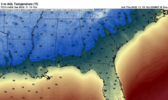
There it is. South of 85 screw job.View attachment 123626
This is so far out it could easily end up 60 degrees for this day. But, it is amazing all the event that setup along and northwest of a line from Charlotte to Raleigh. As a kid living in Goldsboro, I was always jealous of my extended family in Durham when they got snow/ice and I got rain. But I also remember a few big storms where we did better. Haven't seen those types of storms in a while.There it is. South of 85 screw job.View attachment 123626
Ah yes. My expertise.There it is. South of 85 screw job.View attachment 123626
I say this all the time but it’s amazing even here the difference between the airport-ish area of Durham County and here.This is so far out it could easily end up 60 degrees for this day. But, it is amazing all the event that setup along and northwest of a line from Charlotte to Raleigh. As a kid living in Goldsboro, I was always jealous of my extended family in Durham when they got snow/ice and I got rain. But I also remember a few big storms where we did better. Haven't seen those types of storms in a while.


I think Monday has a high boom or bust potential. Looks to me like it will come down to how fast the column cools under the heaviest precipitation. Going to be a fine line between a cold rain and a few inches of snow a change of 1-3 degrees will make a massive difference.It was 78 this afternoon. Boy is that a distant memory... There are 3 chances for snowflakes in the next week ?and im not sure what month we'll see 78 againView attachment 123649
Monday looks a little better again on the GFS btw. The NWS is not impressed thinking probably just a flizzard more than anything but they didn't rule out a surprise View attachment 123650


You act like a southerner when it comes to snow. Do most people in Iowa get excited as you do ?Come to papa! Lots more rain than expected! And flurries and sleet to end!? Chair in position! View attachment 123651View attachment 123652View attachment 123653
He was from Greenville South Carolina until a few years ago. The novelty hasn't worn off yet.You act like a southerner when it comes to snow. Do most people in Iowa get excited as you do ?
I think Monday has a high boom or bust potential. Looks to me like it will come down to how fast the column cools under the heaviest precipitation. Going to be a fine line between a cold rain and a few inches of snow a change of 1-3 degrees will make a massive difference.
00z models as a whole have looked better so far. 00z CMC had its best looking run yet as well, so the Euro will be interesting to see.