Brent
Member
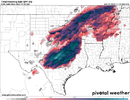
Monday looks crazy here on the Hrrr.View attachment 123789
Man I hope so. The NAM drying up the precip as it approaches gives me concern
Monday looks crazy here on the Hrrr.View attachment 123789
NAM sucks, seeMan I hope so. The NAM drying up the precip as it approaches gives me concern
NAM sucks, see
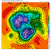
️GFS looking good!View attachment 123794View attachment 123795
Isn't suppression our friend this far out?0z gfs even more suppressed. Euro will always be king.
Sent from my iPhone using Tapatalk
I think the general rule is that suppression is our friend if’s there’s snow somewhere in the Southeast. If it’s bone dry, the wave probably isn’t coming back (except is rare cases). I still haven’t been able to let this one go.Isn't suppression our friend this far out?
I seem to remember last year during the big storm it was like meh so maybe
I thought Eiro looked good tonigh for you also??I will say there's a TV met here who loves to hype the snow and he's said basically nothing here. On the news tonight even showed one of the no snow models ? something is off
Also my totals on the GEFS have definitely gone the wrong way
I think the key here now is that there is still a system, but of course the moisture is staying suppressed. This is one of those set ups that could see a lot of changes in the last 24-48 hours leading up. Heck the 11/2000 storm that has been referenced was only forecasted to be a small chance of drizzle in my area 48 hours out as most of the moisture was expected well south and east, instead the moisture way overperformed on to the north and west and gave 3” of snow.I think the general rule is that suppression is our friend if’s there’s snow somewhere in the Southeast. If it’s bone dry, the wave probably isn’t coming back (except is rare cases). I still haven’t been able to let this one go.
Wintry - 1/26-1/28 Winter Storm Potential
GFS here is the FV3 https://mageval.ncep.noaa.gov/ When is the official replacement day?southernwx.com
could you share that please?That look on the Euro is completely nuts.
Another big thing is going to be some front end FGEN similar to the storm from January. There likely will be more moisture and front end thump of some kind if we can maintain the S/W. At this point, cold and suppressed is good as long as we can keep the storm. I still wouldn’t expect anything more than a few hours of snow that may cover the grass before melting but that’s great for November.I think the key here now is that there is still a system, but of course the moisture is staying suppressed. This is one of those set ups that could see a lot of changes in the last 24-48 hours leading up. Heck the 11/2000 storm that has been referenced was only forecasted to be a small chance of drizzle in my area 48 hours out as most of the moisture was expected well south and east, instead the moisture way overperformed on to the north and west and gave 3” of snow.