Shaggy
Member
dec 3rd 2000!!!!!!!WRAL mentioned the 99-00 winter was a third year niña.
dec 3rd 2000!!!!!!!WRAL mentioned the 99-00 winter was a third year niña.

I actually have a mean on the GEFS snow mapI was joking last night about it turning into a winter storm. I'm still expecting a cold rain but who knows View attachment 124037
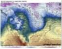
Congrats Amarillo.... <--- that's a new one.View attachment 124033
Nothing to see here, just the Euro dropping 2 feet of snow in the Southern Panhandle of TX.

Hottest hot ? ? ? ?? ? ? ? ? ? great agreementThis is good. View attachment 124038
This is good. View attachment 124038
Good for whatThis is good. View attachment 124038
ColdGood for what
Strong blocking signal over Greenland and near AK and the west coast with a split flow. Hard not to like that, unless you're LoganelliotGood for what
See that’s where I get confused on here. He posted earlier two maps showing warm around that time frame. And this shows cold.Strong blocking signal over Greenland and near AK and the west coast with a split flow. Hard not to like that, unless you're Loganelliot
I don't remember him posting warm maps, but he may have. I'm in the car and am not going back through the thread. But there are a lot of different models that potentially show a lot of different things, and the European ensemble image he posted was just one of them. Myfro and Logan are the ones who usually like posting the warm maps. Maybe one of them did it.See that’s where I get confused on here. He posted earlier two maps showing warm around that time frame. And this shows cold.
See that’s where I get confused on here. He posted earlier two maps showing warm around that time frame. And this shows cold.
Don’t forget Lil StevoStrong blocking signal over Greenland and near AK and the west coast with a split flow. Hard not to like that, unless you're Loganelliot
Consider the sourceSee that’s where I get confused on here. He posted earlier two maps showing warm around that time frame. And this shows cold.
We want the pacific on our side for sure. It has to be the biggest Greenland block to trump a bad or unfavorable pacific. Mjo is important more than people realize, especially in a weak to moderate niña. I like the 10th-20th time frame for a change to colderLikely there will be a period where warm dominated while the SER gains strength. I think it’s likely( as models usually tend to do) the models are bringing cold in a bit too early and the early part of December ends up warmer than average. But I do believe that DEC 10-20 range is where we could see a fairly dramatic pattern flip that will be able to produce a winter event somewhere in the SE or mid Atlantic region. We need the -NAO though to make the SER tap out for a while. So for models we want to focus on trends that happen over Greenland to see where this pattern is headed and how quickly.
Likely there will be a period where warm dominated while the SER gains strength. I think it’s likely( as models usually tend to do) the models are bringing cold in a bit too early and the early part of December ends up warmer than average. But I do believe that DEC 10-20 range is where we could see a fairly dramatic pattern flip that will be able to produce a winter event somewhere in the SE or mid Atlantic region. We need the -NAO though to make the SER tap out for a while. So for models we want to focus on trends that happen over Greenland to see where this pattern is headed and how quickly.

This isn't a bad signal this far out, but if the mjo can make it to phase 7 and 8 or at least cod, the cold shot should be legit imo.
Even if the cold does come, will we have the precip to go with it? Seems like we haven’t had much until recently.That pattern above on the eps can easily verify warm initially until you establish the -nao trough. Once you do though it would be game on
That map I think you're referring to is a run to run change. Not actual anominalies.See that’s where I get confused on here. He posted earlier two maps showing warm around that time frame. And this shows cold.
I think the MJO progression and what role in plays in the overall pattern will be very interesting to watch this year. It has obviously been the main driver these last two years of Niñas, but as I’ve said before, this Niña appears to be acting more like a neutral ENSO.This isn't a bad signal this far out, but if the mjo can make it to phase 7 and 8 or at least cod, the cold shot should be legit imo.
If the SPV remains weaker this year, blocking should be easier to come by and be more frequent. Will it set up in the right place? Hopefully it will a few times.The latest CFS run does just what SD says needs to happen with Atlantic blocking. It evolves through December and really has its legs under it mid Dec through Christmas. Sends 540 line down into GOM lol.
Its the theme its singing that is about all you can look for off the CFS. Then just see if it keeps it up or starts changing its tune as it runs each day. So far its been playing the same song we like to hear the past few days.


Merica models are going to take a huge L here. Almost everything else has been meh at best
You can see the massive "oopsies" the GFS is pulling holding the ULL back.Merica models are going to take a huge L here. Almost everything else has been meh at best


I thought 0z was a ??run? I mean, I had to move 1000 miles away to get a foot sleet storm, but I’ll take it! ??00z GFS was a Stanley steamer. This a good look? December 8 redux on hold View attachment 124082


Doubt seriously models long range hold that look… besides early still, take that look January for sureStrong blocking signal over Greenland and near AK and the west coast with a split flow. Hard not to like that, unless you're Loganelliot
The classic “delayed but not denied”As expected models are a bit too quick with the pattern change. Looking more likely that we’re still warm with the SER dominating early December. Still like the 10-20 time period for the change.
No suprise thereAs expected models are a bit too quick with the pattern change. Looking more likely that we’re still warm with the SER dominating early December. Still like the 10-20 time period for the change.
That certainly lines up with what the MJO progression is showingAs expected models are a bit too quick with the pattern change. Looking more likely that we’re still warm with the SER dominating early December. Still like the 10-20 time period for the change.
Again this has always been my thinking. To think the pattern change isn’t coming would be most likely wrong as there is heavy support for a dominant -NAO come mid December. This also will align with mjo propagation so it’s not so much delayed but not denied but more of this is how things were always suppose to goThe classic “delayed but not denied”
 I was joking last night about it turning into a winter storm. I'm still expecting a cold rain but who knows