Brent
Member
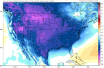
Let's see how this trends. This is the first time they've had accumulation .png")


How long the warmer pattern lasts is the million dollar question after these brief cold shots. What's interesting is the epo is literally off the charts negative on both gfs and European models?.I smell a cutoff/Miller B CAD cold rain setup. As mentioned above that SE can vortex is gonna mean lots of cool, wedged days View attachment 123779View attachment 123780
I wouldn’t call these cool/cold shots brief. We just saw in October a good 10 day or so stretch of average to below average temperatures and then the 2 week stretch of warm temperatures we’re coming out of now and we’re going into what appears to be about a 10 day or so stretch of solidly below average temps. I know that some mets have said to expect a good deal of variability with respect to the pattern with cold stretches followed by warm stretches with the potential for extremes both ways. This could be the beginning of that. One thing is for sure, as Fro said with that SE Canada vortex consistently showing up, those of us east of the mountains could be seeing a lot of CAD, even during the milder periodsHow long the warmer pattern lasts is the million dollar question after these brief cold shots. What's interesting is the epo is literally off the charts negative on both gfs and European models?.


That looks like 4/2/2019 all over again.The ole union county jackpot.
View attachment 123782
The 18z GFS was more suppressed, but had a greater cold push
From what I can tell trend wise, there is a trend toward a stronger push each run up in the midwest at 500mb. The Euro had no system because that system was squashed up there this time. How it evolves over the coming days will tell if there'll be enough tilt or not to pull moisture and if so how strong and how far inland.The 18z GFS was more suppressed, but had a greater cold push
Ah the blizzard of 2019That looks like 4/2/2019 all over again.
What’s sad is that the 2.5” I got that day is the only time my ground was covered between January 2018 until January 2022.Ah the blizzard of 2019
Flirting with a “much bigger deal” look as well.Living dangerously
View attachment 123781
We only did a little better over here in Union county SC. We both need a repeat of Jan 2000.What’s sad is that the 2.5” I got that day is the only time my ground was covered between January 2018 until January 2022.
Living dangerously
View attachment 123781


Monday looks crazy here on the Hrrr.View attachment 123789
NAM sucks, seeMan I hope so. The NAM drying up the precip as it approaches gives me concern

NAM sucks, see


Isn't suppression our friend this far out?0z gfs even more suppressed. Euro will always be king.
Sent from my iPhone using Tapatalk

I think the general rule is that suppression is our friend if’s there’s snow somewhere in the Southeast. If it’s bone dry, the wave probably isn’t coming back (except is rare cases). I still haven’t been able to let this one go.Isn't suppression our friend this far out?


I seem to remember last year during the big storm it was like meh so maybe
I thought Eiro looked good tonigh for you also??I will say there's a TV met here who loves to hype the snow and he's said basically nothing here. On the news tonight even showed one of the no snow models ? something is off
Also my totals on the GEFS have definitely gone the wrong way
I think the key here now is that there is still a system, but of course the moisture is staying suppressed. This is one of those set ups that could see a lot of changes in the last 24-48 hours leading up. Heck the 11/2000 storm that has been referenced was only forecasted to be a small chance of drizzle in my area 48 hours out as most of the moisture was expected well south and east, instead the moisture way overperformed on to the north and west and gave 3” of snow.I think the general rule is that suppression is our friend if’s there’s snow somewhere in the Southeast. If it’s bone dry, the wave probably isn’t coming back (except is rare cases). I still haven’t been able to let this one go.
Wintry - 1/26-1/28 Winter Storm Potential
welcome to my back yard ... It's not very often that you get rain with temps in the 40s ! Maybe you even get a little sleet mixed in tonight ?southernwx.com
could you share that please?That look on the Euro is completely nuts.
Another big thing is going to be some front end FGEN similar to the storm from January. There likely will be more moisture and front end thump of some kind if we can maintain the S/W. At this point, cold and suppressed is good as long as we can keep the storm. I still wouldn’t expect anything more than a few hours of snow that may cover the grass before melting but that’s great for November.I think the key here now is that there is still a system, but of course the moisture is staying suppressed. This is one of those set ups that could see a lot of changes in the last 24-48 hours leading up. Heck the 11/2000 storm that has been referenced was only forecasted to be a small chance of drizzle in my area 48 hours out as most of the moisture was expected well south and east, instead the moisture way overperformed on to the north and west and gave 3” of snow.


 ️
️