Well that's less than idealAll this time I thought you were a female ? I'm not sure why.
-
Hello, please take a minute to check out our awesome content, contributed by the wonderful members of our community. We hope you'll add your own thoughts and opinions by making a free account!
You are using an out of date browser. It may not display this or other websites correctly.
You should upgrade or use an alternative browser.
You should upgrade or use an alternative browser.
Webberweather53
Meteorologist
A lot of that precip probably isn’t reaching the ground, the higher reflectivity actually looks to be attributable to melting layer bright band at the height of the radar beam.Yellow returns showing up now wouldn’t be surprised to hear of some pockets of sleet near Matthews then further east into the lower Piedmont
Notice the low correlation coefficient which usually is indicative of non-uniformities in the hydrometeors being sampled and that’s usually attribute to melting. The actual dBZ values after accounting for this would be considerably lower
drfranklin
Member
- Joined
- Dec 1, 2016
- Messages
- 511
- Reaction score
- 760
very cold light rain and 38.9


whatalife
Moderator
Even if it did happen in Jan or Feb....we’d still find a why to screw it up

Sent from my iPhone using Tapatalk
another report of wintry this time south-East of charlotte near the SC/NC unionville area via mPING
So that means you don't want any advertising dollars spent on the forum?Just remember that any business ventures, the closing of deals or profits earned from use of this forum will result in 15% royalties to each and every Southernwx.com staff member. Thank you
Sent from my SM-G950U using Tapatalk
First time poster on here. I can tell you I’m seeing a light sleet/drizzle mix in Wingate, NC.
37F
37F
Welcome aboard! Congrats on the sleet!First time poster on here. I can tell you I’m seeing a light sleet/drizzle mix in Wingate, NC.
37F
D
Deleted member 609
Guest
I can confirm it is raining hereanother report of wintry this time south-East of charlotte near the SC/NC unionville area via mPING
It was sarcasmSo that means you don't want any advertising dollars spent on the forum?
Sent from my SM-G950U using Tapatalk
.All this time I thought you were a female ? I'm not sure why.

Sent from my SM-G950U using Tapatalk
I know but I'm not tellingDiscovered by the Germans in 1904, they named it San Diego, which of course in German means a whale's vagina. I'm sorry, I was trying to impress you. I don't know what it means. I'll be honest, I don't think anyone knows what it means ...
Sent from my iPhone using Tapatalk
Sent from my SM-G950U using Tapatalk
I'm serious about running a few ads on the forum Who do I contact?
It is getting interesting, literally just got the popcorn out of the microwaveYea we might need a new thread for this....
Sent from my iPhone using Tapatalk
Sent from my SM-G950U using Tapatalk
SDI'm serious about running a few ads on the forum Who do I contact?
Sent from my SM-G950U using Tapatalk
Thread's a lot shorter now. Let's try to keep somewhere the vicinity of the topic, please.
SW trend ftw! 0z NAM coming strong:

NBAcentel
Member
Shoveling some positive digital snow
Hit me upI'm serious about running a few ads on the forum Who do I contact?
@Brick Tamland @Jimmy Hypocracy
Go duke it out in PM land or in the Whamby thread. Talk about the rain, sleet, whatever-model-you-prefer threat in here. Delete torpedoes are locked and loaded.
Go duke it out in PM land or in the Whamby thread. Talk about the rain, sleet, whatever-model-you-prefer threat in here. Delete torpedoes are locked and loaded.
Intrigued. I see some westward retrogression? Coastal precip shield expansion? Yas
I don't see us getting much ZR with temps at 32 degrees. I remember Mets from the January "Ice Storm" going with the models, not taking into account how much freezing will occur. With the NAM, I'm extremely skeptical.


ZR is a self limiting process! I’m happy I get toI don't see us getting much ZR with temps at 32 degrees. I remember Mets from the January "Ice Storm" going with the models, not taking into account how much freezing will occur. With the NAM, I'm extremely skeptical.
be the first to reference that overused, yet true, factoid this winter
Cad Wedge NC
Member
True ...... unless there is a constant supply of cold dry air from a high up north.ZR is a self limiting process! I’m happy I get to
be the first to reference that overused, yet true, factoid this winter
NBAcentel
Member
#winning !!! But anyways while many say with these types of soundings that they don’t support sleet, I’ve seen setups with crappy refreezing layers as small as this still produce sleet, but this in my opinion isn’t worthy of a thread, and btw with that WAA, rain drops would counter dynamical cooling with the fresh airmass trying to advect in due to heat fluxes from raindrops (helping to drag that warmer air aloft)

NBAcentel
Member
ZR is a self limiting process! I’m happy I get to
be the first to reference that overused, yet true, factoid this winter
THIS IS IT chief
D
Deleted member 609
Guest
I remember the storm we had last November and when it had 14 inches of model snow in the mtns. which really was ZR.Please watch out for snow drifts
Warmer nam run in this area with the low closer to the coast
Warmer nam run in this area with the low closer to the coast
yeah, rain shield further NW past few runs
One good thing will come from this thread...Brick moves to the bottom of list for the people that want to make winter storm threads. Come Jan/Feb we need people that don’t have bad juju.

NBAcentel
Member
I wouldn’t mind making a thread, but TBH we should make a thread that explains winter teleconnections more, for example the -EPO, and how it develops, why it developed, it’s effect on our weather, how long it last, and record how long it last
SimeonNC
Member
Does any of the sounds from the NAM support any possible sleet or is it all modeled ZR and Cold Rain?
32 over 28. Some moisture nearby. NWS now says snow and drizzle poss.
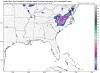
Future radar on WXII12 has some snow breaking out for Iredell to southern Wilkes over the brushy mtns
View attachment 25995
It's either suppression or a warm nose. I'm not sure what it's going to take to get snow here again.Warmer nam run in this area with the low closer to the coast
NBAcentel
Member
View attachment 25995
It's either suppression or a warm nose. I'm not sure what it's going to take to get snow here again.
It’s only November, not even winter yet, if it was February I’d agree
Morning, What are the rates? I'd like to run ads when we have a thread for we have Inclement weather in our state.
PM me and we can discussMorning, What are the rates? I'd like to run ads when we have a thread for we have Inclement weather in our state.
RAH mentioning a few sleet pellets or a little freezing drizzle