HSVweather
Member
Still sunny here and wind is howling1500 SB cape for most of central Alabama now. Cape is rising fast. Not good.
Still sunny here and wind is howling1500 SB cape for most of central Alabama now. Cape is rising fast. Not good.

I feel like they pulled the trigger too early in trimming that.i honestly think they need to move the enhanced risk back south to at least cover the tuscaloosa, bibb, shelby, chilton and jefferson co areas. even out BMX NWS took basically off of central bama out of their enhanced risk as well
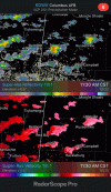
View attachment 100597

Yep.Is that the same storm chaser who was on scene at the joplin tornado?