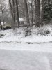
DIE DIE ALL YOU UNWANTED CREATURESRIP to plum, cherry trees and even some early apple trees View attachment 80301
-
Hello, please take a minute to check out our awesome content, contributed by the wonderful members of our community. We hope you'll add your own thoughts and opinions by making a free account!
You are using an out of date browser. It may not display this or other websites correctly.
You should upgrade or use an alternative browser.
You should upgrade or use an alternative browser.
Pattern Muddy March 2021
- Thread starter SD
- Start date
DIE DIE ALL YOU UNWANTED CREATURES
That never ever happens....
RIP to plum, cherry trees and even some early apple trees View attachment 80301
1. I'd love for this cartoon to verify closely and there's hope, but I won't bet on it with it being 9 days out.
2. Regardless, I'm looking forward to a few very walkable comfy low dewpoint days in early April!
3. What's being shown here is actually rather common for one period in April (usually early) in most years.
4. The trees should be fine because that's climo, bro.

That -NAO is showing up big time almost bigger than it showed out all winter ... this could mean lots of volatility in the models over the next few days .. like we saw over winter... I don’t want low dew point comfortable days (although I’ll take them over heat and humidity) I WANT EARLY APRIL 1.5 inch PASTE BOMB ... come on MYFRO LETS DANCE
If we can hang at 31/32 we would probably be ok, if we start seeing 28-30 there would be be some issues with plants that are further along in their spring processes. If we go below 28 that's where you start running into major issuesRIP to plum, cherry trees and even some early apple trees View attachment 80301
?
NAM still has the sat night cluster then brings thru what looks like a MCS Sunday
As you can see I got my 2.5 inch early April paste bomb two years ago...so I doubt I saw that again in my lifetime unless I move to the mountains or to the northThat -NAO is showing up big time almost bigger than it showed out all winter ... this could mean lots of volatility in the models over the next few days .. like we saw over winter... I don’t want low dew point comfortable days (although I’ll take them over heat and humidity) I WANT EARLY APRIL 1.5 inch PASTE BOMB ... come on MYFRO LETS DANCE
Attachments
That’s very interesting, like a Sup rooted to a boundary 


That’s very interesting, like a Sup rooted to a boundary View attachment 80321View attachment 80322View attachment 80323
Wind profile with it is interesting but the cape and MLLRs suck


LickWx
Member
Poor guy, you won’t even see a high below 50 most likely let alone ahhhh this stuff .That -NAO is showing up big time almost bigger than it showed out all winter ... this could mean lots of volatility in the models over the next few days .. like we saw over winter... I don’t want low dew point comfortable days (although I’ll take them over heat and humidity) I WANT EARLY APRIL 1.5 inch PASTE BOMB ... come on MYFRO LETS DANCE
GEFS is pretty warm after first few days of April, already mean highs in the 70s
LickWx
Member
@GaWx what specific spot in the US do the models have the greatest cold bias towards as of late ? I remember at one point last year you posted a map and the area models had the greatest cold bias towards was an area from Raleigh to Greensboro north to Richmond and Roanoke . Wonder if that still exists
LickWx
Member
On average the last sub 60 degree high occurs in April. It won’t be till October on average we get another sub 60 high, even then October’s mean lowest max has trended much warmer I think it’s somewhere around 56-58 now ? So closing in on 60 itself .
Yep, -NAO or not, TPV or not, climo wins broOn average the last sub 60 degree high occurs in April. It won’t be till October on average we get another sub 60 high, even then October’s mean lowest max has trended much warmer I think it’s somewhere around 56-58 now ? So closing in on 60 itself .
znel52
Member
That's some nice climo broOn average the last sub 60 degree high occurs in April. It won’t be till October on average we get another sub 60 high, even then October’s mean lowest max has trended much warmer I think it’s somewhere around 56-58 now ? So closing in on 60 itself .
smast16
Member
- Even so, Greensboro still had 12 of the last 21 Aprils with 32 or lower (vs 14 of 21 at RAH).
- But since 1950, Greensboro has had 52 of 71 Aprils with 32 or lower vs 52 of 71 at RAH.
So, @Lickwx , I learned something new today. RAH airport may be colder than one would expect vs Greensboro considering that Greensboro is in a slightly colder location. Could it be that it is the Great Radiator of NC in @pcbjr Hogtown fashion?
Yes. I used to drive by the airport daily on my commute to work. The airport is pretty much nuzzled right into city suburbs, and a pretty true representation of the city's temperature as a whole. However, being neslted into the suburbs like it is, it is very influenced by the city's UHI.
Many times I've left my house ~15 miles away and been mid to upper 20's and when I get to the airport my car is reading low 30's
LickWx
Member
Lol I’d wager your climo has the first sub degree high in November ! That lag is no joke ! Probably still in April for the last sub 60 though .That's some nice climo bro
LickWx
Member
Greensboro airport is on the north side of the suburbs , north of it looks like it transitions to exurbs. RDU used to be in a very rural area , however last 15 years that’s area has heavily suburbanized . Though 5 miles north it turns back to exurbs and rural area. I mentioned however that it is sorrounded on its south, west , and east sides by large forest tracts . Makes it a bit different in that regards.Yes. I used to drive by the airport daily on my commute to work. The airport is pretty much nuzzled right into city suburbs, and a pretty true representation of the city's temperature as a whole. However, being neslted into the suburbs like it is, it is very influenced by the city's UHI.
Many times I've left my house ~15 miles away and been mid to upper 20's and when I get to the airport my car is reading low 30's
Last edited: