Icon is winter storm here, right at 3.75 to 4 on the county line. CMC looks like it's gonna be stellar. Euro was nice little hit at 12z, so hopefully it can hold serve. Fickle set up, so not alot of wiggle room for negative trends .
-
Hello, please take a minute to check out our awesome content, contributed by the wonderful members of our community. We hope you'll add your own thoughts and opinions by making a free account!
You are using an out of date browser. It may not display this or other websites correctly.
You should upgrade or use an alternative browser.
You should upgrade or use an alternative browser.
Wintry More SE Snow ? (1/16-1/18)
- Thread starter GeorgiaGirl
- Start date
Storm5
Member
We dont accept people from NC. They are cursedWe’ll end up getting enough precipitation for a significant winter storm only to watch temps climb as we move in. Typical Triangle winter storm. Going to need to move south to see snow. Maybe northern AL.
Sent from my SM-J320VPP using Tapatalk
Webberweather53
Meteorologist
While the NAM looked funky after 48 hours, the 0z suite thus far has trended towards the wetter/more amped ECMWF/DWD-ICON camp as expected given the GFS's canonical biases in the northern stream & changes upstream in the NW Canadian Territories and Alaska regarding the major ACWB event that occurred there... The GFS and long range NAM are being isolated onto on an island by themselves atm

Late eveningWhat do you guys think the timeframe for this hitting northwest Georgia is going to be? If it snows, around what time do you think it will start on Tuesday?
Sent from my iPhone using Tapatalk
Sent from my SM-G955U using Tapatalk
accu35
Member
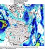
Anyone have a large map of CMC, my TT wont laod up
Really need precip to be going by 15z Wednesday. I don't want to sit around until late Wednesday aftn to get goingWe’ll end up getting enough precipitation for a significant winter storm only to watch temps climb as we move in. Typical Triangle winter storm. Going to need to move south to see snow. Maybe northern AL.
Sent from my SM-G955U using Tapatalk
Lol, CLT and SC areas hosed on GGEM based on temps alone. Prob ra/sn mix.

GeorgiaGirl
Member
Anyone have a large map of CMC, my TT wont laod up
Some of the precip only maps did load on there. I'm trying to pull the actual website and can't atm with how my internet is acting as I'm curious about that band but from what I see, it's a big hit for East NC, prob back to RDU.
Well, now Shawn had the map I was trying so hard to pull. Really don't understand the warm area this time, and it's not even in Georgia. It's a close call but I think I'd see snow from that.
The Canadian is usually too cold. Bad signs since other modeling has mid 30's - 40s.
Because 33 BL temps are torchy!

whatalife
Moderator
Really hard to draw it any better then that. No one model to hold onto if you are in our area due to temps.
Sent from my iPhone using Tapatalk
Snownut
Member
As pretty much always, I85 will be the cutoff. North of 85 sees snow, South 85 sees mix.
Sent from my SM-G955U using Tapatalk
Late evening
Sent from my SM-G955U using Tapatalk
Thanks! That’s what i wanted to hear!
Sent from my iPhone using Tapatalk
GeorgiaGirl
Member
The Canadian is usually too cold. Bad signs since other modeling has mid 30's - 40s.
Assuming it's right. I think the Canadian and ICON are likely outliers on the too cold and too warm side.
I'm really not getting the Savannah River valley warm nose thing this January though. Guess it really has to be a "fresh cold air source locked in" if you're in East Georgia and anywhere in South Carolina south of I-85 and not just one that is a bit moderated.
The next frame warms up for our areas as it has the ptype of "snow" falling:

Round Oak Weather
Member
I think middle ga is becoming more likely to at least see a dusting or so of snow
As mentioned CMC more precip but it's borderline with temps so I'm posting the clown map but....

I wouldn't take that accum map verbatim as I kinda alluded to in my post and as Shawn posted above those are some warm bl temps...3” near SE VA I’ll take that
whatalife
Moderator
As mentioned CMC more precip but it's borderline with temps so I'm posting the clown map but....
I was getting ready to post this too. For CAE that ain’t happening with those temps...
Sent from my iPhone using Tapatalk
I was getting ready to post this too. For CAE that ain’t happening with those temps...
Sent from my iPhone using Tapatalk
For CAE, the GGEM has it as rain, and as the heavier rates begin, cools us off enough to support it. Basically, when the rates lighten up, r/sn mix or rain. heavier brings more flakes.
For this to work out, I'd like to see the model with at least .30+ of qpf in a 6 hour window.
Yeah I agree... see my post directly above. I should've been clearer in my original postI was getting ready to post this too. For CAE that ain’t happening with those temps...
Sent from my iPhone using Tapatalk
GeorgiaGirl
Member
It's not going to be in the single digits in North Georgia and Tennessee. The CMC is laughable by putting that. But other models are warmer there and still have mid 30s like the CMC did. It's the ICON that is on the warmest side.
That said...with the QPF...snow TV if you can pitch the ICON's temps.
That said...with the QPF...snow TV if you can pitch the ICON's temps.
My area as well but if those temps verify we waste some precip as rn or rn/sn mix before the change over, and then it's only a few hours of sn after a rn/sn mix... it's difficult to get 3" in that scenario. But it's only one model and it's the CMC so who knows... long way to go yetBut once the snow starts it drops to the mid 20s in my area from what I saw
Brett
Member
Yeah very true, thanks for the information , I’m definitely learning a lot on this forum!!My area as well but if those temps verify we waste some precip as rn or rn/sn mix before the change over, and then it's only a few hours of sn after a rn/sn mix... it's difficult to get 3" in that scenario. But it's only one model and it's the CMC so who knows... long way to go yet
Stormlover
Member
and those amounts are only 10:1 ratiosAs mentioned CMC more precip but it's borderline with temps so I'm posting the clown map but....
olhausen
Member
Good lord sign me up for this! I just looked at the 0z gfs and it has snow while my temps boarder around 10-12 degrees. It won’t take much to get a decent snow with temps like that. I think the coldest I’ve seen snow here was with temps around 17-18 degrees so this event would shatter that.As mentioned CMC more precip but it's borderline with temps so I'm posting the clown map but....
and those amounts are only 10:1 ratios
Well over here in parts of the Carolinas we would have 4:1 type ratios. so meh.
Dang it if the CMC is right look at those precip totals in ENC too bad temps are a major issue

Blue_Ridge_Escarpment
Member
If you’re mixing it may be 0:1 lolWell over here in parts of the Carolinas we would have 4:1 type ratios. so meh.
Webberweather53
Meteorologist
Really worried there could be a relative break/"snow hole" yet again east of the mountains in NC. Initially, underneath the parent upper level vortex as it crosses the Appalachians, there's stretching which increases the cyclonic vorticity advection aloft and intensifies the ULL and the precipitation shield over the west-central Piedmont. However since elevation doesnt change terribly much across the piedmont and as the trough encroaches on the climatological baroclinic zone just offshore in association w/ the Gulf Stream, there won't be much stretching to aid in intensifying the ULL. Some of the energy will also thus transfer to the Atlantic which will induce sinking motion/descent that could take a big chunk out of this precipitation shield by the time it reaches the eastern piedmont or coastal plain before it probably re-intensifies again further east in association w/ the coastal low offshore
Webberweather53
Meteorologist
Unlike the recent 0z NAM, the same changes in the s/w earlier in the run on the DWD-ICON, CMC, & GFS which also were apparent on the NAM, continued to propagate forward later on in their runs and we got a cut-off much sooner over NC and the mid-south and/or a neutrally tilted trough much earlier... I.e. the "trend" on the long range 0z NAM w/ a more strung out s/w like the GFS showed was almost assuredly a fluke
Kuchera ratio map for CMCand those amounts are only 10:1 ratios

Unlike the recent 0z NAM, the same changes in the s/w earlier in the run on the DWD-ICON, CMC, & GFS which also were apparent on the NAM, continued to propagate forward later on in their runs and we got a cut-off much sooner over NC and the mid-south and/or a neutrally tilted trough much sooner... The "trend" on the long range 0z NAM w/ a more strung out s/w like the GFS showed was almost assuredly a fluke
Need these ensembles to start honking a bigger event for me to get any excitement, still. Especially down this way. I remember when we first started tracking this threat, the majority of the GEFS and EPS supported something bigger. Now it's gone to nothing-fringe event down this way. Hopefully better up you guy's away. Either way, the 10 inch+ monster members have been gone for days.
RollTide18
Member
Met on my local news called the Euro solution an outlier
Met on my local news called the Euro solution an outlier
Well amount wise here, the 0.7 matches the 12z OP Euro at 0.8 basically.

RGEM 00Z
Forevertothee
Member
Latest UKMET looks like the CMC in terms of precip.FWIW - the CMC surface temps are really messed up. At 18z on Wednesday in Wake County the CMC has already dropped 0.1", yet it's still 35/30 AND the 925mb temp is -2C in Wake County. At 12z it had the temps at 26F/20F. There is no way you go from that to 35F/30F with 0.1" QPF falling by 18z.
Nick_boynton
Member
GeorgiaGirl
Member
UKMET looks like a hit, no idea on temps though.
Webberweather53
Meteorologist
I accidentally posted this in banter but I'll put it here: The UKMET definitely looks better this run, another one joins the ICON/ECMWF camp... GFS & long range NAM are really getting left in the dust by other NWP models (shocker...)