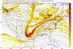
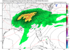
YupWon't matter what we get as it's overruled by maritime continent convection.
Sent from my iPhone using Tapatalk
-
Hello, please take a minute to check out our awesome content, contributed by the wonderful members of our community. We hope you'll add your own thoughts and opinions by making a free account!
You are using an out of date browser. It may not display this or other websites correctly.
You should upgrade or use an alternative browser.
You should upgrade or use an alternative browser.
Pattern Mega March 2023
- Thread starter SD
- Start date
Nice NWS 0 percent chance of rain at start of today. Dumped at work and wrecked my mowing plans
LukeBarrette
im north of 90% of people on here so yeah
Meteorology Student
Member
2024 Supporter
2017-2023 Supporter
18z GFS just did something funny
Yeah. The 12z euro and Candian say no. Would need to get them to jump on board and for us to get closer; and (of course) for the storm to trend a little more SE for me to get hopeful.18z GFS just did something funny
ATLwxfan
Member
18z GFS just did something funny
A nice one day shot of BN temps. Enough to give the mountains a slog of snow. -PNA flexes a ridge right on its coattails.
Sent from my iPhone using Tapatalk
LukeBarrette
im north of 90% of people on here so yeah
Meteorology Student
Member
2024 Supporter
2017-2023 Supporter
Would be cool to plan a trip to the mountainsA nice one day shot of BN temps. Enough to give the mountains a slog of snow. -PNA flexes a ridge right on its coattails.
Sent from my iPhone using Tapatalk
Flotown
Member
gfs being stubborn bout some snow round here next friday,will it cave to the euro and canadian or other way around??anybody got any ensemble news o this?
ForsythSnow
Moderator
Flotown
Member
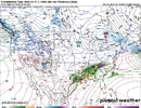
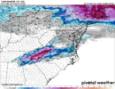
thanks!a little noise there,geez at 7!!!Still running but 12z had a few interesting members close to this and one very massive storm, which was the map below View attachment 133532
Unfortunately I wouldn’t expect much from this. In terms of winter weather at least. The pattern still wouldn’t favor this as I’m sure the SER will trend a bit stronger and push this track further NW… but this is likely the storm that would start the trend to a favorable week 2 of March… that’s when I would be looking for more fun to pop up.. GFS shows the increasingly favorable pacific by then.Still running but 12z had a few interesting members close to this and one very massive storm, which was the map below View attachment 133532
Yeah, but I would definitely watch late next week for severe weather. Models do seem to all support the idea of a system with strong dynamics.Unfortunately I wouldn’t expect much from this. In terms of winter weather at least. The pattern still wouldn’t favor this as I’m sure the SER will trend a bit stronger and push this track further NW… but this is likely the storm that would start the trend to a favorable week 2 of March… that’s when I would be looking for more fun to pop up.. GFS shows the increasingly favorable pacific by then.
severestorm
Member
Might just be me, but this isn't a ideal situation the GFS is projecting snow wise for my area at least. Zero anchoring high to the North.

Euro has the right evolution IMO


Euro has the right evolution IMO

accu35
Member
I’ll still watch for winter weather for the mountains if anythingUnfortunately I wouldn’t expect much from this. In terms of winter weather at least. The pattern still wouldn’t favor this as I’m sure the SER will trend a bit stronger and push this track further NW… but this is likely the storm that would start the trend to a favorable week 2 of March… that’s when I would be looking for more fun to pop up.. GFS shows the increasingly favorable pacific by then.
ThanksI’ll still watch for winter weather for the mountains if anything
accu35
Member
I know lolThanks
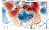
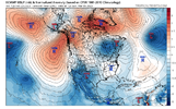
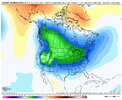
If you thought we were going to go happily straight into spring.. you will be sorely mistaken. Winter will make its return in March .. quite impressively as well. If we’re going to find a way to get snow in this winter it’s going to have to be in this pattern. Euro weeklies continue to support this robust return to winter. Most models shooting for an intense shift into a high amplitude phase 8. +PNA will return. And so will snow chances. 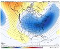


- Joined
- Jan 5, 2017
- Messages
- 3,775
- Reaction score
- 5,985
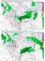
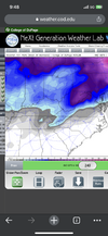
If you want snow in March in the SE, you're going to need those deep greens over you, not the light blues. This ain't January.If you thought we were going to go happily straight into spring.. you will be sorely mistaken. Winter will make its return in March .. quite impressively as well. If we’re going to find a way to get snow in this winter it’s going to have to be in this pattern. Euro weeklies continue to support this robust return to winter. Most models shooting for an intense shift into a high amplitude phase 8. +PNA will return. And so will snow chances. View attachment 133538View attachment 133539
NoSnowATL
Member
If you thought we were going to go happily straight into spring.. you will be sorely mistaken. Winter will make its return in March .. quite impressively as well. If we’re going to find a way to get snow in this winter it’s going to have to be in this pattern. Euro weeklies continue to support this robust return to winter. Most models shooting for an intense shift into a high amplitude phase 8. +PNA will return. And so will snow chances. View attachment 133538View attachment 133539
You need medication.
Itryatgolf
Member
With the ao and epo eventually trending negative, we will get cold. Kinda agree with SD on whole artic dumping on us
Yeah there are certainly some signs now of colder times once we get to around 3/8-3/10. The AO and NAO look to be going in the tank and the MJO, which is now on the left side of the circle now appears to be headed towards a high amp phase 8… we’ve not seen high cold phases modeled this whole winter. Also there are indications showing of legit a legit cold airmass building up in NW Canada starting next week… widespread -25 to -40 degree cold which is impressive when you consider those areas are approaching 8 hours of daylight now. I don’t know if we’ll get cold enough for snow opportunities, but northern areas of southeast may at least have a shot.With the ao and epo eventually trending negative, we will get cold. Kinda agree with SD on whole artic dumping on us
Maybe for the Deep South .. but us in the upper SE just need colder than average 850s and some colder than average surface temps and all we need is some good dynamics to bring the cold to the surface. Snow this late in the season is usually 35-38 heavy wet types of snowIf you want snow in March in the SE, you're going to need those deep greens over you, not the light blues. This ain't January.
accu35
Member
accu35
Member
Downeastnc
Member
GFS and Euro on same page next Friday. Canadian is furtherest west, but still spits out Ice. It is the outlier at 5H right now. This is another great opportunity / track that is most likely gonna fail just because we cant tap cold.


Darklordsuperstorm
Member
If we aren't going to get this I would rather just keep my sun and 70s/80s!GFS and Euro on same page next Friday. Canadian is furtherest west, but still spits out Ice. It is the outlier at 5H right now. This is another great opportunity / track that is most likely gonna fail just because we cant tap cold.

I still would not get caught up with next weekends storm. Unless we see multiple days of models latching on.. there is Very little ensemble support for it and the pattern favors more mid Atlantic/ SNE .. but I am pretty happy about how the models are evolving with our pattern after.. recent GEFS got a lot colder and even sooner. I still would wait for week 2 in march but GEFS says things change a bit earlier. 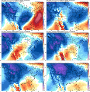

iGRXY
Member
We likely get pretty cold (vs averages) by mid march through the month. That I agree with but those of us east of the apps need A LOT of help for me to get excited about any storm because we are flexing the hell out of the SER right now and any storms are cutting. If I'm in the western southeast I'd watch closely because cold chasing moisture works out for you guys. The 6z GFS is a much likelier scenario with a further NW tracking LP that drops a little deform band around middle TN and through out the Ohio valley and eventually NE. Beyond that, you can absolutely get snow in the southeast in March but you're pushing you're luck if you really are excited about the idea of snow in mid to late march in the year of our lord 2023. We can't even get it in peak climo. You would need the coldest air in the northern hemisphere sitting either over you or just to your north and lining up another storm perfectly with perfect timing. That might sound like a party pooper, but to me that's realistic. I am like 95% sure we get an extended "winter" with below average temps, but averages are going up now and air masses will be moderating as we enter more spring time patterns. If this was the 70's, then yeah I wouldn't through in the towel honestly until mid April, but like Slim Charles said, the thing about the old days ... they the old days.
The one thing that I’m noticing the last several days that does give me a bit of hope is that over the next week there is a legit cold air mass building up in NW Canada… as I said last night despite those areas approaching 8 hours of daylight now, there looks to widespread -20 to -40 degree cold developing there next week. With strong blocking up top developing there should be a good source region to tap into. As little help as I think Pacific is going to give us, the PNA does move close to neutral later next week… with the amount of blocking showing though I’m really not sure you would want to see much of a +PNA anyway… I still think that kinda messed us up for storm chances back when we had the strong blocking in December because the +PNA ended up suppressing everything way to far south.We likely get pretty cold (vs averages) by mid march through the month. That I agree with but those of us east of the apps need A LOT of help for me to get excited about any storm because we are flexing the hell out of the SER right now and any storms are cutting. If I'm in the western southeast I'd watch closely because cold chasing moisture works out for you guys. The 6z GFS is a much likelier scenario with a further NW tracking LP that drops a little deform band around middle TN and through out the Ohio valley and eventually NE. Beyond that, you can absolutely get snow in the southeast in March but you're pushing you're luck if you really are excited about the idea of snow in mid to late march in the year of our lord 2023. We can't even get it in peak climo. You would need the coldest air in the northern hemisphere sitting either over you or just to your north and lining up another storm perfectly with perfect timing. That might sound like a party pooper, but to me that's realistic. I am like 95% sure we get an extended "winter" with below average temps, but averages are going up now and air masses will be moderating as we enter more spring time patterns. If this was the 70's, then yeah I wouldn't through in the towel honestly until mid April, but like Slim Charles said, the thing about the old days ... they the old days.
iGRXY
Member
I agree, but this is basically winters last Hooray if you will. You're going to get another cutting storm with an artic front and artic air behind it with severe weather on the front end. After it sweeps through you're going to have an extremely short period to score something, hints me saying perfectly timed storm, before we likely retreat back to slightly below to average temps through the month. After this cold shot winter is likely done. Air masses are quickly going to be moderating considerably in the artic by mid march and nothing to really reinforce it further. The Carolinas better hope next Friday's storm trends further south or we get some type of trailing s/w or get the front to stale near us and get something to ride along the front because that's the last shot of the season IMO. I'll gladly eat crow in the snow if I am wrong, but there's just too many variables against us and we are counting on pattern change in March that likely will be delayed anyways to make it happen. We couldn't even reel in 2 storms this year that was showing a foot + on Operationals and 4" ensemble means under 100-120 hours. To me we are relying on perfect timing and I know how that works out 9/10x.The one thing that I’m noticing the last several days that does give me a bit of hope is that over the next week there is a legit cold air mass building up in NW Canada… as I said last night despite those areas approaching 8 hours of daylight now, there looks to widespread -20 to -40 degree cold developing there next week. With strong blocking up top developing there should be a good source region to tap into. As little help as I think Pacific is going to give us, the PNA does move close to neutral later next week… with the amount of blocking showing though I’m really not sure you would want to see much of a +PNA anyway… I still think that kinda messed us up for storm chances back when we had the strong blocking in December because the +PNA ended up suppressing everything way to far south.
HugeSnowStick
Member
Colder in Cabo San Lucas than the majority of the SE.
iGRXY
Member
Tijuana will be able to smell the snow.
tennessee storm
Member
look for most the cold stay out west, just been pattern were stuck inThe one thing that I’m noticing the last several days that does give me a bit of hope is that over the next week there is a legit cold air mass building up in NW Canada… as I said last night despite those areas approaching 8 hours of daylight now, there looks to widespread -20 to -40 degree cold developing there next week. With strong blocking up top developing there should be a good source region to tap into. As little help as I think Pacific is going to give us, the PNA does move close to neutral later next week… with the amount of blocking showing though I’m really not sure you would want to see much of a +PNA anyway… I still think that kinda messed us up for storm chances back when we had the strong blocking in December because the +PNA ended up suppressing everything way to far south.
ATLwxfan
Member
I agree, but this is basically winters last Hooray if you will. You're going to get another cutting storm with an artic front and artic air behind it with severe weather on the front end. After it sweeps through you're going to have an extremely short period to score something, hints me saying perfectly timed storm, before we likely retreat back to slightly below to average temps through the month. After this cold shot winter is likely done. Air masses are quickly going to be moderating considerably in the artic by mid march and nothing to really reinforce it further. The Carolinas better hope next Friday's storm trends further south or we get some type of trailing s/w or get the front to stale near us and get something to ride along the front because that's the last shot of the season IMO. I'll gladly eat crow in the snow if I am wrong, but there's just too many variables against us and we are counting on pattern change in March that likely will be delayed anyways to make it happen. We couldn't even reel in 2 storms this year that was showing a foot + on Operationals and 4" ensemble means under 100-120 hours. To me we are relying on perfect timing and I know how that works out 9/10x.
The caveat here is if there is tropospheric influence from the SSWE. You could easily get cold enough. Mix in a neutral PNA and some blocking and it gets interesting. But that’s a lot of ducks to get in a row. So in the meantime get outside and enjoy the late May weather!
Sent from my iPhone using Tapatalk
tennessee storm
Member
exactyly, im over this winter back in january... lol winter to me is toastIf we aren't going to get this I would rather just keep my sun and 70s/80s!
accu35
Member
accu35
Member
The D7 system is probably a mirage with mediocre blocking in the north Atlantic and no pac help, it's a prime NW trend candidate. It looks like we will start stepping cooler as time goes on but I'm not seeing that smoking gun that says low 20s or late season snow right now. If we had gone through this evolution 3 weeks ago we would have a much wider window of opportunity now it needs help.
accu35
Member

