Pretty typical late spring severe threat for us. A few wind reports, a few hail reports, not a huge needle moverI guess the severe threat today doesn't look like much since we don't have a thread.
-
Hello, please take a minute to check out our awesome content, contributed by the wonderful members of our community. We hope you'll add your own thoughts and opinions by making a free account!
You are using an out of date browser. It may not display this or other websites correctly.
You should upgrade or use an alternative browser.
You should upgrade or use an alternative browser.
Pattern May Thread
- Thread starter Detective WX
- Start date
Hey Everybody, Like to introduce my friend (...going as Don Blake). He's a man of details and will be a great asset providing observations for the south Raleigh area.Just had a quick, 2-minute shower here in Garner.
Brick Tamland
Member
Under a severe thunderstorm watch until 9:00 PM.
Brick Tamland
Member
SEVERE THUNDERSTORM WATCH OUTLINE UPDATE FOR WS 228
NWS STORM PREDICTION CENTER NORMAN OK
115 PM EDT MON MAY 16 2022
SEVERE THUNDERSTORM WATCH 228 IS IN EFFECT UNTIL 900 PM EDT
FOR THE FOLLOWING LOCATIONS
NCC001-007-013-015-029-037-041-049-051-053-055-057-061-063-065-
067-069-073-077-079-081-083-085-091-093-095-101-103-105-107-117-
123-125-127-131-133-135-137-139-143-145-147-151-153-163-165-167-
177-181-183-185-187-191-195-170100-
/O.NEW.KWNS.SV.A.0228.220516T1715Z-220517T0100Z/
NC
. NORTH CAROLINA COUNTIES INCLUDED ARE
ALAMANCE ANSON BEAUFORT
BERTIE CAMDEN CHATHAM
CHOWAN CRAVEN CUMBERLAND
CURRITUCK DARE DAVIDSON
DUPLIN DURHAM EDGECOMBE
FORSYTH FRANKLIN GATES
GRANVILLE GREENE GUILFORD
HALIFAX HARNETT HERTFORD
HOKE HYDE JOHNSTON
JONES LEE LENOIR
MARTIN MONTGOMERY MOORE
NASH NORTHAMPTON ONSLOW
ORANGE PAMLICO PASQUOTANK
PERQUIMANS PERSON PITT
RANDOLPH RICHMOND SAMPSON
SCOTLAND STANLY TYRRELL
VANCE WAKE WARREN
WASHINGTON WAYNE WILSON
$$
Have a feeling this line approaching the watch might get a little outflow dominant and choke off as it approaches US1. If it doesn't SB capes around 2500 ML capes around 1500 and increasing Dcape should give us a few wind reports and maybe a couple of hail reports in any longer duration updrafts
Shaggy
Member
Finally summer like weather!?
Shaggy
Member
Big wind and rain. Surged power here at work shut the plant down.
Already seeing that outflow surge aheadHave a feeling this line approaching the watch might get a little outflow dominant and choke off as it approaches US1. If it doesn't SB capes around 2500 ML capes around 1500 and increasing Dcape should give us a few wind reports and maybe a couple of hail reports in any longer duration updrafts
You nailed itHave a feeling this line approaching the watch might get a little outflow dominant and choke off as it approaches US1. If it doesn't SB capes around 2500 ML capes around 1500 and increasing Dcape should give us a few wind reports and maybe a couple of hail reports in any longer duration updrafts
Brick Tamland
Member
Have a warning to the north of me in Franklinton.
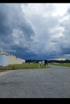
Finally summer like weather!?View attachment 118506
Since when are 50s and 60s summer-like weather?
Brent
Member
I got to Galveston late last night and honestly temperature wise it's not a lot different than when I've been in late July last few years. Houston has been above normal everyday this month(their average is 86 for reference today) and no end in sight at least through Friday or even Saturday

Iceagewhereartthou
Member
Rough few days coming up but the windows will be open the next couple of nights with mid 50s coming! I love what the GFS is doing after the weekend heat; several fronts seem to be heading our way. Still way out there and very possibly won't happen but great to still see some comfortable temps possible as we head towards June.

Yep! Gonna be the year without a summer!Rough few days coming up but the windows will be open the next couple of nights with mid 50s coming! I love what the GFS is doing after the weekend heat; several fronts seem to be heading our way. Still way out there and very possibly won't happen but great to still see some comfortable temps possible as we head towards June.

Unless there's an intra-hour or 5pm high, DFW will be 89'd today. ?
Last edited:
Shaggy
Member
Can't say we've had a lot of thunderstorm days here but the days we have had have so far been solid. Just had another big storm in Pitt County. 2 weeks ago we had 4 severe storms in one day and now this makes the 2nd one today.
Downeastnc
Member
2 storms so far last one had nickel size hail....waiting to see what the storms over RDU can do ifcthey hold up.