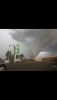
What’s beneath the door?? My cruise?? All our snow from last winter? Jimmy Hoffasister in law’s storm cellar in OKC. I’d never really been in one
View attachment 19386
-
Hello, please take a minute to check out our awesome content, contributed by the wonderful members of our community. We hope you'll add your own thoughts and opinions by making a free account!
You are using an out of date browser. It may not display this or other websites correctly.
You should upgrade or use an alternative browser.
You should upgrade or use an alternative browser.
Pattern May: gateway to everyone's favorite season
- Thread starter GaWx
- Start date
64 degrees rain cooled air. 20 degrees hotter to my east in Winston. That was a textbook summer storm that drifted east into the foothills before disappearing.
Z
Zander98al
Guest
The 18z nam compared to the 12z nam isn't as impressive with the low pressure system.

I almost want to say I think tomorrow ends up more active than the models show but that generally leads to disappointment
Sent from my SM-G955U using Tapatalk
Sent from my SM-G955U using Tapatalk
Z
Zander98al
Guest
Tornado warning on the TN/KY border
BufordWX
Member
SPC new day 2 outlook has slight risk for some of us now.
Z
Zander98al
Guest
SPC new day 2 outlook has slight risk for some of us now.View attachment 19390

GeorgiaGirl
Member
Nowhere else to post this, so this is from Texas this morning:
Nasty looking clouds.
Nasty looking clouds.
NBAcentel
Member
Could see some strong storms today, gusty outflows the main threat with pulse T-Storms, inverted Vs, decent DCAPE, steep 0-3km lapse rates, dry air aloft, good environment for strong outflows/weaker downbursts today

Cad Wedge NC
Member
You definitely have some reading to do. There is a big difference between "dry lightning", as you described, and "heat lightning". Please read more post less!Heat lightning in Wilkes. Dry and breezy while buckets are being poured to the west. Going to need flood advisories soon.
Weathermen out here in Oklahoma are remembering the May 3, 1999 tornado outbreak today. News channel 9 puts on a good broadcast. CJ and JC need to step their game up

Slight area was expanded for tomorrow

Sent from my SM-G950U using Tapatalk

Sent from my SM-G950U using Tapatalk
Blacksburg lost Verizon signal...guessing Raleigh will be covering Wilkes today.
Z
Zander98al
Guest
Might see some cool looking shelf clouds tomorrow.Slight area was expanded for tomorrow
Sent from my SM-G950U using Tapatalk
Really watching what's going on around SHV tonight. Any sort of mcv will probably be the catalyst to anything getting going in this area tomorrow evening.
Sent from my SM-G955U using Tapatalk
Sent from my SM-G955U using Tapatalk
Z
Zander98al
Guest
Looks like two systems may effect the southeast the coming week. Looking at the GFS and Euro it doesn't seem to look that bad but the placement of the low pressure system will be important. Considering itll be mid may instability should be in good supply.
Worst storm of the year currently.
Possible Tropical Storm Wilkes Co NC
NBAcentel
Member
I can see the storm surge of dust in my yard, the birds are coming towards me, the wind mightily coming from the SE, I can see the outer bands of capped cumulus here ?Possible Tropical Storm Wilkes Co NC
NBAcentel
Member
Your average late spring/summertime microburst soundings, moderate-high Theta-E advection, 2000-3000 jkg of SBcape, weak-moderate 0-6km bulk shear, decent DCAPE, noice soundings that support wet microbursts and like what @Zander98al said, cool shelfies 


More storms at 11pm. I’ve had more rain first 3 days of May than monthly norm.
?
I’m 15 miles east of Moore right now. They’ve been talking about this tornado anniversary all day on the news. It still gives the locals nightmares 20 years later. This is their unwanted claim to fame
Hurry home, you’re missing a big severe outbreak tomorrow! Which means drizzle at best!?I’m 15 miles east of Moore right now. They’ve been talking about this tornado anniversary all day on the news. It still gives the locals nightmares 20 years later. This is their unwanted claim to fame
Post pictures please. ?? I will bring the mojo back home with me. We were under a Flash Flood Warning until 4pm today. Standing water in the roads and major highways. Dirt and gravel roads were washed out. They say the rain has been relentless here since early MarchHurry home, you’re missing a big severe outbreak tomorrow! Which means drizzle at best!?
after 1am and storms still firing in Wilkes
Some light damage occurred along and just south of 421 Wilkesboro. Blacksburg did not give a good lead time due to being backed up by I assume NWS Raleigh. Storm was over when I got the Warning.
Attachments

Brent
Member
I’m 15 miles east of Moore right now. They’ve been talking about this tornado anniversary all day on the news. It still gives the locals nightmares 20 years later. This is their unwanted claim to fame
pretty crazy they got hit in 2013 too
Before I moved here we drove through there a few months later and the damage was incredible
But nothing will top driving through Joplin after theirs on the same trip(as we went back to Bama slowly) and it had been 2 years already
Cad Wedge NC
Member
Possible Tropical Storm Wilkes Co NC
I have figured it out .... the only reason that he's still here is the mods keep him for comic relief..... he certainly doesn't add anything educational to our forum.I can see the storm surge of dust in my yard, the birds are coming towards me, the wind mightily coming from the SE, I can see the outer bands of capped cumulus here ?
HRRR looks violent western Piedmont/northern foothills.
NBAcentel
Member
Hmmm, hrrr mixes out DPs during the afternoon with diurnal heating, results in less cape but nearly a 30 degree sfc temp-DP depression for some areas, that would add to the wind threat in return for lower cape, if storms survive heading in drier low levels/inverted V anyways, not really much of a hail sounding 
Snippet fro GSPHmmm, hrrr mixes out DPs during the afternoon with diurnal heating, results in less cape but nearly a 30 degree sfc temp-DP depression for some areas, that would add to the wind threat in return for lower cape, if storms survive heading in drier low levels/inverted V anyways, not really much of a hail sounding View attachment 19404

Impressive cool shot on the Euro

Sent from my SM-G955U using Tapatalk

Sent from my SM-G955U using Tapatalk
cd2play
Member
Blackberry winterImpressive cool shot on the Euro
Sent from my SM-G955U using Tapatalk
Certainly looks like we may cool down and see some wetter conditions for the the mid month period. I'm not sure im ready to go all in on some of the low 70s the eps hasBlackberry winter
Sent from my SM-G955U using Tapatalk
NBAcentel
Member
Snippet fro GSP View attachment 19405
Yeah, some areas mix out, while some areas don’t (bigger hail risk)
Full sun here now and muggy! Have some high hopes for good storms this afternoon! 1” of rain or bust!Yeah, some areas mix out, while some areas don’t (bigger hail risk)
This future radar looks pleasing to the eye!
Another one! Watch out Fro, you always get the good stuff!
BufordWX
Member
lots of storms developing around me. Load of lightning with them too. Gonna be a interesting day.