North of 3 ,still spittingBecause some said a repeat of 6-12” I said no. I said 1-2” and anyone over 2” would likely be mtns. I had much better forecast than those who were calling for massive amounts and floods.
-
Hello, please take a minute to check out our awesome content, contributed by the wonderful members of our community. We hope you'll add your own thoughts and opinions by making a free account!
You are using an out of date browser. It may not display this or other websites correctly.
You should upgrade or use an alternative browser.
You should upgrade or use an alternative browser.
May be?
- Thread starter GaWx
- Start date
NBAcentel
Member
And I feel like it’s all pooled up in my front yard..
LickWx
Member
76 with a dew of 74 right now. I can live with that just need some warmer temps. Should get to around 80. Love the high dews
NBAcentel
Member
NBAcentel
Member
NBAcentel
Member
JHS
Member
GSP's record for May rainfall is probably safe. Nothing much over upstate SC now and not expecting much today for the rest of today.
B
Brick Tamland
Guest
Well, it's raining again.
B
Brick Tamland
Guest
Got an alert for lightning within 5 miles.
LickWx
Member
Rain dropped temps but they rebounded quickly and it got more humid . 83 dew 75.
Storm has passed, very heavy rain, thunder/lightning, and some wind. Sun is coming back out. It will be interesting to see if we see any more development downstream later on. Things look more active to the east for now. Maybe Raleigh can finally get a decent storm!
B
Brick Tamland
Guest
Had some rain here and that was it. Maybe another round will come through later.
Phil
Member
We had some heavy rain here about 11:30Am but that's all we've had so far.......Not good when it rains then the Sun comes back out...... I am moving to the Sahara Desert....
lack of instability today. those sc storms fizzled north of charlotte nc
NBAcentel
Member
lack of instability today. those sc storms fizzled north of charlotte nc
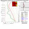
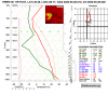
There’s no lack of instability today, surface based cape is pushing 3000 joules in CLT, just no good forcing agent right now, could change later with some energy moving in
NBAcentel
Member
There’s no lack of instability today, surface based cape is pushing 3000 joules in CLT, just no good forcing agent right now, could change later with some energy moving in
Couldn't of said it better myself. Actually it appears storms are forming again south of Charlotte.
and it is, can see towers on the NC/SC border already View attachment 42252View attachment 42253
Jinx! Ha. But yeah, already picked up about 1.2 inches with today's storm. With more on the way, I won't be surprised if we hit close to 20 inches in some parts of the metro before the end of the month. Just crazy. Also, it appears those storms are skipping around Raleigh, again. So bizarre!
it's not been very sunny here cloudy and damp. i see other areas saw much more sunshine
NBAcentel
Member
pcbjr
Member
Now this is a late May real afternoon - unlike 1 year ago today when it was 102º
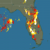
 en.blitzortung.org

Lightning & Thunderstorms - Florida, Louisiana, Alabama, Georgia
Blitzortung.org provides lightning and thunderstorm information in real-time on maps for USA, United Kingdom, Australia, new Zealand, Europa, Africa, Asia and other Countries.

No... There is still plenty of convection covering almost 2 thirds of the country. This has little to no effect on our weather. We have plenty of fuel, just not enough forcing, yet. This will change tonight and into tomorrow.
cd2play
Member
The fact that you are not instagramming this right now is insane
BHS1975
Member
Insane downpours flooding interstate 40.

Sent from my iPhone using Tapatalk

Sent from my iPhone using Tapatalk
Cadi40
Member
My power is out in Union County, no wind but a storm is approaching with lots of lightning.
pcbjr
Member
B
Brick Tamland
Guest
And it's all quiet here yet again. No storms tonight, either.
Incredible light snow looking NE towards sparkle city right now!
cd2play
Member
Probably won't stick on many of the roads since it's 80 degrees.Incredible light snow looking NE towards sparkle city right now!
Light SHOW! LmfaoProbably won't stick on many of the roads since it's 80 degrees.
Check this out. Let me do my best @Myfrotho704_ impersonation! I sat in the front yard and watched this ball of fury from a safe distance. That little cell put on a hell of a show for me and my little man


