NBAcentel
Member
Wtf 

A lot easier to keep it all in one thread instead of having to go back between two different threads for the same system. Is it really that hard to read everything in one thread?I started a new thread for today only. I will update the thread title for this specific thread to tomorrow and friday
Brett Adair is one of the most knowledgeable severe weather experts around. He isn’t some hype forecaster for clicks. He wouldn’t be saying that unless he meant it. I don’t see it as being irresponsible, he’s saying what he thinks.
Yes. If I’m focused on today I don’t want to be reading about the Carolinas. Two threads were definitely needed.A lot easier to keep it all in one thread instead of having to go back between two different threads for the same system. Is it really that hard to read everything in one thread?
I doubt people in Al/Ms/Tn care what Mike maze or brad P have to say about NC. Just like I doubt people in NC who are coming here for a NC update care about Al.A lot easier to keep it all in one thread instead of having to go back between two different threads for the same system. Is it really that hard to read everything in one thread?
That would still be considered moderate IMO ... supercells are big and cover a large area .. if h get four of five scraping along and redeveloping I would say you would have widespread severe weather (i.e someone getting hail/damaging winds/ and someone getting a tornado) if there’s only one or two then enhanced seems likelySure but does it really matter if its enhanced or moderate if theres 4 to 5 discrete supercells recycling as they cross the state it's still a bad bad day.
We just have to watch the model trends.
Brett Adair is one of the most knowledgeable severe weather experts around. He isn’t some hype forecaster for clicks. He wouldn’t be saying that unless he meant it. I don’t see it as being irresponsible, he’s saying what he thinks.
Honestly when it comes to severe weather (not winter weather I’ll be pissed if anywhere other than Raleigh NC sees snow lol) I want to stay informed about everyone effected and whats going on especially during a severe outbreak like this one ... I like seeing all the posts mixed but I have no issue going back and forth .. I mean if u don’t wanna look at something .. simply scroll past it lolI doubt people in Al/Ms/Tn care what Mike maze or brad P have to say about NC. Just like I doubt people in NC who are coming here for a NC update care about Al.
Seems like on all maps there’s a gap in nort central Georgia, is the line supposed to weaken as it gets here tonight and restrengthen later in the day Thursday in far eastern ga/sc?Just to clarify, any Georgia info should be posted here?
I'm not sure. Isnt Georgia supposed to get some storms later this evening/tonight ? If so I think it's ok to post in today's thread.Just to clarify, any Georgia info should be posted here?
I'm not sure about Ga bc I could see some stuff sneaking in late in the evening. What do you guys thinkJust to clarify, any Georgia info should be posted here?
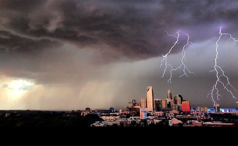
 www.charlottestories.com
If its happening now, put it in the nowcast. Regardless of location.I'm not sure about Ga bc I could see some stuff sneaking in late in the evening. What do you guys think
That happens often as we all know but I just heard TWC say we can expect winds up to 75mph in the moderate area in west central Georgia.Seems like on all maps there’s a gap in nort central Georgia, is the line supposed to weaken as it gets here tonight and restrengthen later in the day Thursday in far eastern ga/sc?
Honestly when it comes to severe weather (not winter weather I’ll be pissed if anywhere other than Raleigh NC sees snow lol) I want to stay informed about everyone effected and whats going on especially during a severe outbreak like this one ... I like seeing all the posts mixed but I have no issue going back and forth .. I mean if u don’t wanna look at something .. simply scroll past it lol
Perhaps but looks like Western counties won't be the wall this time it will be further east into Cobb county etc perhaps so gonna be bumpy for the border counties.Seems like on all maps there’s a gap in nort central Georgia, is the line supposed to weaken as it gets here tonight and restrengthen later in the day Thursday in far eastern ga/sc?
It's easier to separate the 2 than having everything in one thread in my opinion. One for the AL/MISS/TN area and another for us just like SD did it. I 100% agree with him here.A lot easier to keep it all in one thread instead of having to go back between two different threads for the same system. Is it really that hard to read everything in one thread?

Interesting how the HRRR/RAP speeds things up while the 3km keeps us in crazy parameters spaces longer with more opportunity for more storms to fire


I would say somewhere around Lagrange looking and temps and windI know the key to severe weather in Georgia is the warm front moving north and busting the wedge. Can someone show me where the warm front is right now and when it will reach the south metro/Newnan area? TIA
I know the key to severe weather in Georgia is the warm front moving north and busting the wedge. Can someone show me where the warm front is right now and when it will reach the south metro/Newnan area? TIA

Yeap it's knocking on Lagrange's door for sureI would say somewhere around Lagrange looking and temps and wind


New SPC outlook