• Hello, please take a minute to check out our awesome content, contributed by the wonderful members of our community. We hope you'll add your own thoughts and opinions by making a free account!

Tropical Major Hurricane Milton

10 am NHC.....looks like they learned something last week.🤔🤔🤔

"However, it is critical to remember that even at 36-48 hours away, NHC's track forecasts can be off by an average of 60-70 n mi, which means we still can't pinpoint an exact landfall location...."

"The NHC intensity forecast is close to the top
end of the model envelope, which includes the GFS and ECMWF models, since these models should have a better handle on a potential positive trough interaction."
 
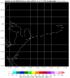
Yeah, that looks a bit south of previous GEFS runs. Drives me nuts the HWRF is insistent on its northern route vs everything else.
If I remember correctly, the times it's been stubborn like that, it's had the closest forecast to landfall point. But take me with a grain of salt....I'm an Hwrf fan so I tend to look over it's faults. 🤣😂🤣😂
 
If I remember correctly, the times it's been stubborn like that, it's had the closest forecast to landfall point. But take me with a grain of salt....I'm an Hwrf fan so I tend to look over it's faults. 🤣😂🤣😂
The HWRF can't simply be ignored but latest short term movement of Milton has been east and even wobbled a little south of due east again since the last center fix.
 
The HWRF can't simply be ignored but latest short term movement of Milton has been east and even wobbled a little south of due east again since the last center fix.
It's 80 miles from Tampa to Crystal River, so even shorter across water. It could go either way.

Here's another reason I support HWRF.....there is quite a right turn after 27n 84w for HMON for example. Anything is possible, obviously after this week, but a large storm making a right turn? I don't know. Hwrf has more of a slope in approach.
They are both at the same point, same timeframe.

hwrf_ref_14L_14.png

hmon_ref_14L_11.png
 
Last edited:
MOV8-4.14L.GIF
 
SUMMARY OF 100 PM CDT...1800 UTC...INFORMATION
----------------------------------------------
LOCATION...22.5N 88.2W
ABOUT 125 MI...205 KM NE OF PROGRESO MEXICO
ABOUT 520 MI...840 KM SW OF TAMPA FLORIDA
MAXIMUM SUSTAINED WINDS...155 MPH...250 KM/H
PRESENT MOVEMENT...ENE OR 65 DEGREES AT 8 MPH...13 KM/H
MINIMUM CENTRAL PRESSURE...923 MB...27.26 INCHES
 
Back
Top