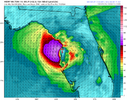
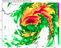
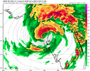
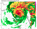
AH HUR HNTR TEAL72 HEADED IN FROM Biloxi MS.. SHOULD ARRIVE IN A BIT.. THEY ARE JUST NOW JUST SOUTH OF LA
-
Hello, please take a minute to check out our awesome content, contributed by the wonderful members of our community. We hope you'll add your own thoughts and opinions by making a free account!
You are using an out of date browser. It may not display this or other websites correctly.
You should upgrade or use an alternative browser.
You should upgrade or use an alternative browser.
Tropical Major Hurricane Milton
- Thread starter SD
- Start date
Henry2326
Member
Henry2326
Member
I won't be surprised.....the stronger storms tend to pull North and east. HWRF is on an island of itself at Crystal River for landfall, more north.UNLESS MY EYES ARE TIRED IT HAS TAKEN A BIG NORTH TUG
THE 4 AM UPDATE HAS IT SE OF THE ISLAND TO THE LEFT OF CENTER
View attachment 152885
Chattownsnow
Member
He appears to have shed the remaining part of the former eyewall and is ready to re-intensify based on IR imagery
MichaelJ
Member
Pretty sure this will come inland just north of Tampa as a Cat 4 with 140mph winds as dry air will take some of the top off, still going to be a strong storm and Tampa will be hit hard. Let's see if the NHC agrees
Belle Lechat
Member
- Joined
- Aug 29, 2021
- Messages
- 976
- Reaction score
- 738
UNLESS MY EYES ARE TIRED IT HAS TAKEN A BIG NORTH TUG
THE 4 AM UPDATE HAS IT SE OF THE ISLAND TO THE LEFT OF CENTER
View attachment 152885
Yes, it now has a N component.

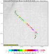
You can see Isla Perez of the Alacranes lightly to the left of the center in the Recon map. They were in a weaker part of the eyewall, winds decreasing to the north and south of them as it passed over. It appears they didn't even get hurricane force wind gusts, as I showed previously.

Scorpion Reef - Wikipedia
Last edited:
Brent
Member
More and more I'm feeling this like this is the feared Tampa storm sadly
We can only hope it weakens a lot but it may not matter
We can only hope it weakens a lot but it may not matter
Belle Lechat
Member
- Joined
- Aug 29, 2021
- Messages
- 976
- Reaction score
- 738
| HURRICANE AND STORM SURGE WARNINGS ISSUED FOR PORTIONS OF THE EAST COAST OF FLORIDA... ...RESIDENTS IN FLORIDA ARE URGED TO USE TODAY TO PREPARE FOR MILTON'S ARRIVAL AND EVACUATE IF TOLD TO DO SO BY LOCAL OFFICIALS... |
| 7:00 AM CDT Tue Oct 8 Location: 22.5°N 88.8°W Moving: ENE at 12 mph Min pressure: 929 mb Max sustained: 145 mph |
Belle Lechat
Member
- Joined
- Aug 29, 2021
- Messages
- 976
- Reaction score
- 738
Henry2326
Member
HWRF and I agree. I quit counting Hwrf runs with this solution.Pretty sure this will come inland just north of Tampa as a Cat 4 with 140mph winds as dry air will take some of the top off, still going to be a strong storm and Tampa will be hit hard. Let's see if the NHC agrees
Jax gets hit hard too.
