Henry2326
Member
S
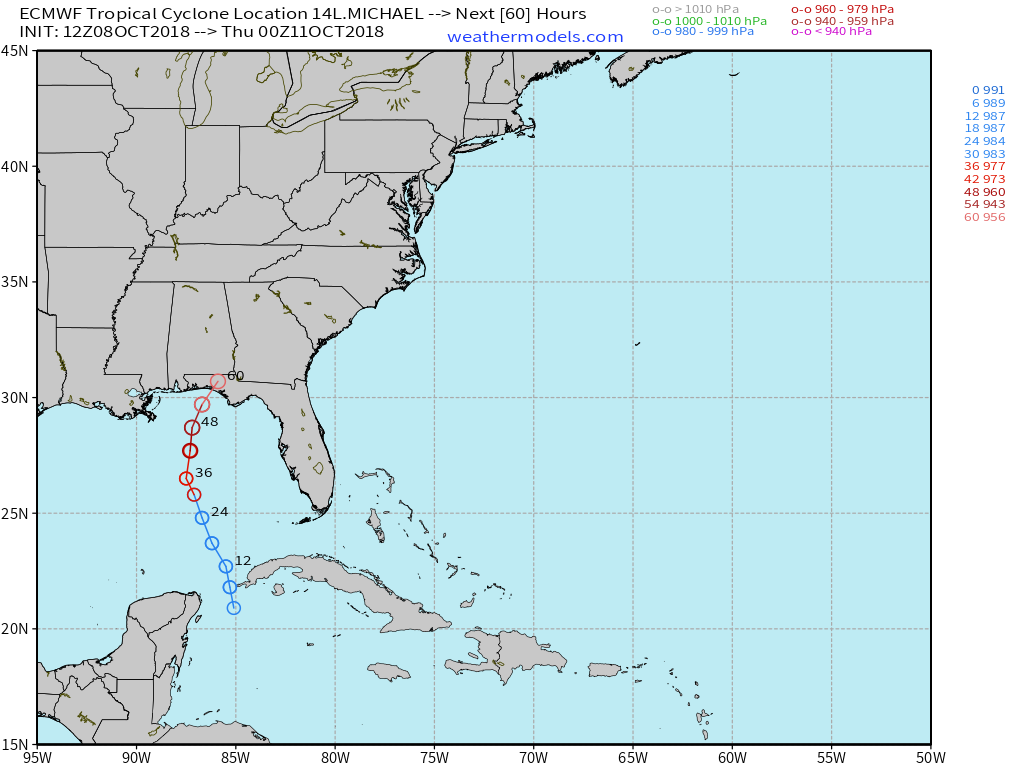
Still running about 18 hours sooner than the EURO...I don't believe the FV3 has wavered much at all...

Still running about 18 hours sooner than the EURO...I don't believe the FV3 has wavered much at all...

Yeah that's further inland and NW as well than earlier.12z UKMET went further west inland I believe.
Yay just what I needed. A TS though my backyard.I don't believe the FV3 has wavered much at all...
 . Unfortunately, the FV3 probably won't budge much and it seems reasonable to say it could stay within 50 or so miles of that path.
Wow way west. Very close to the FV3 track.12z UKMET went further west inland I believe.
And just shy of the NHC track.Wow way west. Very close to the FV3 track.
 B Rad pre heating his oven! Getting ready to cook that crow he’s about to eat!
Yep and if the Euro comes west any we will be getting very close to a consensus...12z UKMET went further west inland I believe.
That's the 00z run. Which was west yesWow way west. Very close to the FV3 track.
I think it was 12Z according to time stamp on the map.That's the 00z run. Which was west yes
Yep and if the Euro comes west any we will be getting very close to a consensus...

That’s a large jump north from 0ZUK sped up a lot from it's 0z run. It's 12 hours faster than the 0z run and 12 hours faster than the GFS. Will need to see it's ensembles to see if that was a blip run or not.
Last 3 runs of the UK all valid 12z Thursday.
View attachment 6788

If the FV3 wins...man props. Good test for it for sure.
It was one of the more eastern ones on Florence, but I still feel as if the middle ground ended up winning on the models there.
At this point it would just be nice to go into Winter....It would be nice to go into winter with a good US model.
FV3 coming in hot! Get the bread and Milk!View attachment 6787 B Rad pre heating his oven! Getting ready to cook that crow he’s about to eat!
The operational Euro is also running 4x daily from what I understand.Yeah it runs 4x a day now and will be useful for winter storms and systems like this. I believe it went live October 1st.
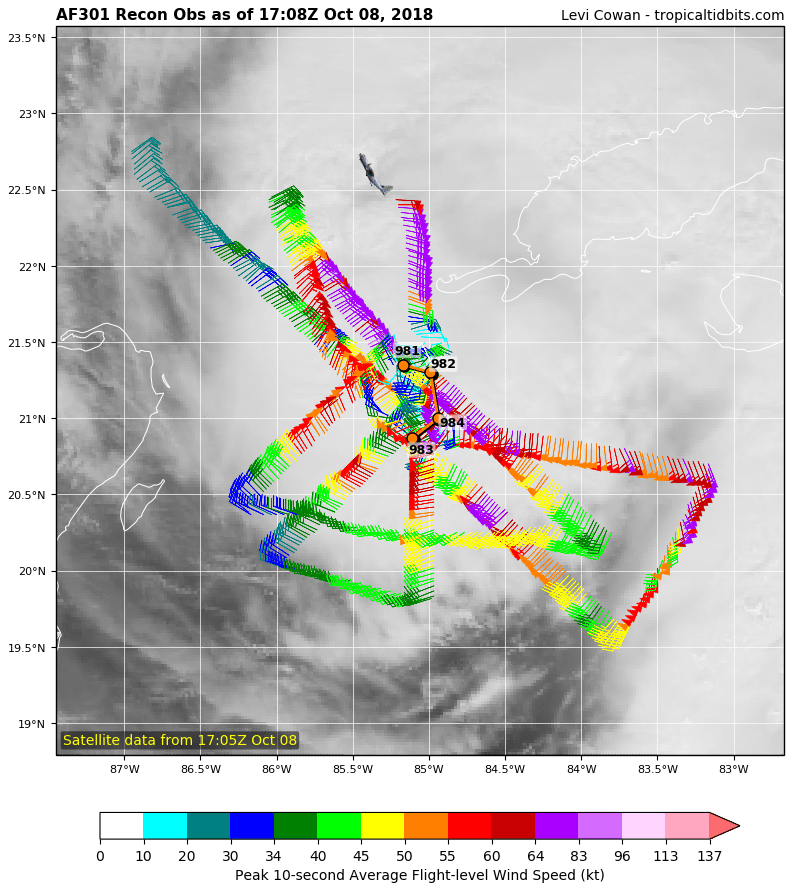
Huge strong wind field
12z Euro is a running
That's almost an understatement ...Euro is quite a bit west this run so far through 36.

Euro seems significantly faster and is a major shift west so far on the free maps.
Well then. FV3 might actually be legit really good.
Even South Carolina also.Pretty good match to timing/track with GFS now. Looks rough for FL/GA
Wow, West
