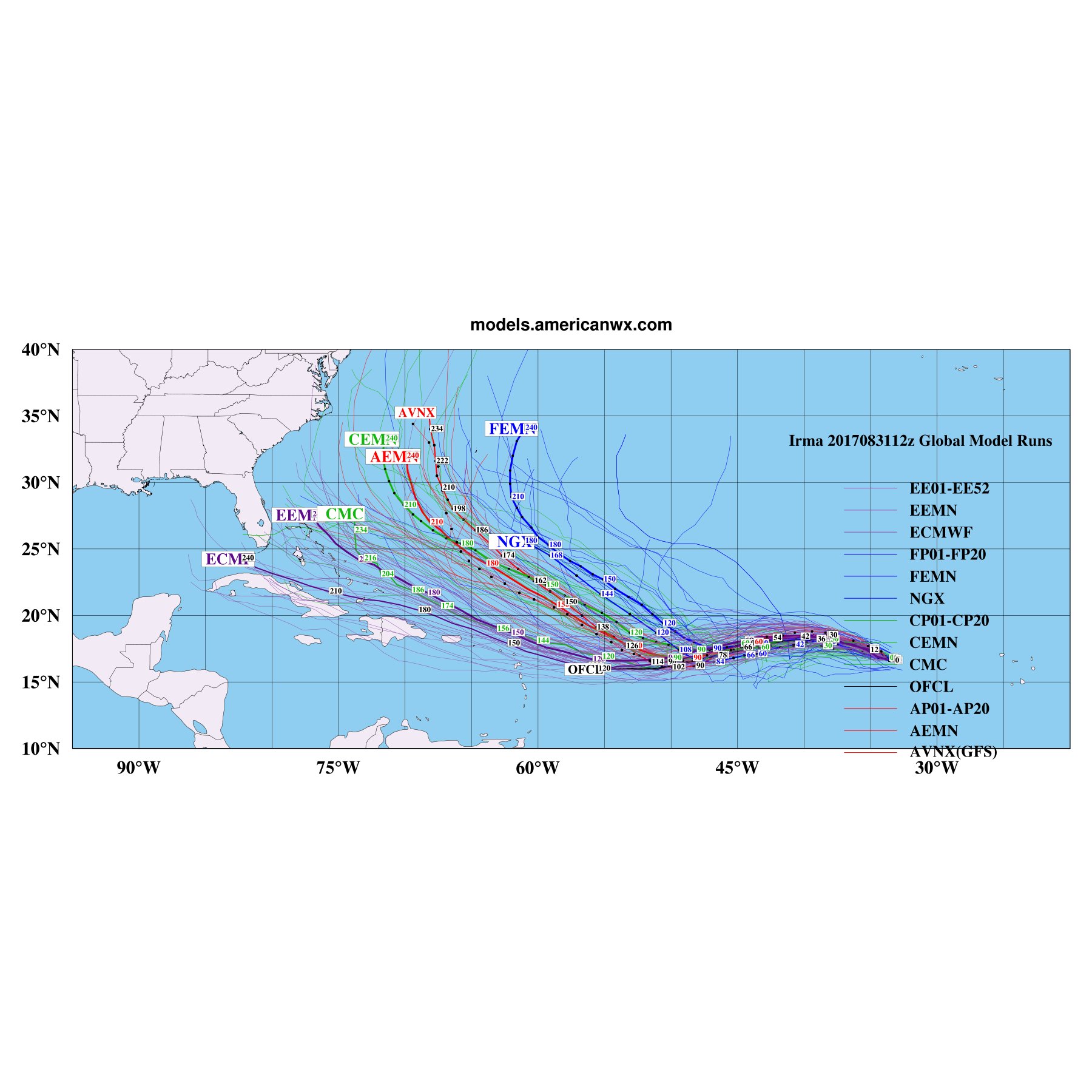
The GFS has a notorious poleward bias in this part of the Atlantic and even though it's been analyzing the intensity correctly (@ least more so than the Euro) it's been verifying way too north even in the short term. NCEP's utilization of "vortex bogusing" to allow the GFS model to properly initialize Irma's intensity is advantageous in that it gets somewhat close to the intensity (as close as it can w/ its resolution), however they insert a "fake" idealistic, vortex into the model that can differ appreciably from reality so caution should be urged here. It also should be noted that the HWRF (which also tends to have a large poleward bias with east Atlantic TCs) is actually on the southwestern most portion of the NWP guidance envelope... Regardless, once we get recon data assimilated into the models and as this grows in size once it closes in on the Lesser Antilles, the global models will have an easier time resolving it & thus forecast confidence will increase. (the increase in size will receive contributions from the increasing upper level moisture content, lowering background MSLP, and potential for more eyewall replacement cycles that usually result in a broadening of the TC's wind and pressure field). The NHC is also using experience with these situations in that the intensity of the subtropical ridge is often underestimated (as we saw during Hurricane Ike (of course improvements have been made since) & how the storm has verified so far against the guidance, which for the most part has been well south & stronger than advertised...