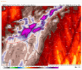
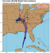
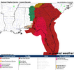
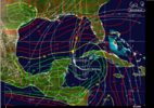
The movement the next 24 hours will def help paint the picture toward landfall point. West vs east.
-
Hello, please take a minute to check out our awesome content, contributed by the wonderful members of our community. We hope you'll add your own thoughts and opinions by making a free account!
You are using an out of date browser. It may not display this or other websites correctly.
You should upgrade or use an alternative browser.
You should upgrade or use an alternative browser.
Tropical Major Hurricane Helene
- Thread starter SD
- Start date
- Status
- Not open for further replies.
They must be thinking the ULL is going to start pull it sooner. Out pretty hard to bet against the EURO thoughStill on the western track! Wow wow wow NHC must know something
HugeSnowStick
Member
It was always forecast to go this direction, then NWIt's all so confusing to me. All these models are east and the NHC keeps nudging it further west.
If they know something we don’t, I wish they would pass it along to the local Mets who are hyping this up. Cause my area is now a pretty good amount out of that cone and we still are being told worst storm in years.
Drizzle Snizzle
Member
Yeah all the conflicting information is not a good thing. There should be some sort of consensus by now since we're just a little over 24 hours away.If they know something we don’t, I wish they would pass it along to the local Mets who are hyping this up. Cause my area is now a pretty good amount out of that cone and we still are being told worst storm in years.
East side of the center is the worstIf they know something we don’t, I wish they would pass it along to the local Mets who are hyping this up. Cause my area is now a pretty good amount out of that cone and we still are being told worst storm in years.
HugeSnowStick
Member
I already have half a foot of standing water in my yard. This could be catastrophic for the Atl metro.
Nerman
Member
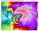
That "H" is way up there in Georgia on this!
Sctvman
Member
Mets-Braves tonight is PPD
Drizzle Snizzle
Member
At this rate, on the next update, the center will be in East Alabama.
mydoortotheworld
Member
This is probably one of the more insane things I’ve ever seen on this board
Henry2326
Member
From NHC discussion:
A catastrophic and deadly storm surge is likely along portions
of the Florida Big Bend coast, where inundation could reach as high
as 20 feet above ground level, along with destructive waves.
Catastrophic and life-threatening flash and urban flooding,
including landslides, is expected across portions of the southern
Appalachians through Friday.
Considerable to locally catastrophic flash and urban flooding is likely for northwestern and northern Florida and the Southeast through Friday. Widespread minor to moderate river flooding is likely, and isolated major river flooding is possible.
Some of the Rapid Intensification (RI) indices, particular DTOPS, respond to this environment by indicating at least a 90 percent chance of a 35-kt increase in intensity over the next 24 hours.
The NHC intensity forecast now shows an intensity of 115 kt (Category 4) at 24 hours, which is mirrored by several of the regional hurricane models and the SHIPS guidance.
It should be noted that additional strengthening is possible beyond 24 hours before Helene makes landfall Thursday evening.
- Joined
- Jan 5, 2017
- Messages
- 3,779
- Reaction score
- 5,989
NHC is being very generous with the Cat 1 ranking, I think. They even admit that they are taking the highest value from the satellite intensity estimates. Why do that? Why not report the average intensity estimate, which makes Helene only a tropical storm. It is currently only slightly west of where the 12Z Euro said it would be at this time.They must be thinking the ULL is going to start pull it sooner. Out pretty hard to bet against the EURO though
Blue_Ridge_Escarpment
Member
Mets-Braves tonight is PPD
PPD tonight and tomorrow. DH Monday.
HugeSnowStick
Member
And that tongue will most likely be pulled west, Heck I have already had 2.32inchesThis is probably one of the more insane things I’ve ever seen on this board
LovingGulfLows
Member
- Joined
- Jan 5, 2017
- Messages
- 1,499
- Reaction score
- 4,100
Tropical Storm Warning now for my area.
Expected to be at least a cat 4 at landfall.
Henry2326
Member
Yep, it has been all week on the HWRF and HMON.That "H" is way up there in Georgia on this!
I've been expecting this all week. I live on the west side of Atlanta. It's gonna be brutal. Moved from Charleston hoping to never be in this situation again. I would have left Charleston with pressure less than 965. No where to go....The irony of it......
BufordWX
Member
Hurricane Warning now issued up to Macon.
511 PM EDT Wed Sep 25 2024
...TROPICAL STORM WARNING IN EFFECT...
A Tropical Storm Warning means tropical storm-force winds are
expected somewhere within this area within the next 36 hours
* LOCATIONS AFFECTED
- Atlanta
* WIND
- LATEST LOCAL FORECAST: Equivalent Strong Tropical Storm force
wind
- Peak Wind Forecast: 45-60 mph with gusts to 85 mph
- Window for Tropical Storm force winds: early Friday morning
until Friday afternoon
Reminder that the cone is for the center not impacts. So when you realize that it's a little less confusing. You can be outside the cone and still have very serious impacts.
Especially on the east side/right front quadrant.Reminder that the cone is for the center not impacts. So when you realize that it's a little less confusing. You can be outside the cone and still have very serious impacts.
Regarding the NHC track being west of almost all modeling. This is why we still have human beings making forecasts using all available tools and have not yet turned over weather forecasting to AI-generated forecast products.
That said, I'm, surprised they haven't mentioned the reasoning in the discussions as they usually do.
That said, I'm, surprised they haven't mentioned the reasoning in the discussions as they usually do.
TerryInTucker
Member
Same.. paired with a main break at the foot of my driveway. Wish I had a rain gauge!I already have half a foot of standing water in my yard. This could be catastrophic for the Atl metro.
Nah… it’s pretty much locked in the last few runs
Drizzle Snizzle
Member
Wind Gusts to 105 mph here according to FFC.
Showmeyourtds
Member
Not sure if this has been shared, but this can give you an idea to zoom in on your area with respect the storm track & trajectory.
Enjoy!

 zoom.earth
Enjoy!
Weather Satellite & Radar Map | Zoom Earth
Near real-time global weather satellite images. Updated every 10 minutes across the US.
mydoortotheworld
Member
lj0109
Member
Entire State of SC is now under a Tropical Storm Warning with the latest updated package....that's a first 
Henry2326
Member
Theoretically, on the east side that close to the path, and based on the HWRF and HMON, it should be a bit higher than that. I would say 115-120, if it comes in at landfall as cat4/5, and you are 6 hours later.Wind Gusts to 105 mph here according to FFC.
Regarding the NHC track being west of almost all modeling. This is why we still have human beings making forecasts using all available tools and have not yet turned over weather forecasting to AI-generated forecast products.
That said, I'm, surprised they haven't mentioned the reasoning in the discussions as they usually do.
Gonna be certainly fun to watch to see what line of thinking is correct here.
Henry2326
Member
That feels like a "cover my butt" reaction.Entire State of SC is now under a Tropical Storm Warning with the latest updated package....that's a first
severestorm
Member
Still really struggling with the dry air it seems.
Drizzle Snizzle
Member
I guess it just depends on how how strong it is at landfall and whether its strengthening or weakening at landfall.Theoretically, on the east side that close to the path, and based on the HWRF and HMON, it should be a bit higher than that. I would say 115-120, if it comes in at landfall as cat4/5, and you are 6 hours later.
lexxnchloe
Member
Once she gets to about 25°N, I bet she ramps up quickly.
lexxnchloe
Member
severestorm
Member
- Status
- Not open for further replies.

