-
Hello, please take a minute to check out our awesome content, contributed by the wonderful members of our community. We hope you'll add your own thoughts and opinions by making a free account!
You are using an out of date browser. It may not display this or other websites correctly.
You should upgrade or use an alternative browser.
You should upgrade or use an alternative browser.
Tropical Major Hurricane Helene
- Thread starter SD
- Start date
- Status
- Not open for further replies.
ForsythSnow
Moderator
Michael and Ian are the only thing making me not agree. It really depends on storm structure and how fast it organizes. Modeling indicates it's a hurricane when it reaches the gulf, so if it isn't, it'll be weaker than a 4 .Not enough time to get to a cat 5 I don’t think
Cat 4 pushing 5 easy. Bet on itAs my experience I've been tracking storm since 2000 I must say this is going to be a cat 3 moving very fast I don't see this getting a cat 5 or 4
Then Charley rapidly intensified, strengthening from a 110 mph (175 km/h) hurricane with a minimum central barometric pressure of 965 mbar (965 hPa; 28.5 inHg) to a 145 mph (235 km/h) hurricane with a pressure of 947 mbar (947 hPa; 28.0 inHg) in just three hours. ItNot enough time to get to a cat 5 I don’t think
ULL is deeper but slower on the GFS through 60.
ForsythSnow
Moderator
If I'm taking a guess, it'll be further west this run since the ULL and storm will begin pivoting sooner. Already a touch west prior than 6Z.ULL is deeper but slower on the GFS through 60.
As of 84 it's already on land but still 30 or so miles NW.
Showmeyourtds
Member
Looks like that ULL is anchoring down over Texarkana....meanwhile, Helene is going to stop by & see if she can get on @ Augusta National on hr 93
Henry2326
Member
NoSnowATL
Member
NoSnowATL
Member
I thought it would have too. There was a little more separation between the ULL and the storm allowing the NNE movement to continue on this run.If I'm taking a guess, it'll be further west this run since the ULL and storm will begin pivoting sooner. Already a touch west prior than 6Z.
As of 84 it's already on land but still 30 or so miles NW.
weatherboyy
Member
I bet you're a cookie don't get a cat 5 or cat 4Cat 4 pushing 5 easy. Bet on it
jaymackd3
Member
Anyone have the recon link, please?
Aircraft Reconnaissance | Tropical Tidbits
Live updating recon data for the Atlantic basin
Recon link
jaymackd3
Member
Thank you very much!Aircraft Reconnaissance | Tropical Tidbits
Live updating recon data for the Atlantic basinwww.tropicaltidbits.com
Recon link
12z UKMET: similar to 0Z with landfall just E of Apalachicola ~midnight Thu night moving NNE into S GA then curls back NNW into N GA just S of Atlanta
TROPICAL DEPRESSION 97L ANALYSED POSITION : 16.7N 82.2W
ATCF IDENTIFIER : AL972024
LEAD CENTRAL MAXIMUM WIND
VERIFYING TIME TIME POSITION PRESSURE (MB) SPEED (KNOTS)
-------------- ---- -------- ------------- -------------
1200UTC 23.09.2024 0 16.7N 82.2W 1006 25
0000UTC 24.09.2024 12 18.6N 82.2W 1004 33
1200UTC 24.09.2024 24 18.6N 84.6W 1003 34
0000UTC 25.09.2024 36 19.1N 84.6W 1000 38
1200UTC 25.09.2024 48 20.6N 85.1W 997 46
0000UTC 26.09.2024 60 22.8N 85.4W 992 46
1200UTC 26.09.2024 72 25.3N 85.5W 988 48
0000UTC 27.09.2024 84 28.5N 85.0W 984 53
1200UTC 27.09.2024 96 33.2N 83.9W 988 36
0000UTC 28.09.2024 108 38.1N 85.2W 996 33
1200UTC 28.09.2024 120 39.1N 91.0W 999 26
0000UTC 29.09.2024 132 39.0N 92.2W 1003 13
1200UTC 29.09.2024 144 CEASED TRACKING
I've always thought a decent projection, as far as placement, was to take the UKMET and the EURO from about 2 to 3 days out and determine the median between those two.
HugeSnowStick
Member
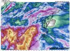
LOL,That hole over ATL makes no sense whatsoever...
Drizzle Snizzle
Member
Dry slot ?LOL,That hole over ATL makes no sense whatsoever...
Brent
Member
LOL,That hole over ATL makes no sense whatsoever...
Hey it happened here in the winter two years in a row
HugeSnowStick
Member
Not buying it.Dry slot ?
Ron Burgundy
Member
The “Glenn Burns Atlanta Heat Island” (TM)Dry slot ?
Blue_Ridge_Escarpment
Member
That’s where the eye goes overLOL,That hole over ATL makes no sense whatsoever...
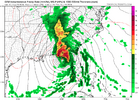
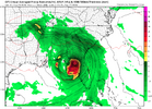
GFS is on its own with the Eastward projection but I'd assume that low rainfall spot is some kind of meteorological nonsense involving dry air intrusion from the upper level low but idk
HugeSnowStick
Member
Agree, too far east.GFS is on its own with the Eastward projection but I'd assume that low rainfall spot is some kind of meteorological nonsense involving dry air intrusion from the upper level low but idk
Mandatory viewing for all
I bet not!Not buying it.
Attachments
HugeSnowStick
Member
So, what, are you trying to dig at me or something? Just makes no sense!I bet not!
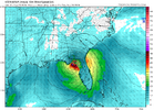
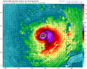
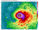
888 MB!Unsure if I’m looking at a hurricane intensity model or this secretly the NAM in disguise??? 903mb in 66 hours
View attachment 151514
Not at all. I know you all need rain. No one knows a thing at the momentSo, what, are you trying to dig at me or something? Just makes no sense!
ForsythSnow
Moderator
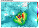
Might not get that strong, but I would not be surprised at all to see it blow up quickly. That's the way it's been with the Gulf storms the past few years.HAFS A stands for HAFS Apocalyptic. I have to question how valid this is or if we are actually about to see the strongest hurricane ever. I'm leaning the former where it's overdone.
View attachment 151515
- Joined
- Jan 23, 2021
- Messages
- 4,603
- Reaction score
- 15,199
- Location
- Lebanon Township, Durham County NC
accu35
Member
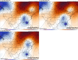
Can you post the gefs at landfall?I thought this was an interesting image off GEFS. Almost seems like theres two camps:
View attachment 151516
ForsythSnow
Moderator
Plane has finally reached PTC9 and should be looking for a center shortly. This should help some at knowing where it actually is.
NoSnowATL
Member
- Status
- Not open for further replies.

