ForsythSnow
Moderator
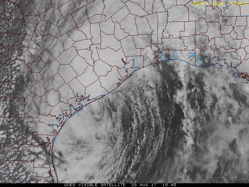
Harvey back up to 45 MPH.
Lol, you beat me to itHarvey back up to 45 MPH.
LOL. Something new we have this advisory is an actual end to the storm. Harvey finally has a time limit until post-tropical status.Lol, you beat me to it

Already doubled today sadly. Hoping for no more.Body count bout to go way up
Sent from my iPhone using Tapatalk
They are looters trying to rob rescuers. But CNN likes to write their own story.(CNN)As Harvey continues dumping rain on East Texas and the waters there continue to rise, people are starting to panic, rushing rescue boats and even shooting at them if they don't stop, said one volunteer rescuer.
Doing anything for a quick view it sounds like. They are hurting pretty bad. People aren't panicking, they are helping each other.They are looters trying to rob rescuers. But CNN likes to write their own story.
Sent from my SM-G900T using Tapatalk

43" reported SE of Houston now...
may eclipse even the 50" totals at this rate


Winds indicate a 50 mph TS.Didn't know this, but recon is flying around Harvey again and finding 995mb pressure.
What's stupider is I heard a professor in Tampa said they deserved it. Sad that people are getting angry and pointing fingers. It's not ever good to say something like that.It annoys me to see people throwing out "Hurricane Harvey was Climate Engineering", just so damn stupid!
What's stupider is I heard a professor in Tampa said they deserved it. Sad that people are getting angry and pointing fingers. It's not ever good to say something like that.
...THIS IS A FLASH FLOOD EMERGENCY FOR JEFFERSON...ORANGE and HARDIN
COUNTIES...
...THE FLASH FLOOD WARNING REMAINS IN EFFECT UNTIL 1015 PM CDT FOR
JEFFERSON...SOUTHWESTERN NEWTON...HARDIN...ORANGE AND SOUTHEASTERN
JASPER COUNTIES...
At 833 PM CDT, Doppler radar continued to indicate a nearly
stationary area of heavy rains impacting the warned area. Widespread
flooding is already occurring. High resolution forecast guidance
indicates another 10 to 15 inches of rain is possible over the
remainder of the night. This is a PARTICULARLY DANGEROUS SITUATION.
SEEK HIGHER GROUND NOW!


