• Hello, please take a minute to check out our awesome content, contributed by the wonderful members of our community. We hope you'll add your own thoughts and opinions by making a free account!

Tropical Major Hurricane Harvey

Sounds like if the NAM is right the worst is yet to come for the Houston area.
Yea not a good sight to see...this is into Tuesday night (06z Wednesday)
qpf_acc.us_sc.png
 
The Tropical Storm Warning has been extended from Port O'Connor
southward to Mesquite Bay and from Sargent northeastward to High
Island.

Interests elsewhere along the upper Texas coast and in southwestern
Louisiana should continue to monitor the progress of Harvey.

Rainfall totals could reach 50 inches in some locations, which would
be historic for that area.
 
Lots of dry air in the circulation so that will slow things down. I want to say it probably doesn't strengthen much, but then the other part knows Harvey doesn't play by the rules.
 
yeah I'm not very bullish on it restrengthening as of now(the center is quite broad and disorganized) but if it forms convection wrapped around the center then we might have a bigger problem
 
just when it looks like the models shift east... the 0z GFS has Harvey flooding Dallas on Friday, a foot falls just east of me, big swath right up the middle of Texas. :confused:

I'll take the Euro plz.
 
Through 4PM today, the official Houston station had received an astounding 28.41" of rainfall month to date with much more still to come!! The 28.41" was already enough to obliterate the previous record for any month on record (back to 1889), which had been the 19.21" of June, 2001 (Allison)!! Let that sink in, folks.

Edited to say "month to date"
 
Last edited:
yeah I'm not very bullish on it restrengthening as of now(the center is quite broad and disorganized) but if it forms convection wrapped around the center then we might have a bigger problem

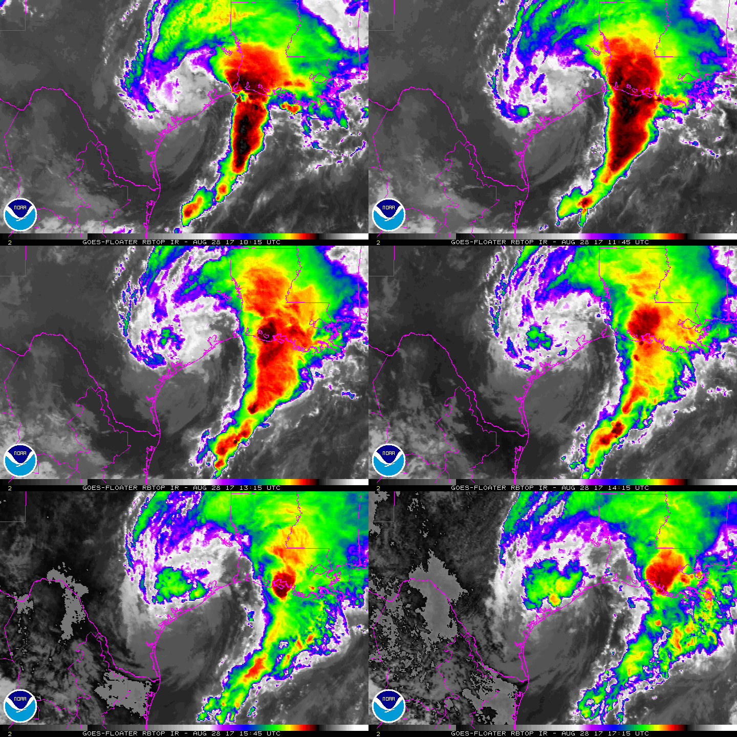
Looking at satellite, Im much more positive that it does not strengthen. Definitely looks more extra-tropical than tropical now. From the "cold front" to the strong flow on NW side and the overall comma shape. You can also see the increase in forward motion of the front over the gulf.

Another thing is looking at 500mb, it is much more part of a trough than a separate entity.

WhIle it's ghost will still cause problems, I tend to think Harvey as a TC is gone.

swir-animated.gif
 
Euro goes inland around the TX/LA border Wednesday at the same strength it is now, east of the Houston metro this run
 
Strength wise im not worried, rain/storms will be the big issue
 
at201709.gif
Well the path is little further east. Harvey is currently moving at 3mph very slow.
 
Houston's taking it on the chin again this morning and Harvey isn't looking like letting up.... also not sure it's moving anymore looks like it's hit a wall right at the shoreline.
 
Houston's taking it on the chin again this morning and Harvey isn't looking like letting up.... also not sure it's moving anymore looks like it's hit a wall right at the shoreline.
Its moving at 3mph very very slow. Is the reason Harvey will stay over waters for about 2 days
 
My friend who is a nurse in Houston is pleading on Facebook for people to be rescued in the Norchester neighborhood.
 
You are not even "abnormally dry". How do you need it desperately ?
It has not rained in here for well over a week, and out lake needs to still recover. It is over 5 feet below and it has needed to go up. If it doesn't there are threats to keep the level 2 drought restrictions for a lot longer. Not to mention that I have seen weeds wilting on the side of the road, which isn't common at all.
 
63d5599a0b21b29ac992665bb0c008fff1eb2473aaf849fb796a16c3c660c4a9.gif
If the firing convection holds together around center than Harvey could ramp up faster than forecast
 
Not saying this to be comical, but Harvey is coming to deliver the knock out blow tonight and tommorrow to Houston and surrounding counties.
Surface wind gust are picking up and clouds are cooling. Coc is practically walking through the sand at the beach and about to enter the water. Sst are in upper 70s due to flood water runoff right up against the shoreline. So if he can meander a few miles off coast its going to make matters worse.
Thing that's concerning is if he gets enough wind or ump to put surge onshore flow back up the bayous while dumping heavy rain one last time. Just going to compound the problems.
 
If Harvey makes landfall again, does that count as a 2nd, or a 3rd landfall? I am hearing Harvey already made two with its initial landfall, but I think that it is documented as 1 landfall, but the storm is going to make landfall at a totally different location at a different day, so would that mean we would have still 3 US landfalls, 4 US landfalls (1 initial, 1 coming soon), or 5 US landfalls for the season (2 initial from barrier island and mainland, 1 coming soon)?
 
It really doesn't look purely tropical at this point but dang those cooling cloud tops right over the center as it approaches the gom is concerning....
 
It really doesn't look purely tropical at this point but dang those cooling cloud tops right over the center as it approaches the gom is concerning....
I would have to argue it is coming back to one. Look at the satellite loop through the day today. It has regained some of that classic outflow appearance over land, but it is not visible on IR or WV, only visible. Here is a quick circling of what I am talking about. Have to monitor this area and the rest of the storm through the day to see if this persists or spreads.
Harvey_Offshore_Aug282017_Sat.jpg

That joker is trying to restack as well. Look at the gif Accu posted. You can see the pivot of the 700-500mb low jump southward. You can also see thicker clouds pulling around the western side as moisture has began to increase. I may end up being wrong on my prediction last night.
 
That joker is trying to restack as well. Look at the gif Accu posted. You can see the pivot of the 700-500mb low jump southward. You can also see thicker clouds pulling around the western side as moisture has began to increase. I may end up being wrong on my prediction last night.
We all seem to have been wrong about one aspect or another about this storm. One thing is for sure is that this thing is hard to predict and could definitely gain some strength before the next landfall, but the limiting factor is that deep dry air it has wrapped into it.
 
18Z 3KM Nam...I mean any more rain is bad for this area, but seeing this much more rain across these areas would be completely catastrophic with more rain still falling...
18z_3km_nam.png
 
Back
Top