• Hello, please take a minute to check out our awesome content, contributed by the wonderful members of our community. We hope you'll add your own thoughts and opinions by making a free account!

Pattern Magnificent March

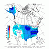
Enjoy the late Feb warmth... at the very least, early March is bringing a cool down to the southeast.. anything more? stay tuned, this isn't the worst looking pattern out there, folks:
gfs_T2ma_namer_39.png
 
Last edited:
GEFS shows the east coast ridge retrograding, product of the -NAO being forecast I'm assuming:
gfs-ens_z500a_us_59.png
nao.sprd2.gif
 
we'll see.. that's some pretty consistent prognostication for a serious NAO dip. Whether that deeply affects winter weather chances in the SE is a different story. East coast storm formation chances are greatly enhanced however.
 
seems as we get closer n closer nao doesnt seem to go in the tank as much... to be honest seems like the average early march cool down see every year.... in and out....

All major models have shown a deep -NAO for the last 2-3 days and haven’t backed off since, so I’m not sure where you’re seeing that
 
All major models have shown a deep -NAO for the last 2-3 days and haven’t backed off since, so I’m not sure where you’re seeing that
Long range in the 6z gfs this morning does start show the negative nao. Your talking bout ... see if models start catch that as we go along
 
You got get agreement on ops to it carry over to ensembles so it starts there
It’s actually the opposite. Ensembles are better at picking up on trends and pattern changes first, then you look at the op models about 3-5 days out, and they might have a clue then, maybe.
 
Long range in the 6z gfs this morning does start show the negative nao. Your talking bout ... see if models start catch that as we go along

The long range operationals have been showing a strongly negative west based -NAO for days
 
Here's my issue with trying to make a come back in March....the h5 pattern looks pretty nice in the long, long range (problem #1, it's long long range) as has been discussed with the blocking. Temp anomalies are solidly below normal for that time of year, and models are even trying to retrograde the western trough more toward the Aleutians popping a ridge over the rockies, pushing lower heights over the east. But being in March, the temp is barely scratching freezing in MBY. I just doubt at that point, we're going to get cold enough in mid-March. And I know it's possible to get really cold air at that time, but I believe it's unlikely. We'll see. The big -NAO has me watching though.

gfs-ens_z500a_nhem_58.png

gfs-ens_T2ma_nhem_58.png

gfs-ens_T2m_eus_58.png

I hear yeah. The problem with trusting literal 2mT’s that far out is that it’s highly unreliable. That’s as good as trusting a winter storm verbatim in the late 300hr+ outputs. The deeper the anomalies this far out the stronger the signal, technically, because there’s so much spread in ensemble members. The anomalies will only get deeper and more extreme as we get closer, so seeing near freezing now is actually a good thing. Ensembles aren’t meant to be taken verbatim either, especially at mesoscale levels. I don’t even look at mesoscale data this far out. If you trend the 2mT’s on the same time frame in the GEFS for the next few runs I guarantee it will get colder. Pattern recognition first, then worry about the small stuff.
 
Great post. I agree completely. Most March snow events are with anomalously deep troughs/upper lows. A negative NAO can get you that, but even with a negative NAO in March the odds are quite poor beyond the first week for significant wintry weather.

Just look at March 2013 as a recent example. 6th coldest March on record at RDU with a textbook negative west-based NAO and the pattern still produced nothing.

compday.q0hqJJuia5.gif


P.S. What does the 6th coldest March at RDU look like from a temperature perspective? Not even one day with highs in the 30s.

View attachment 4107

Jon does make a good point that ensembles may be smoothing things out and if we do get a really extreme block, the temp could go extreme as well. Thanks for posting that about 2013. That sums up where I am right now. March cold is not quite January and early February cold. But never say never.
 
^I'm looking forward to just having cool temperatures and not be so crazy warm like they are this month. I'm certainly not expecting wintry precip in or near my area. I hope folks keep their expectations in check as nobody is actually predicting a big SE winter storm.
 
^I'm looking forward to just having cool temperatures and not be so crazy warm like they are this month. I'm certainly not expecting wintry precip in or near my area. I hope folks keep their expectations in check as nobody is actually predicting a big SE winter storm.
I agree completely. Up here, the CAD is what has saved us from 70s, but south of here, it's been torching. Seasonal temps are going to feel great, and if anyone thinks we are getting a storm in this upcoming pattern is crazy. There is a tiny potential if it gets really cold, but regardless, I wouldn't get any hopes up on snow. Every year the March argument comes up, and people fail to realize what actually caused the storms in the first place.
 
I don't think you're all that crazy if you're along or north of I-40 and/or in the mountains that you could see a storm out of this pattern. The climo in areas like Raleigh, Greensboro/Winston-Salem, the VA border counties, western piedmont and foothills/mountains is good enough to legitimately support a storm through at least mid-March if the right pattern comes along. Elsewhere especially closer to the I-20 corridor (Birmingham, Atlanta, Columbia, etc) I wouldn't hold my breath.
 
Back
Top