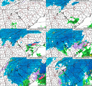
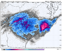
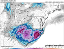
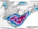
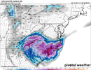
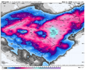
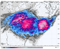
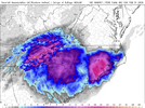
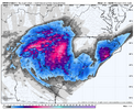
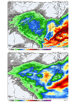
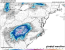
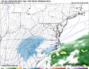
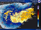
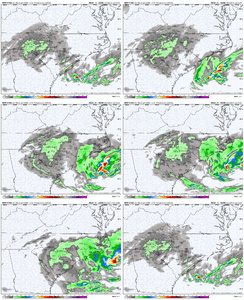
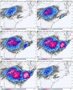
The model agreement just gives me the that comforting feeling.So anywhere from 0.3-18.2", depending on which resolution NAM we use.
-
Hello, please take a minute to check out our awesome content, contributed by the wonderful members of our community. We hope you'll add your own thoughts and opinions by making a free account!
You are using an out of date browser. It may not display this or other websites correctly.
You should upgrade or use an alternative browser.
You should upgrade or use an alternative browser.
Wintry Machine Learning Mauler 1/30-2/1
- Thread starter SD
- Start date
LovingGulfLows
Member
- Joined
- Jan 5, 2017
- Messages
- 1,499
- Reaction score
- 4,100
For some reason the snowfall output is very light for the nearly the entire first half of the event on this latest run
This has been an issue with the 3km nam all week for some reason. The banding on the surface reflection looks way more impressive than it's final QPF outputs. It's so bizarre.
come on mhx. blizzard warnings. i know one of you is lurking. do it for the culture
Fountainguy97
Member
Man the 18z high-res models are stacking some impressive moisture against the apps on the TN side. I can't wait!! Snow in the single digits as the NW moisture pulls through sounds nice
That's not true at all. The 12z run did, but the 18z is not (not that it's a great run).18z 3k NAM also blanking the Triangle. We're officially intoterritory.
3km NAM is 3-6" at RDU (0.3" QPF), apparently that's "blanking"? The 12z run had basically nothing, so I'll take it!
- Joined
- Jan 23, 2021
- Messages
- 4,602
- Reaction score
- 15,197
- Location
- Lebanon Township, Durham County NC
Well for one thing the car got stuck halfway down the driveway todayWhat's taking @BullCityWx so long to chime in on the new 15z SREF??? Even jucier than prior runs!
I love the SREF and NAM being very similar
WxBlue
Meteorologist
Can confirm. NE snowstorms are a lot more stable than this. It's getting comical at this point.From an outside perspective this sort of model disagreement does not happen when a snowstorm comes through the Northeast or Midwest. Only Southeast LOL
blueheronNC
Member
It all happens on the backend as the coastal gets cranking on the way out. No warm front FGEN precip. I'd hate to be sitting here Saturday evening with bare ground waiting for the coastal to contribute.3km NAM is 3-6" at RDU (0.3" QPF), apparently that's "blanking"?
iGRXY
Member
NBAcentel
Member
I don't disagree that it would not be fun to deal with, but a blanking it is not. Definitely a possibility we have to be prepared for, though, where we only get a few inches while everyone on both sides of us digs out. That would suck!It all happens on the backend as the coastal gets cranking on the way out. No warm front FGEN precip. I'd hate to be sitting here Saturday evening with bare ground waiting for the coastal to contribute.
beanskip
Member
NAM and HRRR in RDU -- what's 20 inches of snow between friends?
It's hard to believe these are supposed to be more or less the same model sometimes.NAM and HRRR in RDU -- what's 20 inches of snow between friends?
iGRXY
Member
WxBlue
Meteorologist
3km NAM looked bleak but rallied to about 6-7" in my area with a lot more just a stone throw to my east. I'll take it.
Never seen anything like this and I thought that I 95 R/S line was a monkey wrench into forecasting. I bet the CAMs show something completely different at 0zCan confirm. NE snowstorms are a lot more stable than this. It's getting comical at this point.
Seeing central to southern coastal plain starting to evolve as the jackpot zone. Where our coastal forms further south.
Interesting how the NWS doesn't seem to be buying the ULL enhancement around CLT or the precip minimum closer to RDU like many models are showing.
BrickTamland
Member
That's encouraging. Seems they are not smelling what the HRRR is cooking.
iGRXY
Member
The NWS is using a NBM for totals that's running at least a cycle behind.
Looks like they do to an extent buy the precip min near RDU as a possibility. They lowered the low end totals to 1” and it seems they have percentages reflecting that. Just seems they believe that has a relatively small chance at verifyingInteresting how the NWS doesn't seem to be buying the ULL enhancement around CLT or the precip minimum closer to RDU like many models are showing.
Shaggy
Member
I feel like if we can get the RGem to match the 3k Nam then it's gonna be a big weekend for lots of folks
Are all the totals from NWS 10:1 to? If we know ratios will be higher is that accounted for in these types of forecasts? Asking for real not for weenie, I’m just curious.The NWS is using a NBM for totals that's running at least a cycle behind.
Dunkman
Member
I love that the 27.1 spot is 0.0 on the HRRR
Tsappfrog20
Member
Allan Huffman Update


Sent from my iPhone using Tapatalk


Sent from my iPhone using Tapatalk
NBAcentel
Member
Need at least 1 more suite of modeling and consistent hrrr runs for them to bite. Me personally, I buy it, because it’s better for my area and benifits me more.Interesting how the NWS doesn't seem to be buying the ULL enhancement around CLT or the precip minimum closer to RDU like many models are showing.
Those QPF totals are feast or famine for KRDU and surrounding areas. I hope the HRRR is off of its rocker with this run.
Seeing central to southern coastal plain starting to evolve as the jackpot zone. Where our coastal forms further south.
The coastal plains will remain undefeated in the non-mountaintop snow totals.
iGRXY
Member
This is 100% sound logic and should not be argued withNeed at least 1 more suite of modeling and consistent hrrr runs for them to bite. Me personally, I buy it, because it’s better for my area and benifits me more.
I was reading about this earlier. I don't know if true but read the HRRR struggles with dry air intruding at 700-500 mb layer. Evidently it want to collapse qpf too aggressively. I'm not sure if this happened on the latest HRRR run, as I haven't had time to look but would be interesting to see.HRRR usually money at this range.
LukeBarrette
im north of 90% of people on here so yeah
Meteorology Student
Member
2024 Supporter
2017-2023 Supporter
About time. Ready to see y’all’s rippage videos!

