-
Hello, please take a minute to check out our awesome content, contributed by the wonderful members of our community. We hope you'll add your own thoughts and opinions by making a free account!
You are using an out of date browser. It may not display this or other websites correctly.
You should upgrade or use an alternative browser.
You should upgrade or use an alternative browser.
Wintry King Kong Winter Storm Potential Feb 13th-16th
- Thread starter deltadog03
- Start date
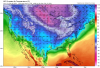
_LI.jpg")
NBAcentel
Member
Man let’s just move the big vortex East, that’s all I want at this point, forget about wintry wx for now
agreedMan let’s just move the big vortex East, that’s all I want at this point, forget about wintry wx for now
GaSnowhound
Member
This could well be more of the reality of things. Certainly sounds plausible to my novice mindIt feels like the models are forecasting phase 7 of the mjo for the foreseeable future and are spitting out patterns that match that. The reality is, the big block is going to mute that pattern, and the models will correct cooler as we work in...as long as the blocking persists.
The good news is that arctic air will be in North America. But the big problem is, until we actually get some ridging along the west coast, the cold is going to continue to dump into the western 4/5 of the country.
What that means for the southeast is continued cool/near normal conditions with some slop events possible for the very northern and western parts of the SE. The NE, Midwest, upper south-central, and western US will continue to get the bulk of the wintry weather.
We can't rule out a brief arctic intusion into the SE. But the magnitude of which has been appearing in the 10 day-ish time frame is almost certainly overdone. If, however, we see this type of cold make it across the mountains and into the area, a more serious winter threat could emerge.
The long and short of it is, the seasonal pattern of long range cold evolving to near normal temps will likely remain until we see better tropical forcing and some ridging along the west coast. If and when blocking breaks down, we will probably be discussing severe weather.
NBAcentel
Member
GFS is developing a sorta “extension” of the TPV that’s digging, it was a better run in the pacific yet that what I said above ruins it 
NBAcentel
Member
At this point GFS is tryna maximize amplification lol 
cd2play
Member
I would rather have highs in the upper 70s than be stuck with single digits and no precip.Man let’s just move the big vortex East, that’s all I want at this point, forget about wintry wx for now
The vortex looks to be shifting east with every run so who knows.GFS is developing a sorta “extension” of the TPV that’s digging, it was a better run in the pacific yet that what I said above ruins it View attachment 72090

Storm5
Member
I’m not sure why people are still focused on the Thursday / Friday . That period is dead now. We have to wait see what comes of the Saturday-Tuesday period now
Sent from my iPhone using Tapatalk
Sent from my iPhone using Tapatalk
D
Deleted member 609
Guest
ThisI’m not sure why people are still focused on the Thursday / Friday . That period is dead now. We have to wait see what comes of the Saturday-Tuesday period now
Sent from my iPhone using Tapatalk
The PNA ridge has slid east and amplified with each of the past four runs. We're not done with this King Kong monkey just yet.
JLL1973
Member
This could be a good run for the midsouth again. Probably going to be ice so I don’t know if I would call it good
That period looks to be dead for Ga. and the Carolinas, but I wouldn't say it's a goner yet for Alabama and points west though.I’m not sure why people are still focused on the Thursday / Friday . That period is dead now. We have to wait see what comes of the Saturday-Tuesday period now
Sent from my iPhone using Tapatalk
Cold push is stronger at HR132.....I-40 in TN has a mess from the first initial wave on Thursday.
NBAcentel
Member
Don’t like this consistently popping up 
Agreed. The Cad also have got stronger the last 4-5 runs.The PNA ridge has slid east and amplified with each of the past four runs. We're not done with this King Kong monkey just yet.
Another round of rain on Friday.
I'm also not sure why all of the massive highs never enter the US east of the Rockies.I’m not sure why people are still focused on the Thursday / Friday . That period is dead now. We have to wait see what comes of the Saturday-Tuesday period now
Sent from my iPhone using Tapatalk
agreed...unless in TN, and maybe some areas of NCI’m not sure why people are still focused on the Thursday / Friday . That period is dead now. We have to wait see what comes of the Saturday-Tuesday period now
Sent from my iPhone using Tapatalk
Here comes the cold push

CAD has started to get more consistent in the guidance and also the GEFS have always been full steam ahead on CAD areas receiving a big ice storm .. so not surprising the operational is moving that way
Whatever one may think of today's runs of the GFS, be thankful they bear NO resemblance to last night's King Clown run.
Storm5
Member

I’m sure this gets crushed
Sent from my iPhone using Tapatalk

NBAcentel
Member
Cold was delayed VS last run, hopefully that’s a blip
JLL1973
Member
I disagree. Models still showing wintry precip over north ms. Who knows it could disappear and y’all may be rightagreed...unless in TN, and maybe some areas of NC
Hmm...let see what the GFS tries to do here. Nice Ridge out WEST
_LI.jpg")
sorry, your right....It doesI disagree. Models still showing wintry precip over north ms. Who knows it could disappear and y’all may be right
Storm5
Member
Jesus single digits in Mississippi and tenn next Saturday am
Sent from my iPhone using Tapatalk
Sent from my iPhone using Tapatalk
Storm5
Member
It’s a good look just need the energy to not get crushed to death

Sent from my iPhone using Tapatalk

Sent from my iPhone using Tapatalk
D
Deleted member 609
Guest
A little something this time

Storm5
Member
Here we go !

Sent from my iPhone using Tapatalk

Sent from my iPhone using Tapatalk
You’re right except for the possibility of a strong CAD for the Carolinas. Even the CPC outlook yesterday was focused for the 2/13-2/15 time rangeI’m not sure why people are still focused on the Thursday / Friday . That period is dead now. We have to wait see what comes of the Saturday-Tuesday period now
Sent from my iPhone using Tapatalk
Flotown
Member
wow at the cold
And right on cue, here comes the infamous GFS day ten SE snow storm entering California
 .
.
.JLL1973
Member
Here we go !
Sent from my iPhone using Tapatalk
Yeah, but wouldn't the HP be racing out of the NE, along with our cold air, before this gets here?
D
Deleted member 609
Guest
Don't think so unless it gets held back. Its cold as ---- all overYeah, but wouldn't the cold HP be racing out of the NE, along with our cold air, before this gets here?

D
Deleted member 1449
Guest
Maybe but too early to sweat such details.Yeah, but wouldn't the HP be racing out of the NE, along with our cold air, before this gets here?