Rain chances for tomorrow have gone from 70% to 50% to now 40% and I think that's being generous
-
Hello, please take a minute to check out our awesome content, contributed by the wonderful members of our community. We hope you'll add your own thoughts and opinions by making a free account!
You are using an out of date browser. It may not display this or other websites correctly.
You should upgrade or use an alternative browser.
You should upgrade or use an alternative browser.
Pattern June 2022
- Thread starter SD
- Start date
Hmmm, 98°F at DFW now. Might still have a shot at 100°F after all.
It's the warmest day of the year to-date, BTW.
It's the warmest day of the year to-date, BTW.
Per the daily report, DFW made it to 99°F at 3:21pm.
110°F heat index:

lol (110°F high on Sunday)

57 this morning and probably last comfortable morning for a while. Also, rain chances down to 30% oh well, southern summer life
BHS1975
Member
57 this morning and probably last comfortable morning for a while. Also, rain chances down to 30% oh well, southern summer life
Looks like 0 percent from the latest HRRR.
Sent from my iPhone using Tapatalk
For the first time this event, the 00z EURO is even hotter than the GFS in the long range.
While the GFS didn't have any significant changes with the pattern, it does show the ridge taking much more of a beating from tropical disturbances than before.
While the GFS didn't have any significant changes with the pattern, it does show the ridge taking much more of a beating from tropical disturbances than before.
As one last weak shortwave track around the peripheru of the ridge, some convection has developed this morning in SE Oklahoma and SW Arkansas along with mid-level cloud cover, moving SSE
Although it shouldn't have a huge impact on the overall forecast, it may help to keep temps a bit cooler than expected in areas affected by the cloud debris & outflow boundaries depending on how widespread the activity becomes.
Although it shouldn't have a huge impact on the overall forecast, it may help to keep temps a bit cooler than expected in areas affected by the cloud debris & outflow boundaries depending on how widespread the activity becomes.
bigstick10
Member
Texas is a HELL HOLE.It gets hot in Texas.
Last night's eps 
Shaggy
Member
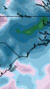
Yeah and neither model gives central eastern NC any love in regards to drought relief.Last night's eps View attachment 119112
Pattern coming up should be ok for rain chances but yeah any widespread drought relief doesn't look as good as it might have yesterday.Yeah and neither model gives central eastern NC any love in regards to drought relief.
Shaggy
Member
Looking at the 6z gfs the concern of the old "drought begets drought" fear starts to enter the back of my mind. Is it a coincidence the precip minimum overlays the severe drought zone? This is the entire runs total.Pattern coming up should be ok for rain chances but yeah any widespread drought relief doesn't look as good as it might have yesterday.
Attachments
lol


Iceagewhereartthou
Member
6z GFS is intersting. It's been advertising the heatwave after the 20th to be even hotter than next weeks, but the 6z brings through a front from almost due North and shows a couple of very pleasant days and nights, with a general return to seasonal or below average temps for the duration of the run. Who knows what will happen at this lead but its a way better look than its been showing.


Larry Cosgrove is thinking the death ridge is here to stay, at least through mid-August...
Also, he specifically references 2011 and 1980 as analogs:
LovingGulfLows
Member
- Joined
- Jan 5, 2017
- Messages
- 1,499
- Reaction score
- 4,100
Ugh, I was telling you all I didn't like what I was seeing on the GFS. Looks like the death ridge is real. Looking at weather.com forcast, mid-high 90s through the entire forecast. We need a bermuda ridge to set up off shore so we can get some southerly flow back into the SE....yes it will increase humidity, but it'll also give us higher daily rain chances with pop up convection.
That being said, as @Iceagewhereartthou posted above, 6z does push the death ridge back towards the west and we started getting some eastern troughing which could save the SE. Ofc, the central and western US bake in this regime.
That being said, as @Iceagewhereartthou posted above, 6z does push the death ridge back towards the west and we started getting some eastern troughing which could save the SE. Ofc, the central and western US bake in this regime.
Ugh, I was telling you all I didn't like what I was seeing on the GFS. Looks like the death ridge is real. Looking at weather.com forcast, mid-high 90s through the entire forecast. We need a bermuda ridge to set up off shore so we can get some southerly flow back into the SE....yes it will increase humidity, but it'll also give us higher daily rain chances with pop up convection.
That being said, as @Iceagewhereartthou posted above, 6z does push the death ridge back towards the west and we started getting some eastern troughing which could save the SE. Ofc, the central and western US bake in this regime.
The saving grace for you all further east may be a persistent -NAO block, which would keep any ridging and heat releases to the east fairly transient.
At the same time though, that outcome would only enhance the temperatures out this way because of compressional heating under the NW flow and further drying out of soils.
Last edited:
Brent
Member
This is gonna be fantastic. Is it September yet 
This is gonna be fantastic. Is it September yet View attachment 119119
Imagine how much worse it would be up your way if not for the MCS train this past week...
Also, he specifically references 2011 and 1980 as analogs:
Welp won't be hot long
At last!
Yep once we establish these big continental us heat ridges it often takes fall to get rid of them. My earlier post about the heat won't last long was more of a joke than reality. The current version of the heat ridge should slowly retrograde in time to the central SW us but the next 10 days will be warm with the centered so close. Once it retrograde we will temper back closer to average with better chances at rain. That said with that ridge lurking and the ability to squeeze it east at times we will at minimum have bouts of extreme heat (highs 95-105) through the next 30-45 daysUgh, I was telling you all I didn't like what I was seeing on the GFS. Looks like the death ridge is real. Looking at weather.com forcast, mid-high 90s through the entire forecast. We need a bermuda ridge to set up off shore so we can get some southerly flow back into the SE....yes it will increase humidity, but it'll also give us higher daily rain chances with pop up convection.
That being said, as @Iceagewhereartthou posted above, 6z does push the death ridge back towards the west and we started getting some eastern troughing which could save the SE. Ofc, the central and western US bake in this regime.
Last edited:
Brent
Member
Imagine how much worse it would be up your way if not for the MCS train this past week...
Honestly the humidity from all the rain is making it worse
Current conditions 79
BHS1975
Member
Current conditions 79View attachment 119121
Enjoy before the inferno.
Sent from my iPhone using Tapatalk
??

And there it is...
That -NAO block and how persistent it remains is why I think you guys will bake all summer and into fall and us in the east I think will see good periods set up with daily storm chances. We even see that later this week after KCLT has a 4 days 98-102, we start seeing storm chances ramp back up on the back sideThe saving grace for you all further east may be a persistent -NAO block, which would keep any ridging and heat releases to the east fairly transient.
At the same time though, that outcome would only enhance the temperatures out this way because of compressional heating under the NW flow and further drying out of soils.
It's crazy that every run of the GFS continues the advertise a daily high of 100°F+ at DFW from start to finish.
It's rare to see such consistently.
It's rare to see such consistently.
NoSnowATL
Member
Good time to start a ice cream business.It's crazy that every run of the GFS continues the advertise a daily high of 100°F+ at DFW from start to finish.
It's rare to see such consistently.
Or moveGood time to start a ice cream business.
Brent
Member
Or move
That wasn't the big reason I left but it definitely was on the longer list ?
Although it's not that much better up here
Oh. (11).png")

Ground temps are going to be an issue here.
that’s what sticks out about this set up. Typically when we see triple digit temperatures in the Carolinas, the humidity tends to be held in check a bit or at least where heat indicies are not out of control… that doesn’t appear to be the case this week