JHS
Member
Had a 70% chance of storms in upstate SC today and there is very little on the radar over this area. I sure wish Barry was taking the track hurricane Francis took in 2004. Maybe it would finally rain around here.
Looking good!Had a 70% chance of storms in upstate SC today and there is very little on the radar over this area. I sure wish Barry was taking the track hurricane Francis took in 2004. Maybe it would finally rain around here.

Already up to 1.5 here now. It just keeps coming.
I'm going to be watching again tonight to see if another sort of band sets up anywhere nearby and does this again. It just came out of nowhere and exploded.I need to put up a range gauge, finally got in on the action last night as well, definitely a lot.


I win, decent amount of rain here View attachment 21068View attachment 21069

Don’t worry. Rain will pick back up when I pull back into the 864While Mack loses ?


Don't count your blessings yet, Thursday through Sunday of next week could all be near 100. Couple of ways this can go #1 we see a lingering low/mid level trough from Barry hang on if a weakness on the east side of the developing central us ridge can form over the area increasing rain chances and keeping us more in the mid 90s. 2nd we see Barry quickly pushed out to sea and the ridge builds in far enough east warm 850s are affected in on the NW flow and we get a bunch of days near 100 with dews mixing into the 50s and 60s.No 100 degree days in the forecast, but plenty of mid 90s. I guess that is the norm now. Instead of two or three days of triple digits we just get a whole month of mid 90s heat.
Weatherflow updated since it is still "learning" total was 2.68.1.77
Sent from my SM-G975U using Tapatalk
Don't count your blessings yet, Thursday through Sunday of next week could all be near 100. Couple of ways this can go #1 we see a lingering low/mid level trough from Barry hang on if a weakness on the east side of the developing central us ridge can form over the area increasing rain chances and keeping us more in the mid 90s. 2nd we see Barry quickly pushed out to sea and the ridge builds in far enough east warm 850s are affected in on the NW flow and we get a bunch of days near 100 with dews mixing into the 50s and 60s.
Sent from my SM-G975U using Tapatalk

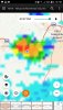
Storms are all around me.... just a matter of time since I just finished cutting the grass.
.... nevermind
Sent from my iPhone using Tapatalk