NBAcentel
Member
I've only gotten a sprinkle in the last week. There's been lots of rain all around me but nothing overhead. **now the last time I said that I got dumped on soon afterwards.Damn that sucks. Looking at the radar returns yesterday and Friday I would of guessed you got a lot more than that.
94/76 heat index 107 at RDU! Epic .
Man not sure exact MP but Nags Head, about a mile or so north of the causeway and it's just a day trip sadly.
Convection today just looks more weak/not as widespread


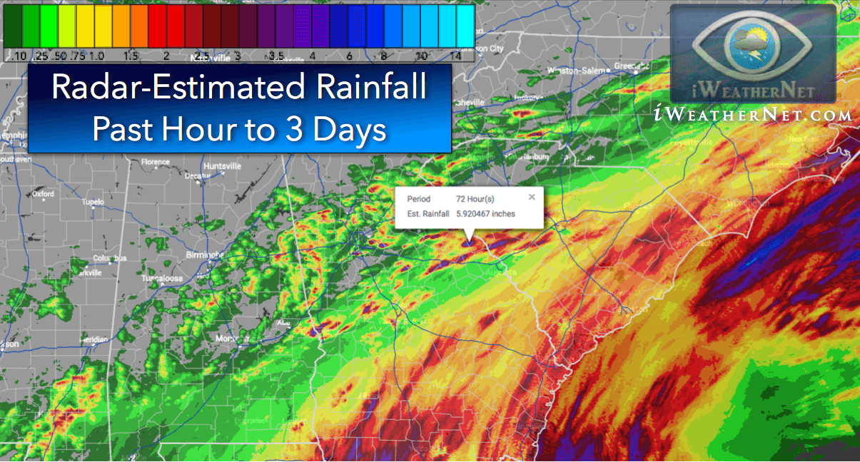
Rainfall totals for the last 24 hours to 3 days - high resolution map
Radar-estimated precipitation accumulation for the past 24 hours to 3 days. High resolution and interactive rainfall data on Google Maps.www.iweathernet.com
Just shows who has scored the last 2 days. Man, there are a lot of blanks on that map. We need a tropical disturbance of some kind.

That map looks completely opposite of what it should . Places down East near the coast and should have dark colors with drier inland , sea breeze been killed I guess . Charlotte is incredibly wet.
Rainfall totals for the last 24 hours to 3 days - high resolution map
Radar-estimated precipitation accumulation for the past 24 hours to 3 days. High resolution and interactive rainfall data on Google Maps.www.iweathernet.com
Just shows who has scored the last 2 days. Man, there are a lot of blanks on that map. We need a tropical disturbance of some kind.
Ouch. That usually is how things go here. We got missed yesterday afternoon, but somehow got a nice hit after midnight Friday night.
Seems like towers are struggling today vs the past few days, maybe subsidence ?Yeah, unless we get some stronger storms and some decent OFB's I can say with pretty high confidence that won't be seeing many storms today. Especially outside the mountains. We have the CAPE, I guess forcing is weak?
Seems like towers are struggling today vs the past few days, maybe subsidence ?
I’m really watching that cluster. It seems like what is popping is wanting to move more ESE today which would have that cluster coming down the Hwy 74 corridor through the Charlotte metroYeah, could be. Curious to see what the storms in Rutherford/Clevland Counties do as they move into more favorable conditions.
93 HI of 103, can’t wait to get out of this desert-like , shi!holeSeems like towers are struggling today vs the past few days, maybe subsidence ?
Currently under a good downpour. The trend of rain everyday continues ?
Wish i Could see the shelf on that View attachment 44552
That's brutal it's really forming a new storm to your eastView attachment 44554
Same old song and dance. Storm is stationary and will rain itself out and the outflow will spark storms to my se. Guys thanks for pulling for me but this aint it either.
clusters of storms starting to get going around the mountains as well
Wouldn't it be nice if that congregated into a mcs and moved throughclusters of storms starting to get going around the mountains as well
It's the price for 6000 j/kg of CAPE these daysAlmost no clouds all day. Impressive
You know it's bad when wake county and the sandhills can't get a stormIt's the price for 6000 j/kg of CAPE these days
Noticed that too. Driving today I watched 2 towers start, get tall, and then fizzle out.Seems like towers are struggling today vs the past few days, maybe subsidence ?
You are cursed. Please never move near me. Lol.View attachment 44556
Its over folks. Everyone else enjoy the storms.
