Have you gotten any rain this week at your house?Love seeing storms train across the exact same areas every single day. It's awesome.
-
Hello, please take a minute to check out our awesome content, contributed by the wonderful members of our community. We hope you'll add your own thoughts and opinions by making a free account!
You are using an out of date browser. It may not display this or other websites correctly.
You should upgrade or use an alternative browser.
You should upgrade or use an alternative browser.
Pattern July '22
- Thread starter Detective WX
- Start date
Love seeing storms train across the exact same areas every single day. It's awesome.
.gif")
BHS1975
Member
Yeah getting hammered.Looks like my complaining might have paid off, storm from Durham looks like it's expanding southward.
BHS1975
Member
HRRR has got your back.View attachment 119791
Don't worry the 3k has mega rain around here around midnight. I'll hold my breath
GarnerNC
Member
Nothing more than maybe a few drops, it's crazy.Have you gotten any rain this week at your house?
I think I got .17 over the course of two events over 48 hours a few days ago.Have you gotten any rain this week at your house?

GarnerNC
Member
Finally!

D
Deleted member 609
Guest
Another one. Every day now.

We finally got a decent rain here at my residence with 1.3 inches in the rain gauge. Now the bad news: For the fourth time in about a month I am without power. Lighting hit the nearest transformer on my street to my house. It’s been one issue or another lately as far as keeping the lights on.
Rosie
Member
Again 000 here??. Huge .03 mtd.Another storm moving through. Getting close to 5 inches for the month already.View attachment 119789
Bannerdude
Member

I just missed continuing my streak of 0.01" precip days
Last edited:
0.00 every day now
They're blowing up just south of me tonight, seeing a great lightning show but no rain.... glad I got mine last night. Dang hope your luck changes dude0.00 every day now
Lightning all around me and low clouds overhead but no rain yet.
And there's the rain.Lightning all around me and low clouds overhead but no rain yet.
Can't help but feel like we are going to run out of chances before it rains.They're blowing up just south of me tonight, seeing a great lightning show but no rain.... glad I got mine last night. Dang hope your luck changes dude
Can't help but feel like we are going to run out of chances before it rains.
Been at least 10 days since I’ve had even a drizzle at my house. Tonight it missed just to my east…and earlier to the north and west and south.
Can’t wait for winter, this is usually a good omen for our snow chances. ?

Nice storm here along the outer banks this evening
I miss the 33 degree rain days. Dog days just getting started and im already burnt out from this garbage.
Brent
Member
We tied the record from 2011 here. What a nasty analog for summer here ?
Is it fall yet
Is it fall yet
iGRXY
Member
Storm coming over the mountains exploded and make that 3 straight days with significant rain. Spartanburg county is about to get blasted again.
Active out here tonight 
Shaggy
Member
I haven't seen rain like I had last night in a LONG time. It rained hard for hours. It will be interesting to see how much we received. I wish I could spread some of it to those who haven't seen any.
Yesterday's high at DFW was an intra-hour 103°F.
iGRXY
Member
We have been getting saved here all week from the heat as well. Never getting above 92 as the clouds start building in by noon and getting serious rain all afternoon into the evening. Even yesterday we had storms all around us that you could feel the rain and and wind and had cooled us down into the 70’s with just clouds. The storm last night has put me over between 3-3.5” the last 3 days
Ooof!!!


Still in the 0.X" depth for the week, but picked up ~.5 last night, although the little Tempest man is still working on the final numbers.
Me thinks the heat advisory is in serious jeopardy around these parts today
Some parts of Spartanburg County are in the 3-4”+ range for the week from several separate storms, but mby east of downtown is around 0.30”. The skips have been consistent and the front is crunchy
I abandoned the tempest rain totals. Last night it went from .01 to .46 when it was raining to .08 while it was still raining and now it's at .4. Might as well get one of those 4ft plastic ones from lowes.Still in the 0.X" depth for the week, but picked up ~.5 last night, although the little Tempest man is still working on the final numbers.
BHS1975
Member
Looks like some serious totals for some folks in the next 48hrs.
LickWx
Member
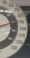
I knew your rain gauge had a hole in it !I abandoned the tempest rain totals. Last night it went from .01 to .46 when it was raining to .08 while it was still raining and now it's at .4. Might as well get one of those 4ft plastic ones from lowes.
BHS1975
Member
Does it have an auto tipping cup?I abandoned the tempest rain totals. Last night it went from .01 to .46 when it was raining to .08 while it was still raining and now it's at .4. Might as well get one of those 4ft plastic ones from lowes.
Ventusky is showing widespread highs of 115°F to 120°F across the Central/Southern Plains on 7/21, which would shattered any all-time highs.
So that circulation west of Charlotte on visible this morning is interesting
Looks like it initialized on the 3k
And the fv3

Looks like it initialized on the 3k
And the fv3
BHS1975
Member
Wave on the front that pops storms around 3pm here.So that circulation west of Charlotte on visible this morning is interesting
Looks like it initialized on the 3kView attachment 119804
And the fv3
View attachment 119805

Me reading the rah disco .gif")
Tied another record maximum low at DFW this morning of 83°F (previously set in 2011).