-
Hello, please take a minute to check out our awesome content, contributed by the wonderful members of our community. We hope you'll add your own thoughts and opinions by making a free account!
You are using an out of date browser. It may not display this or other websites correctly.
You should upgrade or use an alternative browser.
You should upgrade or use an alternative browser.
Pattern Januworry
- Thread starter SD
- Start date
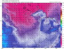
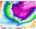
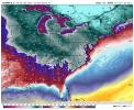
Wow really warming up! Thanks BAM!@Tarheel1 might need a new pair of slacks View attachment 101720
Avalanche
Member
Damn look at International Falls on that map. Please verify!!!
NoSnowATL
Member
iGRXY
Member
It’s going to be freezing now.
Like a turd in a punchbowl
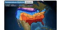
Love when TWC makes their maps. Usually turns out the opposite lol
BHS1975
Member
Something may actually stick with that look.
Sent from my iPhone using Tapatalk
- Joined
- Jan 23, 2021
- Messages
- 4,603
- Reaction score
- 15,199
- Location
- Lebanon Township, Durham County NC
NBAcentel
Member
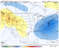
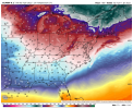
Roxboro might reel a big one inView attachment 101728
For the weeklies to show that look in the same time period that we’ve seen some bombs in the LR
- Joined
- Jan 23, 2021
- Messages
- 4,603
- Reaction score
- 15,199
- Location
- Lebanon Township, Durham County NC
Considering we’re ten miles as the crow flies from TDF ?Roxboro might reel a big one in
Keep in mind that the weeklies through 360 are literally the same as the 00z EPS.View attachment 101728
For the weeklies to show that look in the same time period that we’ve seen some bombs in the LR
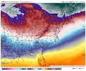
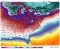
Gfs really went gang busters at the end of its run multiple days in the 20s and lows approaching single digits for many towards the end of the run .. probably terrible wind chills but also it helps with RATES !!! Check this bad boy out .. close to being a big boy but probably still decent with the rates being very good with this 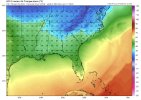
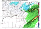


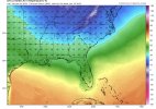
There really seems to be some noise in that 13th-17th timeframe. Now obviously these temperatures are probably overdone, high temperatures in the teens in the Piedmont is probably a once in 15-20 year event, but MJO progression seems to support the idea of cold and storms around that timeGfs really went gang busters at the end of its run multiple days in the 20s and lows approaching single digits for many towards the end of the run .. probably terrible wind chills but also it helps with RATES !!! Check this bad boy out .. close to being a big boy but probably still decent with the rates being very good with this View attachment 101729View attachment 101730
Brent
Member
Love when TWC makes their maps. Usually turns out the opposite lol
February here ???
Actually I think that was the WPC but they probably just copy it
18z GFS continues to bang the 1/16 drum. This certainly isnt to be taken verbatim and yes its a op not ens. But when you see a big dog HECS being spit out, its a sign conditions will be ripe for the actual wx to cook something up. Whether its A SE bomb , slider or noreaster KU. Chances are something brews up around that time when u continously see shenanigans every run or every other run. See if these barks get inside day 10 by weeks end and Euro or Canadian start howling. To remind folks this is the 51 inch Charlotte run from the other day as well as a sub 950 bomb off NE coast another run
Overnight Euro for next Thursday: All I saw from overnight; Ops suport the weeklies statement from Ga wx. Looks like Coldest air of season will greet us by next monday into the entire week off all the Globals.


24.8 this morning
NBAcentel
Member
NBAcentel
Member
Snownut
Member
The good thing we got going for us now is the Cold. I believe within the next two Weeks most of this board will see winter weather especially if we can build a Taller WR to push these Storms further South. I think it could be setting up now For a big winter Storm across the SE.
Sent from my SM-A526U using Tapatalk
Sent from my SM-A526U using Tapatalk
D
Deleted member 609
Guest
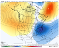
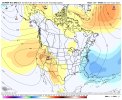
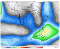
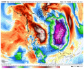
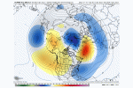
How is long range (>300 days) EPS looking? GEFS looks decent through end of run.Pretty strong agreement in a legit cold shot View attachment 101752View attachment 101753View attachment 101754View attachment 101755View attachment 101756View attachment 101757
NBAcentel
Member
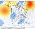
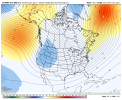
Starts to retrograde stuff to the western US by the end of the run, imo we’re gonna have a shot with that look in the first panel I sent, I also see some hints of wavebreaking on the EPS gonna have to watch for another - NAO from wavebreaking, what’s discouraging is the -SCAND which isn’t great for a -NAO to formHow is long range (>300 days) EPS looking? GEFS looks decent through end of run.
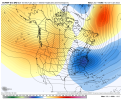
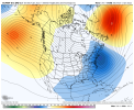
NBAcentel
Member
whatalife
Moderator
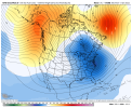
Could be wrong and I do believe @SD stated a week or so ago that we might be able to sneak a -NAO in around the 20th. It fits well at the moment. SD and @Rain Cold have been on top of their game over the last couple of weeks.The GEFS has a -NAO back again in mid jan View attachment 101762
Don’t forget my pattern change call for January 3rd ??Could be wrong and I do believe @SD stated a week or so ago that we might be able to sneak a -NAO in around the 20th. It fits well at the moment. SD and @Rain Cold have been on top of their game over the last couple of weeks.
iGRXY
Member
You get this look and the percentages go through the roof to get a board wide event and yes that includes the I20 crowd. This is the type of pattern that can deliver some type of wintry weather all the way down the I10 corridor. IF we can keep this look through the month I would bet the house we see at least 1 major winter storm across a large portion of the southeast.The GEFS has a -NAO back again in mid jan View attachment 101762
I like the fact that the ridge out west extends up north of AK and that it's not too far east so that it would virtually guarantee a cold but dry pattern. North Atlantic ridge isn't ideal, but nonetheless, we can work with this pattern. The right timing could actually yield a bona-fide widespread snowstorm, and not some slushy mixy winter storm wannabe, given the cold air potential.As folks pointed out above, the modeled pattern looks solid for chances mid January. ?
View attachment 101763
iGRXY
Member
The GEFS looks fantastic for the rest of the month. every teleconnection is perfect for us. the GEFS has a +PNA/-NAO/-EPO/-WPO/-AO through the entire run. EPS looks good in the pacific. the AO and NAO look to stay roughly neutral before going negative towards the end of the run but we keep a -WPO and the EPO stays neutral as well. That is about as good as you're going to get it around here.
cd2play
Member
FiedThe good thing we got going for us now is the Cold. I believe within the next two Weeks most of this board will see cold rain especially if we can build a Taller WR to push these Storms further South. I think it could be setting up now For a big cold rain across the SE.
Sent from my SM-A526U using Tapatalk
I like the fact that the ridge out west extends up north of AK and that it's not too far east so that it would virtually guarantee a cold but dry pattern. North Atlantic ridge isn't ideal, but nonetheless, we can work with this pattern. The right timing could actually yield a bona-fide widespread snowstorm, and not some slushy mixy winter storm wannabe, given the cold air potential.
Agreed, I like the look of what we are seeing...fingers crossed the models are correct.
27.3F this morning with heavy frost.
NoSnowATL
Member
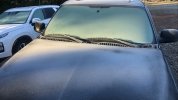
Hit 29. Mega frost this morning. Best one yet.
- Joined
- Jan 5, 2017
- Messages
- 3,779
- Reaction score
- 5,990
28 at my house, heavy frost, too. Makes sense considering the soil moisture levels right now. Creek level hasn't returned to baseline yet...
I hope you gentlemen stock up on coffee. It’s about to get active. Eastern Tennessee folks, you guys look great for possible two cyclonegenesis with measurable frozen precipitation. As pointed out from an earlier poster, the telleconctions are almost perfect. Not briefly, but leading into February as well.
Also, having a kelvin wave eating away a La Niña faster doesn’t hurt.
Sent from my iPhone using Tapatalk
Also, having a kelvin wave eating away a La Niña faster doesn’t hurt.
Sent from my iPhone using Tapatalk
- Joined
- Jan 2, 2017
- Messages
- 1,566
- Reaction score
- 4,279
Was 26 at my house at 430..drove up to above Charlotte and saw 22 on hwy26 at one pointMega frost View attachment 101766

