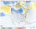
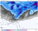
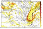
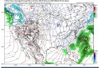
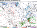
Less Block to the NE the system looks just East here it gives it a try but doesn't pan out still a signal is there so at this range thats decentIt was close View attachment 109328
-
Hello, please take a minute to check out our awesome content, contributed by the wonderful members of our community. We hope you'll add your own thoughts and opinions by making a free account!
You are using an out of date browser. It may not display this or other websites correctly.
You should upgrade or use an alternative browser.
You should upgrade or use an alternative browser.
Pattern Januworry
- Thread starter SD
- Start date
lexxnchloe
Member
Low further offshore. Much better


bigstick10
Member
That is single digits in Atl and a lot of the SELow further offshore. Much better

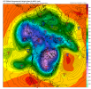
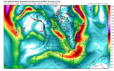
That’s unironically January 2000 if it can dig more.Woah that H5 pattern is insane View attachment 109331
NBAcentel
Member
Flotown
Member
Still think Tuesday system is worth looking at for northern parts and mountains
High of only 30°F at RDU today! Coldest high temperature at RDU since January 2018!
NBAcentel
Member
- Joined
- Jan 23, 2021
- Messages
- 4,603
- Reaction score
- 15,199
- Location
- Lebanon Township, Durham County NC
I’ve been in Durham for four years now and today was easily the coldest day I can remember. Not only it being 25 or 26 but the wind was around 10-15 MPH all dayHigh of only 30°F at RDU today! Coldest high temperature at RDU since January 2018!
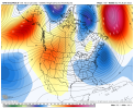
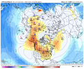
With a rex block, I'd say at least 7 days if not 2 weeks. In met school, 2 wks was the minimum...just sayinWe are really close to trending to a pacific rex block on the GEFS with a Aleutian-AK-W CAN/western US ridge bridge, if that occurs, we extend the great pattern another 3-6 days View attachment 109336View attachment 109337
We could be setting up for an extension of the cold winter weather, which would be surprising. All good things come to an end eventually but when that occurs is up for debate right now.
D
Deleted member 1449
Guest
All the MJO forecasts have the MJO heading into phase 8 in early Feb for a short while. That can't be bad, can it?
BHS1975
Member
Tick it west and we're golden.
Sent from my iPhone using Tapatalk
Gonna be some absolutely nutso ensemble members. Tons showing a massive system.
Exciting prospects for next weekend. Fingers are crossed. Yes, the models nailed the 93 Storm and what a great storm that was.
I almost hate to bring this up and I probably shouldn’t as it appears I am being negative. But I still haven’t gotten over what was called Groundhogzilla … I think about 2009?? Perhaps the greatest model failure we have seen …
I hope next week we are enjoying a winter storm that we will also talk about for the ages like 93. And hopefully the models lock in and nail it rather than pulling the rug from us and slapping us upside the head with it.
Stormlover
Member
No, this is as cold as it gets on the 18Z GFS that you were referring toThat is single digits in Atl and a lot of the SE

NBAcentel
Member
Starting to see reflections of another pacific jet extension far into AK/north of AK around day 7-10, could be the coldest airmass yet
SnowNiner
Member
That jet location has been the key to this whole deal the last couple weeks. Seeing it right at Hawaii seems to be a nice benchmark to pop the Aluetian low, west coast ridge. Longer we keep it there, the longer the pattern lasts imo.
Jet reaches 225knts at 200mb over the North Atlantic on the 18z GFS.
Power? That is power.
Power? That is power.
NBAcentel
Member
It was a increase of 12z run.
mydoortotheworld
Member
I don't know how the hell I can access the individual members on weatherbell. I remember it used to be rather simple but now I can't find it?!
Flotown
Member
We gonna need pics..lolThe 18z euro control looked destined for greatness at 144 at 500
Sent from my iPhone using Tapatalk
Flotown
Member
Little quicker??
Everything is pulled back west should have room to phase and bomb out closer to coast the 18z gfs
Sent from my iPhone using Tapatalk
accu35
Member
The snowstorm for the Deep South?18z Euro looks pretty similar to 12z run at same time
18z Euro looks pretty similar to 12z run at same time
18z euro op doesn’t go far enough out to show next weekend’s potential bomb. But the control looks solid
Sent from my iPhone using Tapatalk
bingcrosbyb
Member
lexxnchloe
Member
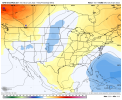
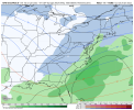
A good spot for it, better than over hatterasView attachment 109497View attachment 109498ICON for next weekend is well east. Though seeing the 540 line down in mid Florida is impressive.
The ICON has just been so bad in the past weeks. I mean, it will be right at least once a week like a broken clock is right twice a day.
I will be curious if the globals will be in a modicum of agreement at 0z tonight.
I will be curious if the globals will be in a modicum of agreement at 0z tonight.
NBAcentel
Member
Another threat. This ain’t real
3 weekends in a row. Why not

