Avalanche
Member
It def needs a sequel!!I said this earlier, but look at the dates… Saturday 1/22 and Monday 1/24… same as January 2000
It def needs a sequel!!I said this earlier, but look at the dates… Saturday 1/22 and Monday 1/24… same as January 2000
Done! Do you mind posting some maps over there to get it started?I think it’s getting close to time for a ?
View attachment 105832View attachment 105833View attachment 105834View attachment 105835View attachment 105836
Post it in the new thread for this threat. It's sure looking promising!
Well, if models are right, I have gotten what I wanted ...... a below normal January with a few good storm chances. If Feb is warm ..... so be it. I think most will be happy if we can get back-to-back events.Based on GEFS, it has the western ridge retrograde west, it does not bring out the SER, but the really cold pattern may moderate end of the month. Who knows if it rebuilds or not. I suspect we will have 2 more opportunities for wintry weather before the moderation, let’s hope we score.

If we can keep the mjo out of the warm phases, we will continue this well into February imo.Almost comical at this point. This may be the greatest long lasting winter pattern I’ve ever seen.

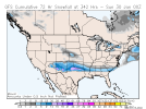
It looks to me like they just copied the charts from January 1988 on that oneEpic winter storm S Plains to SE in two weeks on HH GFS:
View attachment 106202View attachment 106203
@GaWx what's the CFS showing?
Larry, I believe if the mjo can stay out of warm phases, we should remain cold into February. Currently, we have more like an niño atmosphere with convection around dateline from what I understandIn retrospect, it has been hinting at this incredible cold and wintry pattern!
More from 18Z GFS on this epic fantasy:
View attachment 106207
This doesn’t even include the ice well beneath it!
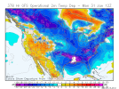
Storms keep coming
View attachment 106218
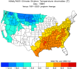
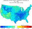
Here ya go to compare '84-'85 ... works ...Epic cold SE HH GFS means tossing not an option! Maybe 1984-5 not so crazy an analog from the chilly Nov to mild Dec to frigid Jan along with similar ENSO. Also, the similar ENSO 1933-4 and 1971-2 both had a frigid shot mid to late month with single digits ATL and RDU. Both of those had a cold Feb with a near boardwide type of winter storm in Feb of 1934 and Feb of 1972 was very icy, esp in main CAD region:
View attachment 106219
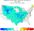

Hard to even know what to say. When is the last time we've seen this kind of pattern? I'm serious, I can't recall. Hopefully, it moves forward.
I don’t post much here or the other board anymore but I can say I don’t remember seeing anything like this. And I’ve been on these boards a long time. Lol!Hard to even know what to say. When is the last time we've seen this kind of pattern? I'm serious, I can't recall. Hopefully, it moves forward.
Good to hear from you, my friend. All is well here. Post away man. And I don't remember seeing anything like this either, not for the duration being forecasted anyway.I don’t post much here or the other board anymore but I can say I don’t remember seeing anything like this. And I’ve been on these boards a long time. Lol!
Hope you’re doing well!
Larry,18Z GFS cold through the end fwiw. No, I will not beg for it to end if this is real. I’ll never get sick of it. I hope it stays cold with no end in sight! Here’s to a cold Feb and March, too!
View attachment 106247
