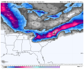
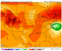
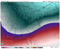
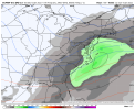
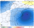
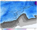
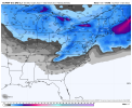
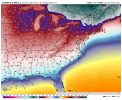
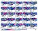
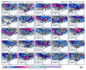
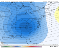
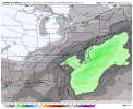
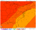
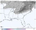
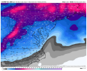
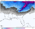
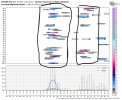
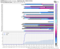
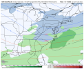
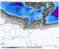
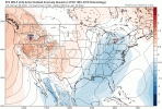
Euro control is another hit for NE GA, upstate SC, and most of NC
-
Hello, please take a minute to check out our awesome content, contributed by the wonderful members of our community. We hope you'll add your own thoughts and opinions by making a free account!
You are using an out of date browser. It may not display this or other websites correctly.
You should upgrade or use an alternative browser.
You should upgrade or use an alternative browser.
Pattern Januworry
- Thread starter SD
- Start date
Snownut
Member
Can you show that map across the upstate?
Sent from my SM-A526U using Tapatalk
NBAcentel
Member
- Joined
- Jan 23, 2021
- Messages
- 4,602
- Reaction score
- 15,197
- Location
- Lebanon Township, Durham County NC
WOW. This control run. 975MB At 75 miles due east of Duck.
Snownut
Member
That's a Nice storm, and there's still time for improvement. This could be much bigger!
Sent from my SM-A526U using Tapatalk
- Joined
- Jan 23, 2021
- Messages
- 4,602
- Reaction score
- 15,197
- Location
- Lebanon Township, Durham County NC
Snownut
Member
View attachment 103171
You give me that look and someone is going to get January 2000 level buried. I don’t care what the maps say.

Sent from my SM-A526U using Tapatalk
Shaggy
Member
Personally I'd still like to see a bit of suppression at this range. Hate to see this trend NW and ruin it for everyone.View attachment 103171
You give me that look and someone is going to get January 2000 level buried. I don’t care what the maps say.
Snownut
Member
With a HP that strong you would think there would be.Personally I'd still like to see a bit of suppression at this range. Hate to see this trend NW and ruin it for everyone.
Sent from my SM-A526U using Tapatalk
NBAcentel
Member
NBAcentel
Member
You know things look good when Columbia SC has a 1 inch snow mean View attachment 103172View attachment 103173View attachment 103174View attachment 103175View attachment 103176View attachment 103177
I also would like to see the energy dig further south. Maybe we could get a bombcyclone. Right now I don’t see the STJ being that strong.
Sent from my iPhone using Tapatalk
Snownut
Member
Hopefully tomorrow's runs of both the Euro and GFS brings the Goods! This could be a thing of Beauty
Sent from my SM-A526U using Tapatalk
Sent from my SM-A526U using Tapatalk
NBAcentel
Member
Personally I'd still like to see a bit of suppression at this range. Hate to see this trend NW and ruin it for everyone.
I agree. I like the HP building in over the top but is that enough to keep it from amping and going NW? I can see this thing tracking inland and spoiling it for the Eastern half of NC/SC before all is said and done. Not sure but maybe this setup is different.
Last edited:
Snownut
Member
It could be a Big hit for WNC and upstate Sc. Probably best a storm has looked for those areas in quite some time.I agree. I like the HP building in over the top but is that enough to keep it from amping and going NW? I can see this thing tracking inland and spoiling it for the Eastern half of NC/SC before all is said and done.
Sent from my SM-A526U using Tapatalk
NBAcentel
Member
NBAcentel
Member
accu35
Member
NE GA is very much in the game. Welcome to the familyNew poster here. Im seeing that NE Georgia is out of the game here for atleast the first possible storm. Is that true ?
Montanasnow30
Member
I wonder when will there ever be a Deep South snow event for the peeps that’s south of I-20 from Jackson ms to Macon ga those folks are beyond long over due in the south
So far so good, but I would I like to the see the high pressure further south, but more importantly, built in quicker.
Shaggy
Member
Both RAH and MHX mentioning the potential in their overnight discos.
this was MHX
Saturday and Sunday...High pressure will briefly ridge into the
area Saturday before another upper level trough arrives and
induces surface low development of the next storm system.
Previous model runs and the current CMC show this low developing
over the Mid Atlantic and then dragging a cold front through
Eastern NC Saturday night, however both the latest GFS and ECMWF
show surface low development much farther south and over the
Carolinas. In these scenarios, Arctic high pressure over Eastern
Canada provides enough cold air this far south for a more
wintry precipitation solution. Will continue to monitor this
trend in the guidance, but with lack of run to run consistency
just yet, will keep precip from this system Saturday night and
Sunday as all rain for this cycle.
Forevertothee
Member
GSP has the first mention of the weekend potential:
LONG TERM /THURSDAY THROUGH SUNDAY/...
As of 245 am EST Monday: The numerical models now feature somewhat
better agreement for Thursday with a lobe of stronger vorticity
diving into the base of the developing eastern trough, leading to
amplification of the trough axis near the southern Appalachians.
This clipper type feature may amplify just in time to pick up modest
moisture, but moisture in profiles will still be a limiting factor
for mentionable PoPs as the low-level flow appears cut off from any
significant Gulf or Atlantic source. In addition, any surface
cyclogenesis ahead of the wave and along the passing front will
occur nearer the coast. Still, steep mid-level lapse rates in excess
of 7 deg C/km will warrant some PoP mention Thursday for at least
the northern tier, with continued low PoPs for northwest flow snow
showers into Thursday night as the trough and front move east. If
nothing else, the Thursday system should bring a reinforcing shot of
cold air to the region.
Modest ridging sets in between systems on Friday, but it is
uncertain how much of a lull will occur as stronger height falls
develop quickly from the Midwest through the Ohio Valley Friday
night into Saturday. Moisture should have a better chance of
returning ahead of the Saturday system as it now appears to amplify
well west of the southern Appalachians, with upglide developing atop
our region on Saturday. There is growing potential for profiles to
be cold enough for wintry ptypes across at least the northern half
of the forecast area on Saturday, if not throughout by Saturday
night. The 00Z GFS has trended toward the earlier ECMWF runs with
regard to some potential for wintry weather Saturday/Saturday night.
The sharp upper trough passage is likely Saturday night before
northwest flow returns on Sunday along with drier profiles. This
system will bear watching, but run-to-run consistency has been too
low thus far to include an HWO mention of wintry weather potential.
NBAcentel
Member
Blue_Ridge_Escarpment
Member
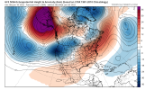
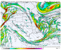
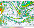
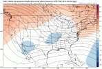
6Z ICON looked better to me with the PV stronger and pushing further south. Energy out west looked better too.Back up and ready to roll, like a well oiled machine, and go to work lol, here’s the 06z gefs View attachment 103188View attachment 103189
When the Gfs is playing catch-up to the euro that’s when you know you got teeth sunk into this threat
You’re right. The icon was headed for glory6Z ICON looked better to me with the PV stronger and pushing further south. Energy out west looked better too.
A battle between the GFS and Euro.
RAH:
By Saturday evening the GFS and ECMWF agree that there should be
precipitation over central North Carolina, but from wildly different
systems. The GFS shows a surface low move southeast from Chicago to
West Virginia before developing a second low off the NC coast, while
the ECMWF has a low move across Alabama and Georgia which then
strengthens near the Outer Banks before continuing east. There is
definitely a chance of precipitation through the weekend and
precipitation type could be an issue, although the temperature
profiles would look much different depending on which model
verifies. The highest chances for precipitation appear to be
Saturday night, although precipitation would likely start during the
day on Saturday and linger into Sunday.
D
Deleted member 609
Guest
What did UK show last night?Back up and ready to roll, like a well oiled machine, and go to work lol, here’s the 06z gefs View attachment 103188View attachment 103189
NBAcentel
Member
Weird look, it may have still workedWhat did UK show last night?
ATLwxfan
Member
GFS in the long range is bleak.
Sent from my iPhone using Tapatalk
Sent from my iPhone using Tapatalk
?The GFS ensemble don’t agree with the Gfs st all.I'm just going to pretend like I didn't see this
View attachment 103190
NBAcentel
Member
NBAcentel
Member
Yeah it was a sketchy GFS run in the long range, but the GEFS run was one of the better ones with the western ridge tucked up nicely against British Columbia?The GFS ensemble don’t agree with the Gfs st all.
Snownut
Member
The GEFS is coming around to the Euro and I think it's just a matter of time before we see the GFS catch on to this.
Sent from my SM-A526U using Tapatalk
Sent from my SM-A526U using Tapatalk
RobertRath
Member
They had one just a couple of years ago. We’ve haven’t had anything more than a dusting in about 6-7 years here in the Jasper area.I wonder when will there ever be a Deep South snow event for the peeps that’s south of I-20 from Jackson ms to Macon ga those folks are beyond long over due in the south

