LovingGulfLows
Member
- Joined
- Jan 5, 2017
- Messages
- 1,499
- Reaction score
- 4,100
06z RGEM also no longer closes off the ULL in Oklahoma so the shortwave trended slightly weaker at the 500mb level.


And btw, you're looking at vertical velocity. Click on the vorticity maps.


@Shawn, can you explain the two lows on this map. It seems like many of the models get really wonky when that surface low starts moving north. One piece hugs the coast more and moves due north, and then the other piece takes over and takes a right turn. If the piece closer to the coast becomes the dominant piece, it's game on for many more folks.
The look where a main low takes a right turn after phasing and doesn't go up the coastline looks so strange to me.The NAM has a rapid occlusion phase, although that look surprises me some.
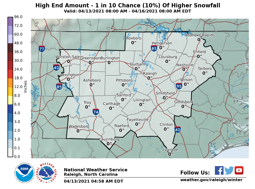
It has 6-8" on high side, hope it happens!!National Weather Services are starting to update their beta Winter Weather Pages. Raleigh says that there's a 10% chance of getting this much snow or more. As I see things, I would give this a 20-25% of verifying.

The look where a main low takes a right turn after phasing and doesn't go up the coastline looks so strange to me.
Thanks. That was what I was thinking. I was using anecdotal data and wishcasting. It's good to know there is some science to support it!It's related to the same problem I alluded to yesterday the Bets-Miller-Janic convective parameterization scheme in the 12km NAM is notorious for creating fictitious diabatically-generated low pressure centers. What's going to end up happening in all likelihood, one will takeover and as a result, this will only serve to aid w/ inland moisture transport, so we end up with an even bigger storm further west...
When do you think models will do better, 12z?It's related to the same problem I alluded to yesterday the Bets-Miller-Janic convective parameterization scheme in the 12km NAM is notorious for creating fictitious diabatically-generated low pressure centers. What's going to end up happening in all likelihood, one will takeover and as a result, this will only serve to aid w/ inland moisture transport, so we end up with an even bigger storm further west...

It's experimental. Notice the bold statement. Here is some more information:What’s the verification scores?
Sent from my iPhone using Tapatalk
Very heavy precip thereLet's pull out the CRAS model for fun!

Allan Huffman @RaleighWx 5m5 minutes ago
(1) W.R.T to the upcoming Jan 3rd/4th storm. The 6z NAM is most likely too extreme. BUT, this is a case where I trust the high-res models more than the more coarse global models. We are now getting to 72 hours and in. The high-res models are more equipped to handle these types of extreme cyclogenesis events in extreme atmospheric weather setups. The waters east of Fl are very warm. There is an extreme cold air mass moving over. Potential phasing of multiple s/w's. The ingredients are there. I still favor the biggest impacts on coastal sections. But I think the I-95 corridor east over the Carolinas/Ga could see snow. And yes we could see a high impact winter storm for some. Watch the hi-res models today. The 6z RGEM also looks threatening at hour 54. Probably the 00z ECMWF is the closest to reality. But, I could see higher end version of that verifying in the end. Lets see. But coastal areas, as I have been saying, this could be your storm. I will put out a map, no later than tomorrow, but maybe before, we shall see. Today should be a very interesting day of model runs. There is even a chance of wintry precipitation as far south as SE Ga and N Fl. Yes N FL.
What's your personal opinion on the Columbia, SC area?I am really not sure why some are so stuck to this coastal Carolinas only idea. The H5 setup does not support this. Furthermore, from a modeling perspective, the NAM is actually pretty good with H5 interactions. During the January 2017 event it was the first one to push the warm nose further inland, but it seems no one remembers why. The reason why is it had the shortwave responsible for our storm a little stronger, and more neutral to eventually negative tilt earlier. Thus, the NAM handled the H5 evolution of the January 2017 winter storm better than any other guidance at 60 hours out, but even it trended stronger and further west with precipitation right on up until the storm. I made a forecast map of 6-10" west of a CLT to Durham line and a lot of my colleagues thought I was crazy because no guidance suggested that, but the pattern did. The pattern suggests RDU to I-95 in NC as the jackpot zone, and I'm sticking with it unless H5 starts going the other way. 6-12" is not out of reach in this corridor, and locally more could fall if the NAM continues to trend. I also believe sleet will cut down on totals east of I-95 when this is all said and done.
I am really not sure why some are so stuck to this coastal Carolinas only idea. The H5 setup does not support this. Furthermore, from a modeling perspective, the NAM is actually pretty good with H5 interactions. During the January 2017 event it was the first one to push the warm nose further inland, but it seems no one remembers why. The reason why is it had the shortwave responsible for our storm a little stronger, and more neutral to eventually negative tilt earlier. Thus, the NAM handled the H5 evolution of the January 2017 winter storm better than any other guidance at 60 hours out, but even it trended stronger and further west with precipitation right on up until the storm. I made a forecast map of 6-10" west of a CLT to Durham line and a lot of my colleagues thought I was crazy because no guidance suggested that, but the pattern did. The pattern suggests RDU to I-95 in NC as the jackpot zone, and I'm sticking with it unless H5 starts going the other way. 6-12" is not out of reach in this corridor, and locally more could fall if the NAM continues to trend. I also believe sleet will cut down on totals east of I-95 when this is all said and done.
Do you see Suffolk VA possibly getting heavier snow right now it shows ligher then the coast?I am really not sure why some are so stuck to this coastal Carolinas only idea. The H5 setup does not support this. Furthermore, from a modeling perspective, the NAM is actually pretty good with H5 interactions. During the January 2017 event it was the first one to push the warm nose further inland, but it seems no one remembers why. The reason why is it had the shortwave responsible for our storm a little stronger, and more neutral to eventually negative tilt earlier. Thus, the NAM handled the H5 evolution of the January 2017 winter storm better than any other guidance at 60 hours out, but even it trended stronger and further west with precipitation right on up until the storm. I made a forecast map of 6-10" west of a CLT to Durham line and a lot of my colleagues thought I was crazy because no guidance suggested that, but the pattern did. The pattern suggests RDU to I-95 in NC as the jackpot zone, and I'm sticking with it unless H5 starts going the other way. 6-12" is not out of reach in this corridor, and locally more could fall if the NAM continues to trend. I also believe sleet will cut down on totals east of I-95 when this is all said and done.
Ok thanks.I think modeled amounts will go up there, but how much will depend on how far up the coast the storm can get before being shunted east.
I think modeled amounts will go up there, but how much will depend on how far up the coast the storm can get before being shunted east.
Thanks man, I'm hoping for a couple inches atleast. Given the cold ground and everything, that will cause a ton of troubleMy opinion is that Columbia would probably be west of the jackpot zone but certainly some snow is possible. Sort of in the same boat as that CLT to GSO region in NC.
I am really not sure why some are so stuck to this coastal Carolinas only idea. The H5 setup does not support this. Furthermore, from a modeling perspective, the NAM is actually pretty good with H5 interactions. During the January 2017 event it was the first one to push the warm nose further inland, but it seems no one remembers why. The reason why is it had the shortwave responsible for our storm a little stronger, and more neutral to eventually negative tilt earlier. Thus, the NAM handled the H5 evolution of the January 2017 winter storm better than any other guidance at 60 hours out, but even it trended stronger and further west with precipitation right on up until the storm. I made a forecast map of 6-10" west of a CLT to Durham line and a lot of my colleagues thought I was crazy because no guidance suggested that, but the pattern did. The pattern suggests RDU to I-95 in NC as the jackpot zone, and I'm sticking with it unless H5 starts going the other way. 6-12" is not out of reach in this corridor, and locally more could fall if the NAM continues to trend. I also believe sleet will cut down on totals east of I-95 when this is all said and done.

lol I'm up, and excitedEveryone needs to wake up! This is a big day for this storm model wise! Lol
All the guys that give us play by play of the models aren't lollol I'm up, and excited

The 1958 example from yesterday was great! I'm guessing something similar is on the table at least.Very, very good analysis. I'd ask you to do the same for the modeled pattern but I know you already showed a couple of examples, and it fits with the thinking. I really think if guidance doesn't pick up on some big slowdown with the trailing wave on the 12z runs this will just continue to shift towards this more inland idea with time.
