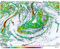
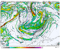
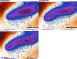
BHS1975
Member
Less interaction with the Baja low.
Less interaction with the Baja low.
Looks about right. GEFS follows the OP fairly closely run to run
Much rather have the blues to my southeast vs northwest.
-- typed “rain” with a straight face hereCovering all the basesView attachment 163491
Based on what you just said, the GFS /EURO are trading places lmao18z Euro was REALLY digging West. I have a feeling if it kept going then we might have got an amped mess. Hopefully we get her back suppressed some overnight.
I'm not sure. The whole issue with some runs like the most recent 12z run is it partially got detached / left behind from the primary trough. This run had more of the primary trough digging in (i.e. more cold injected directly into storm). I'm not sure this one wouldn't have looked really good like the 12z Sunday run. But who knows - predicting models isn't easy.18z Euro was REALLY digging West. I have a feeling if it kept going then we might have got an amped/ice mess again with even worse upper temps. Hopefully we get her back suppressed some overnight.


I'm not sure. The whole issue with some runs like the most recent 12z run is it partially got detached from the primary trough. This run had more of the primary trough digging in (i.e. more cold injected directly into storm). I'm not sure this one wouldn't have looked really good like the 12z Sunday run. But who knows - predicting models isn't easy.
View attachment 163495View attachment 163496
Haha oh we can find ways to avoid snow, don't you worry about that my man!
I'm not sure. The whole issue with some runs like the most recent 12z run is it partially got detached / left behind from the primary trough. This run had more of the primary trough digging in (i.e. more cold injected directly into storm). I'm not sure this one wouldn't have looked really good like the 12z Sunday run. But who knows - predicting models isn't easy.
View attachment 163495View attachment 163496


Warm nose.Haha oh we can find ways to avoid snow, don't you worry about that my man!
Outlook: thread likelyThat little weekend NC coastal event has expanded. Could surprise folks in RDU and the northern Coastal Plain.View attachment 163504
One more push south and you've got flurries over to Drakes Landing.Outlook: thread likely
Does this version of the NBM include updates from 18z euro and eps?
My experience with these brutally cold Arctic air masses that get dumped onto the Rockies is that they usually end up dropping southward along the Rockies more quickly than the models lead you to believe in the medium range.
Pouring extremely cold air into a trough will cause it to dig more quickly and the positive potential vorticity & stability anomalies that are created above the intense low level cold dome “drag” on the trough base, causing it to also dig more. Feedbacks can then occur with a shallow, but intense low-level northerly barrier jet further shoving the cold air mass further south. The GFS & GEFS are notoriously bad at handling these processes and I expect them to eventuality fully give into the EPS & GEPS.
Is that good or badMy experience with these brutally cold Arctic air masses that get dumped onto the Rockies is that they usually end up dropping southward along the Rockies more quickly than the models lead you to believe in the medium range.
Pouring extremely cold air into a trough will cause it to dig more quickly and the positive potential vorticity & stability anomalies that are created above the intense low level cold dome “drag” on the trough base, causing it to also dig more. Feedbacks can then occur with a shallow, but intense low-level northerly barrier jet further shoving the cold air mass further south. The GFS & GEFS are notoriously bad at handling these processes and I expect them to eventuality fully give into the EPS & GEPS.
Does this version of the NBM include updates from 18z euro and eps?
Is that good or bad
Yeah but which eps solution? The "good" one or the "bad" one we've seen....or one yet to come?My experience with these brutally cold Arctic air masses that get dumped onto the Rockies is that they usually end up dropping southward along the Rockies more quickly than the models lead you to believe in the medium range.
Pouring extremely cold air into a trough will cause it to dig more quickly and the positive potential vorticity & stability anomalies that are created above the intense low level cold dome “drag” on the trough base, causing it to also dig more. Feedbacks can then occur with a shallow, but intense low-level northerly barrier jet further shoving the cold air mass further south. The GFS & GEFS are notoriously bad at handling these processes and I expect them to eventuality fully give into the EPS & GEPS.
Got an earlier frame further west?18z AI went nuclear…looks like front end snow for 85w and big ice storm in typical cad region
View attachment 163509View attachment 163510
Euro AI is very amped and a major snow to Ice storm for CAD area's(looks like mostly ice). Much wetter further North and West compared to last run.
Move to Atlanta or Huntsville it seems.What do we have to do to get all snow I’m tired of hearing about ice
Yeah I saw this floating around. I don’t like seeing that edge nose in especially this soon. Needs to take a step back18z AI went nuclear…looks like front end snow for 85w and big ice storm in typical cad region
View attachment 163509View attachment 163510

