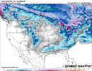
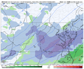
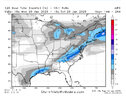
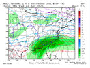
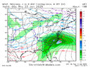
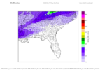
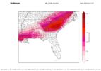
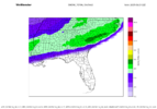
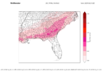
MA licking their chops after seeing where the 18z euro ended
-
Hello, please take a minute to check out our awesome content, contributed by the wonderful members of our community. We hope you'll add your own thoughts and opinions by making a free account!
You are using an out of date browser. It may not display this or other websites correctly.
You should upgrade or use an alternative browser.
You should upgrade or use an alternative browser.
Wintry January 21-23 2025
- Thread starter SD
- Start date
Go big or go home…size matters. We got cold, let’s get this jacked.Yeah I saw this floating around. I don’t like seeing that edge nose in especially this soon. Needs to take a step back View attachment 163513
WolfpackHomer91
Member

Must be their way of saying …. Ok weenies , we see it too. Now Shutup and give us some time lol
Sent from my iPhone using Tapatalk
Pops
Member
Thanks
Ron Burgundy
Member
SIAP - tail end of FFC disco was interesting (boldface is mine)
Again, the confidence on this is about as low as it can get. Zonal
flow, without any coherent, high amplitude features, is notorious
for producing forecasts with very low accuracy and reliability,
especially with precip timing. Clustering algorithms are
literally placing almost equal probabilities in 3 or 4 very
different scenarios. One set of guidance can be mild and sunny on
Monday, while another will be cold with substantial precip. Will
say based on experience that this pattern can produce heavy
precip given a strong enough system and a strong baroclinic zone
with associated vigorous warm/moist advection.
Will need to keep tabs on the forecast for early next week. For
now we have a chance for rain or snow in our deterministic
forecast (even in areas below freezing), but our messaging is
focused on the chance, if any, for arctic air and winter precip.
SNELSON
lexxnchloe
Member
SnowNiner
Member
Go big or go home…size matters. We got cold, let’s get this jacked.
Yeah, I guess....as long as we keep the cold. Seems like the cold is more of a timing thing. Want to keep the SE Canada vortex longer, and that stinkin baja stinkin low needs to come out and not sit.
Need good timing, and average jackedness.
- Joined
- Jan 23, 2021
- Messages
- 4,602
- Reaction score
- 15,197
- Location
- Lebanon Township, Durham County NC
AIFS has 10-12” from Charlotte to roughly here
- Joined
- Jan 23, 2021
- Messages
- 4,602
- Reaction score
- 15,197
- Location
- Lebanon Township, Durham County NC
Probably a lot of ice outside of the snow area deep into South Carolina
GeorgiaGirl
Member
Probably a lot of ice outside of the snow area deep into South Carolina
It is...ha, I just complained about it in the complaining thread.
I could see it on the bad maps, but I was hoping that it wasn't the case.
Yuck, looks like mega ice storm this far east and what a heckuva gradient so it has to be legit
Must be true. The KAVL snow hole is in full effect.
But wow best run yet.
NBAcentel
Member
What interest me is the overrunning precip before this main wave trending better as well
AI snow map says 10:1. Guessing it’s snow and sleet like was mentioned, but looks like it is counting all of it as 10:1. But more importantly, it’s not holding the deep cold in place very long as Fro mentioned. Not good to see based on how it did with the last storm
This would make me nervous 24 hrs out, 6-7 days downright infuriating
NBAcentel
Member
So many moving parts but this isn’t bad but could get away from of us rather easily.AI snow map says 10:1. Guessing it’s snow and sleet like was mentioned, but looks like it is counting all of it as 10:1. But more importantly, it’s not holding the deep cold in place very long as Fro mentioned. Not good to see based on how it did with the last storm
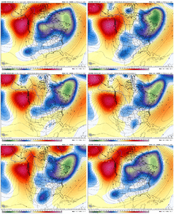
Well it’s us….we never make it easy.This would make me nervous 24 hrs out, 6-7 days downright infuriating
The AIFS really jumped around quite a bit at this range with the last system. It jumps around (like a deterministic model) at this range. Typically settles in around 120-144hrs and then only slight changes. Watch for when it really settles on a solution for 2-3 runs, and around 120-144 hours.. I'm all ensembles at this time.
Imagine in Feb 1973 had the snow deprived snow weenies of the southeast begged the snow gods for a 4” event and not went all in on a nuke for the ages. They were built different. We are too
Tokenfreak
Member
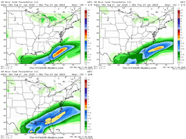
That's a lot of ice. Hopefully it ends up being more sleet or better yet snow later on as the models progress.18z AIFS in WxBlender, which uses dynamic ratios for snow and ZR..
View attachment 163525
View attachment 163526
wow
Member
Yeah the goal here is to keep this from coming down too disconnected from the PV and slowing down the SLP. Need a steady long fetch of precip ahead of the low center via isotropic liftWhat interest me is the overrunning precip before this main wave trending better as well
Last edited:
Tokenfreak
Member
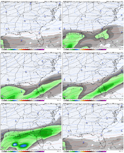
So are these the correct ones or the ones you posted above? I'm confused lolActually blending things as I believe they should be weighted right now:
View attachment 163527
View attachment 163528
Dang, it looks like the AIFS has decided to inject the CMC ice formula into its grid18z AIFS in WxBlender, which uses dynamic ratios for snow and ZR..
View attachment 163525
View attachment 163526
First set I sent are for AIFS. Second is a blend of multiple models. See weights at the bottom of the plots...So are these the correct ones or the ones you posted above? I'm confused lol
SnowNiner
Member
That looks like all ice, sleet. 850 up in stinking VA. I don’t like that at all.
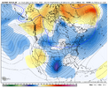
I believe this is the key too. It's why I think the 18z op Euro may have been something special. 18z op Euro and EPS have a more westward extent of the PV trough (keeping cold connected) than the 18z EC AI. However, the EC AI has been trending better in this regard and towards the op Euro and EPS.Yeah the goal here is to keep this from coming down too disconnected from the PV and slowing down the SLP. Need a steady long fetch of precip ahead of the low center via isotropic lift
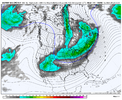
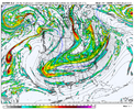
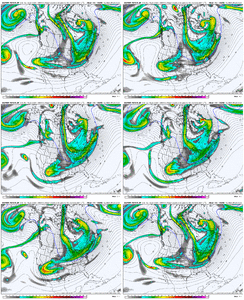
I have not been swayed, I still think the big dog, 12z Sunday ECMWF solution is in play.
Blue_Ridge_Escarpment
Member
Euro AI was head and shoulders above any model for last event. Lot of weight into it IMO
Stormsfury
Member
Yeah that was most of SC barring maybe extreme NE SC (Myrtle Beach)Probably a lot of ice outside of the snow area deep into South Carolina
Like Bouncy said though, we need to get in a little closer. No operational or AI model has enough skill at this range to pinpoint the nuances that will ultimately dictate the outcome of the storm and who will get what.Euro AI was head and shoulders above any model for last event. Lot of weight into it IMO
There is an incredible signal for a winter storm in some form for the south and southeast next week. Should we be worried? Of course we should. This is the south. But I'm not going to ride or die with any individual model run at this point.
At this point, all options are on the table. What more can you ask for in the heart of winter? This is fun.
WolfpackHomer91
Member
This first batch View attachment 163522
Also occurred in Feb 2014….. First Batch came through that Tuesday I believe …. Gave SC/ Sandhills NC 3-5” and then big event came Weds night
Sent from my iPhone using Tapatalk
SnowNiner
Member
Euro AI was head and shoulders above any model for last event. Lot of weight into it IMO
Yeah I agree. Hope the Euro AI trends colder as 1300 mentioned. Closest model to watch, imo.
Take this with a grain of salt as I know next to nothing about models. My thoughts come from being a NC native for 47yrs is all. I grew up in SE Rowan County and you see where I am now. Other then those beautiful clipper systems that occasionally over perform and give me 3-4” of powdery snow. I don’t remember one time ever when ice hasn’t been a component of any storm that comes up from our south. Period.
I appreciate the models and everyone’s knowledge and it’s intriguing to me how knowledgeable some of you are, but from experience, in the end if you live in North Carolina you will see that ice at some point during a winter storm. I’ve seen sleet to snow and back to sleet so thick that we couldn’t even break through to the snow below. I’ve seen 5” of sleet only, I’ve basically seen any combination you can imagine and if you’re honest and live in a line roughly from Statesville to Salisbury to Asheboro and points south you have too.
It’s just not easy to get an all snow event south of the Triad. that is a summation of this post… maybe I should have started out with that instead of ending with it… ,-)

