Sctvman
Member
We switched to snow 30 minutes ago and it's a grass topper already. Piling up fast even with mid sized flakes. If we start getting quarters or bigger it's gonna be a storm!!That'll get it done
View attachment 166615

Still ripping out this way about 15 miles west tooDefinitely getting the heaviest of the evening right now. About a 0.5” on the ground. Everything is covered. Looks like a snow globe outside.
Cutoff is extremely sharp. Basically anywhere N of Ashley Phosphate on I-26 is completely snowcovered. And 95 is a mess through Walterboro and St. GeorgeLooks like a lot of mixing into Charleston. Can anybody confirm that?
To be honest, 4 in greenville. Who knows how long it’ll be before we see something like this again?
Sent from my iPhone using Tapatalk
We close to done out here in Union County?The increasingly close juxtaposition of the 2 aforementioned primary mid-level forcing/temperature advection regimes (the mid level cold front to the west & the warm front to the south) is tightening up the mid-level temperature gradient across east-central NC. This is why radar is suddenly going bananas.
I live in Greenville and we have great rates but flake size is smallish right now waiting for these two bands to merge overhead hopefully....
It’s a disaster zone Mack. Southern half of Greenville county is impassableThey already closed GreenvCkunty Schools for the 1/2 inch they got today! Roads are shite, per several people there, a few got stranded!
Very Likely it willI live in Greenville and we have great rates but flake size is smallish right now waiting for these two bands to merge overhead hopefully....
I think we’ll be done sooner than I’d like to admit. Go enjoy it now triangle
I feel like the radar keeps filling in a bit out west. Am I seeing things? WRAL apparently said this was a 7pm-9pm event here. We started closer to 6 and appear to have at least 90 min left.I think we’ll be done sooner than I’d like to admit. Go enjoy it now triangle
View attachment 166628
You know you're approaching some legit snowfall rates when you're getting near 30 dBz on the radar. Not too bad!
Can confirm. Heavy snow in Westcot off Patriot BlvdCutoff is extremely sharp. Basically anywhere N of Ashley Phosphate on I-26 is completely snowcovered. And 95 is a mess through Walterboro and St. George

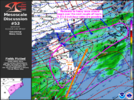
| Mesoscale Discussion 0053 NWS Storm Prediction Center Norman OK 0801 PM CST Tue Jan 21 2025 Areas affected...central and eastern portions of the Carolinas Concerning...Heavy snow Valid 220201Z - 220700Z SUMMARY...Moderate to heavy snow should gradually become widespread through early tonight across portions of the central and eastern Carolinas. DISCUSSION...700 mb warm-air and moisture advection are increasing over central and eastern parts of the Carolinas with the approach of a pronounced 500 mb trough that is traversing the central Appalachians. Beneath the 700 mb moistening, strong surface-850 mb cold-air advection is contributing to further saturation and sensible cooling of the column to support a predominance of snow, which is currently being indicated by surface observations on a widespread basis. Ahead of the upper trough, 700 mb frontogenesis is intensifying, which should support increased snowfall rates. As such, in addition to the transition to snow, 0.5-1.0 inch/hour snowfall rates may develop over the next couple of hours, as also suggested by some of the latest high-resolution guidance runs. ..Squitieri.. 01/22/2025 ...Please see www.spc.noaa.gov for graphic product... ATTN...WFO...AKQ...MHX...RAH...ILM...CHS...CAE...GSP... |
100% true. Heavy sleet. Dusting.Looks like a lot of mixing into Charleston. Can anybody confirm that?
From the RadarScope estimates, the storm is moving at about 23.63 km/hr. Raleigh is about 63.4 miles away from the edge.I say we got 90-120mim left
