-
Hello, please take a minute to check out our awesome content, contributed by the wonderful members of our community. We hope you'll add your own thoughts and opinions by making a free account!
You are using an out of date browser. It may not display this or other websites correctly.
You should upgrade or use an alternative browser.
You should upgrade or use an alternative browser.
Wintry January 21-23 2025
- Thread starter SD
- Start date
WolfpackHomer91
Member
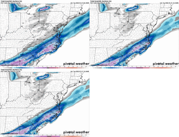
Id say so, except the hrrr has been terrible every run playing catchup for last 13hrsNew 12z hrrr is really drying out on the NW side. I wonder if the new plane recon data is contributing.
Mahomeless
Member
No, you still have to overcome low level dry air. All its showing is where the dendritic growth layer is moist.So with this map, that area in East Central AL and W Central GA, does that imply that when the precipitation arrives it should have minimal resistance to reaching the surface?
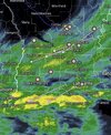
Lafayette already with death band incomingDeath band coming ashore in LA View attachment 166264
Virga popping up over University City and Concord in NC . Yay!
WEATHERBOYROY
Member
WELL, in north central Alabama, I will have to concede to the models. I thought the forecast 1040 high was overdone.......there is a 1042 high to our NW. It has succeeded in pressing the the cold dry air south of us. It looks like all I can expect is maybe some flurries. I would sure love to see some intensification of that gulf LP! Oh well, good luck south and east! God Bless!!
Brandon10
Member
All I know is the trends can stop now....that 850mb line is getting too close to even the ENC coast on the 6z NAM. Hoping to see if a little more east on 12z...
- Joined
- Jan 23, 2021
- Messages
- 4,602
- Reaction score
- 15,197
- Location
- Lebanon Township, Durham County NC
20 mile shift west away from outperforming the last event IMO. If we can get the column saturated all the way through, I think ratios will explode. .3QPF at 16:1 is 4.8" so a dab will do ya.
Radar has virga as far north as Gatlinburg TN
Twister
Member
This just honestly feels like a big surprise for a lot of people Across this board later on. Everyone across northern upstate expecting just flurries when it very well could end up more than thatRadar has virga as far north as Gatlinburg TN
Pretty sure we have occasional flurries south of Sylacauga.
RollTide18
Member
It’s on the way people
Stormsfury
Member
Sctvman
Member
CJ liking the trends north. Talks of WWA expansion further into the northern parts of the upstate later

 www.facebook.com

SNOW TODAY: Trending north! I have confirmed reports of snow flurries in southern Anderson, Greenwood and Elbert counties and the trends over the last 3... | By Chris Justus, WYFF 4 Chief Meteorologist | Facebook
SNOW TODAY: Trending north! I have confirmed reports of snow flurries in southern Anderson, Greenwood and Elbert counties and the trends over the last 3...
 www.facebook.com
NCWeatherhound
Member
IT would be nice ... but naw. Nothing virga-esque in this neck of the woods yet.Some virga already showing up on radar in Raleigh.
Sent from my iPhone using Tapatalk
NAM is also to some extent.New 12z hrrr is really drying out on the NW side. I wonder if the new plane recon data is contributing.
Tsappfrog20
Member
IT would be nice ... but naw. Nothing virga-esque in this neck of the woods yet.
Yea I see I’m wrong but won’t be surprised by some in the next few hours as it’s already in Charlotte and moving this way
Sent from my iPhone using Tapatalk
Brandon10
Member
HRW FV3 is juiced.
NCWeatherhound
Member
My sister over in Duluth says its occasionally spitting a few flakes on and off, which would confirm that moisture plume.
Mahomeless
Member
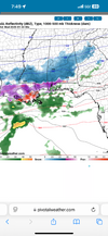
The fresh shot of dry air coming in at 700mb is going to break hearts on the NW half of the precip shield…prepare yourself.
Clearly can be seen on the Jackson, MS radar as the precip shield erodes from NW to SE.
Clearly can be seen on the Jackson, MS radar as the precip shield erodes from NW to SE.
beanskip
Member
Wow -- 3k NAM now keeping TLH above freezing for virtually the entire event, even as the regular NAM trended a bit colder and has precip virtually all frozen. Thoughts and prayers to the NWS TLH forecasters.
WolfpackHomer91
Member

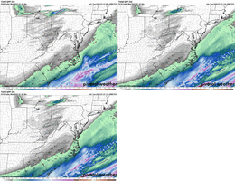
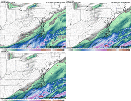
If this is wrong thread i apologize…. Obviously Lesser amounts of Liquid to work with, however very similar footprint for Jackpot Zones ect and ultimately I could see our map looking this way Tomm placement wise. How can I find surface map for this storm somewhere for LP placement ect ?
Sent from my iPhone using Tapatalk
- Joined
- Jan 23, 2021
- Messages
- 4,602
- Reaction score
- 15,197
- Location
- Lebanon Township, Durham County NC
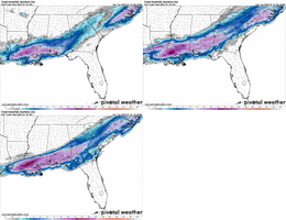
12k NAM at RDU - 3"
3k NAM at RDU - 2"
3k NAM at RDU - 2"
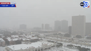
Spitting light graupel/flurries at my work right now in Thomson, GA just west of Augusta, GA on I-20.
SnowDoomer21
Member

Is that virga?
Sent from my iPhone using Tapatalk
GeorgiaGirl
Member
Might be light snow in the medical district downtown now and there is nada on the radar right now.
Don't know for sure, but a coworker is saying so and the clouds look suspicious that way.
Don't know for sure, but a coworker is saying so and the clouds look suspicious that way.
RollTide18
Member
- Joined
- Jan 23, 2021
- Messages
- 4,602
- Reaction score
- 15,197
- Location
- Lebanon Township, Durham County NC
3K NAM seems to be big on a sleet storm on 17 from Savannah to Wilmington. I think you need to be north of KDH to be "safe" from the sleet monster at this point.
Cary_Snow95
Member
Seems the NAM came back SE with precip extent but upped totals for Wake
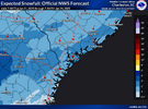
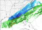
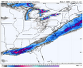
I think you are correct, almost always is but also we don't need it to keep shifting SE either... think it's just zeroing and probably not lose it completely. It is tightening up the gradient, NW side of Halifax Co. gets <1 while SE corner gets 4".I do think the NW extext of the precip will be 20-30 miles NW of where the 3km has it...it almost always is
View attachment 166278
