434
FXUS62 KTAE 211124
AFDTAE
Area Forecast Discussion
National Weather Service Tallahassee FL
624 AM EST Tue Jan 21 2025
...New AVIATION...
.NEAR TERM...
(Today and tonight)
Issued at 425 AM EST Tue Jan 21 2025
KEY MESSAGES...
-A Winter Storm is expected across the area today and tonight
with potentially significant snowfall and ice accumulation
totals.
-Everywhere could see a mixture of precipitation types, although areas
further north and west are more likely to get snow while areas
south and east are more likely to get sleet and/or freezing rain.
-There is a low to medium chance (20-40%) of significant and very
impactful ice accumulation across portions of the FL Big Bend
and south Central Georgia. If realized, significant impacts to
trees and power lines are likely.
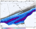
-Snow amounts of 2 to 4 inches are forecast across portions of
the FL Panhandle, SE Alabama, and SW Georgia, although there is a
low to medium chance (20-40%) of accumulations of 6+ inches.
-Regardless of wintry precipitation, extremely cold temperatures
and dangerous wind chills are expected overnight. Forecast wind
chills are in the 4 to 17 degree range, which can absolutely be
dangerous or even deadly to unprotected persons.
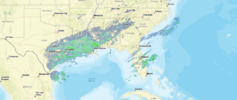
A developing low pressure system over the western Gulf of Mexico
is already bringing snow and ice to the Texas and Louisiana coasts
this morning. This system will continue to deepen and move
eastward towards the area today as a shortwave swings across the
base of a large trough positioned over much of the CONUS.
Southwesterly flow aloft will continue to bring increasing
moisture up over a layer of much colder, drier air at the surface.
As precipitation falls into this layer at the surface, it will
gradually cool and moisten over time. Once enough moistening
occurs, wintry precip will begin to reach the surface and
accumulate.
Surface temperatures will matter quite a bit for eventual impacts of
wintry precipitation. The sooner temps fall below freezing, the
sooner accumulation of snow and/or ice will begin. It`s a bit
concerning that we`re already seeing some returns aloft on radar
across the area this morning, indicating that we may be getting a
quicker start to the moistening of the surface layer than previously
expected and therefore a sooner onset of impacts. For that reason,
we have pushed up the Winter Storm Warnings by a couple of hours to
account for this.
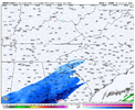
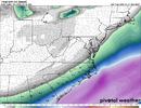
Mixed precipitation will be possible everywhere, although areas
roughly from Panama City over to Tifton are most likely to see
mostly snow. Areas further southeast including Apalachicola,
Tallahassee, and Valdosta are more likely to see a mix of rain,
snow, sleet and freezing rain. The Southeast Big Bend (Perry, Cross
City) are more likely to see predominantly rain and freezing rain.
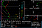
These differences are likely to hinge on razor thin changes in the
surface temps and vertical thermal profile which could very easily
change.
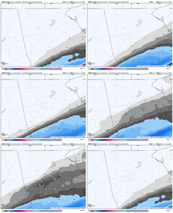
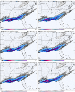
Snow and ice accumulation amounts remain similar to the previous
forecast if not increased just a bit. 2 to 4 inches of snow are
possible across portions of the FL Panhandle, SE Alabama, and SW
Georgia with lower amounts elsewhere. Ice accumulation of .1 to .25
inches are possible across the FL Big Bend and south central GA.
However, there is a low to medium chance (20-40%) that a band (or
bands) of heavier precipitation sets up somewhere over the area.
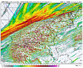
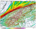
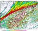
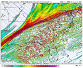
Models are suggesting frontogenesis may occur along a southwest to
northeast oriented line at the 850 to 700mb level. Wherever that
occurs could really enhance precipitation rates and lead to more
accumulation than expected. If in the snowy area, I would not be
surprised if we saw 6+ inches of snow underneath that band. If it
occurs over the sleet/freezing rain area (particularly the FL Big
Bend and south central GA), significant and impactful ice
accumulation will be possible.
Regardless of winter precipitation, dangerously cold conditions are
expected tonight with low temperatures in the teens to mid 20s and
wind chills ranging from 4 to 17 degrees. However, if there is more
snow/ice accumulation than expected or even earlier in the afternoon
than expected, temperatures may fall faster and end up even colder
than currently forecast.
Please, please take this system seriously. Finish your cold weather
preparations this morning and be prepared to lose power and avoid
travel for a couple of days. Check on your neighbors, family, and
friends; particularly the elderly or other vulnerable
populations. Take care of any animals, pipes, or plants. Playing
in the snow is fun, but make sure you are dressed warmly in loose
fitting layers and change into warm and dry clothing as soon as
you`re done. Monitor for signs of hypothermia and frostbite.
&&
Sent from my iPhone using Tapatalk

