• Hello, please take a minute to check out our awesome content, contributed by the wonderful members of our community. We hope you'll add your own thoughts and opinions by making a free account!

Pattern January 2021 - Joyless January

No complaints here for days 10-15...
0a71bb56ec5a5ac722a41340aae71ead.jpg

65d5647044e528a07160899d20b0aad6.jpg


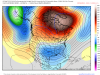
You can also see the path most of the storms want to take in the last 7 days on the EPS.
ce2354ad8844eb86b90388f42aaa9ae9.jpg


Sent from my iPhone using Tapatalk
 
I would think this pattern would yield opportunities for good overrunning that would be good for Birmingham over to Columbia. If Columbia 0's out again this year it will be their longest streak ever without receiving at least an inch of snow. If this pattern locks in from mid Jan until mid Feb I'd think it'd be hard for even CAE to zero out.
 
I would think this pattern would yield opportunities for good overrunning that would be good for Birmingham over to Columbia. If Columbia 0's out again this year it will be their longest streak ever without receiving at least an inch of snow. If this pattern locks in from mid Jan until mid Feb I'd think it'd be hard for even CAE to zero out.
Wow! You know things are good when Grumpy Cat is optimistic!
 
Wave sliding I’m under that mega block. Areas that do well with marginal cold (TN/NC) should be on standby imo. Everyone else, enjoy the show.
I think we'll be fine after mid month. It'll suck watching the mid Atlantic score again, and they will once or twice before us. But you hold that block and lay down snow up there and keep getting storms stuck in the 50/50 location I can't see any reason not to think we reel in 1 or 2.
 
I would think this pattern would yield opportunities for good overrunning that would be good for Birmingham over to Columbia. If Columbia 0's out again this year it will be their longest streak ever without receiving at least an inch of snow. If this pattern locks in from mid Jan until mid Feb I'd think it'd be hard for even CAE to zero out.
overrunning events are my fav
 
Quick question that I am sure can be easily answered by some of you, in a blocking pattern like what is showing up, what exactly is supplying the cold air? I see what looks like a +PNA trying to develop with the -NAO. But I guess I just don't understand where the cold air is being supplied from fully I guess. It's obvious we would be dealing with marginal set ups to begin this transition, but at least we are entering a favored climo period.


download (91).png


download (90).png
 

Attachments

  • download (90).png
    download (90).png
    589.5 KB · Views: 21
Quick question that I am sure can be easily answered by some of you, in a blocking pattern like what is showing up, what exactly is supplying the cold air? I see what looks like a +PNA trying to develop with the -NAO. But I guess I just don't understand where the cold air is being supplied from fully I guess. It's obvious we would be dealing with marginal set ups to begin this transition, but at least we are entering a favored climo period.


View attachment 61355


View attachment 61357
This may help you by looking at the H5 configuration without anomalies. Basically, the -NAO displaces the cold southward, and the +PNA prevents the mild Pacific air from flowing in.
6EB1CBF0-1CAE-4DF0-92D3-69E794E52017.png
 
Last edited:
This may help you by looking at the H5 configuration without anomalies. Basically, the +PNA displaces the cold southward, and the +PNA prevents the mild pacific air from flowing in.
View attachment 61358
Ahh got ya! So it's likely for people deeper in the SE, we need a +PNA to pan out. Otherwise, we are dealing with mainly marginal set ups.

Thank you for the help too, that does help to break it down better.
 
Ahh got ya! So it's likely for people deeper in the SE, we need a +PNA to pan out. Otherwise, we are dealing with mainly marginal set ups.

Thank you for the help too, that does help to break it down better.
Tbh we're probably dealing with marginal setups regardless even with the PNA for a bit. Canada has been flooded with Pac air for awhile. But its still cold up there and with the PNA help it is workable and it should be able to cool down up there significantly now, especially with peak climo.
 
Ahh got ya! So it's likely for people deeper in the SE, we need a +PNA to pan out. Otherwise, we are dealing with mainly marginal set ups.

Thank you for the help too, that does help to break it down better.
Yeah, the best look IMO is for an amped up wave to come out of the Pacific, with a +PNA behind it. Then it moves across the south as it phases with a 50/50 low. That's our best look, and not too far off for that happening.
 
Got a pretty good feeling that we’re gonna hand off the first storm or two in this pattern to the mid Atlantic. We could use a little snow cover to our north to help further lock in this great pattern. As we see a few storms run their course thru the first half of the month and lay some snow down to our north, the Greenland block begins to couple with the stratosphere, & continues retrograding poleward and westward, the air masses that plunge southward will become increasingly deeper/colder as we get into mid-January

Hence, I think the mid Atlantic and perhaps the mountains could score here inside the first 10-12 days of the January. Our window in the SE probably does not legitimately open up until about Jan 15 or so given the above info, but it should last for basically the rest of January at a minimum and given the SSWE, February is also looking favorable atm
Yeah, it would definitely be nice to see about a 1036 mb High sitting in place in New England pushing cold air down over snowpack while it’s held in place by good blocking.
 
EPS weeklies 6 run trend, what a horrible model.


Idk if calling it "horrible" is very fair. Forecasting details beyond 3 or so weeks is beyond the ability of any model. In fact, one of the big realizations of chaos theory was the fact that it's impossible to produce an accurate deterministic forecast beyond about a month, even if our measurements of the atmosphere were very accurate. Like @SD says, after a certain point the ensemble members are so noisy that they stop reflecting the details of the model's initial conditions and start reflecting the steadier, larger-scale forcings/patterns (things like ENSO).

To that end, the weeklies do a pretty decent job. If anything, this just reflects how lucky we are to be eyeing such a favorable pattern during a La Nina.
 
Yeah. I mean they may not but it certainly seems that in the past couple years the weeklies that look good/bad in the really long range are typically a climo look then the wheels fall off as you get closer to real time
It has panned out that way seemingly more often than not. I keep forgetting past teachings of this.
 
Idk if calling it "horrible" is very fair. Forecasting details beyond 3 or so weeks is beyond the ability of any model. In fact, one of the big realizations of chaos theory was the fact that it's impossible to produce an accurate deterministic forecast beyond about a month, even if our measurements of the atmosphere were very accurate. Like @SD says, after a certain point the ensemble members are so noisy that they stop reflecting the details of the model's initial conditions and start reflecting the steadier, larger-scale forcings/patterns (things like ENSO).

To that end, the weeklies do a pretty decent job. If anything, this just reflects how lucky we are to be eyeing such a favorable pattern during a La Nina.
SSWE for the win, imagine if we didn’t have that
 
so glad we’re not looking at this in the LR like I thought we would be a month or so ago at this time View attachment 61361But we’re looking at this instead
View attachment 61360
Yeah it’s pretty much the complete opposite.. SSWE ftw lordd what we can do with a -AO/+PNA/—NAO (west-based).. I’m very happy to be conscious enough to follow this god-like 09-10 pattern.. just in time ? like Eric Webber said, I think we begin during the transition which is obviously beginning now will favor mid-Atlantic/mountainous areas of NC and extreme NGA follow by an increased likelihood of cold and snow late Jan into at least early February for much of the south and I think I would be willing to bet I-20 gets involved in this before this is all over.. fun times ahead everyone should be thrilled ❄️ ⛄️ is coming!!!
 
Seeing that run of the Euro Weeklies has got to get you at least intrigued for what could be coming into play. I know the Weeklies are far from perfect in terms of accuracy and the do gear towards climo the further out they go, but to see them putting out 3 inches of snow for CLT is exciting. I honestly don’t think I’ve ever seen it give CLT as much as 2 inches.
 
Yeah it’s pretty much the complete opposite.. SSWE ftw lordd what we can do with a -AO/+PNA/—NAO (west-based).. I’m very happy to be conscious enough to follow this god-like 09-10 pattern.. just in time ? like Eric Webber said, I think we begin during the transition which is obviously beginning now will favor mid-Atlantic/mountainous areas of NC and extreme NGA follow by an increased likelihood of cold and snow late Jan into at least early February for much of the south and I think I would be willing to bet I-20 gets involved in this before this is all over.. fun times ahead everyone should be thrilled ❄ ⛄ is coming!!!
Yes... the looks we’re seeing are definitely ones that can could get us a good long overrunning Southern Slider which is something that we are so overdue for.
 
Back
Top