L
Logan Is An Idiot 02
Guest
It would be nice to see some of the other models pick up on it
It would be nice to see some of the other models pick up on it
Kinda concerning to see the euro stay steady with temps around 32-35 in cad regions, that’s to close for comfort already, we’re gonna get NAMed, no doubt about it, might be tonight’s 00z run lol


I’d be very shocked if we weren’t NAMed View attachment 68629View attachment 68630


I'm not convinced the cold will hold long enough for major icing! What say you?Im [my back yard) is gonna be heavy on ice with this one. Hopefully we can get a front end thump inch maybe 2. Start seeing 1 inch qpf ill be getting ancy.


Any thunder ?Dumping in here
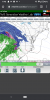
View attachment 68655
Haven’t heard anyAny thunder ?
Damn we suckHaven’t heard any
I think it could, but it’s not something we’re gonna know until now-casting time. A lot will depend on how much snow is put down, if any, with that front end... that’s something that can effect temps not only were the snow cover is, but also in areas just to the south and southwest as the CAD develops and becomes stronger. Also the Euro has hinted at a mesohigh forming in SW VA... if that happens it will hold things in that much longer.I'm not convinced the cold will hold long enough for major icing! What say you?


To early to tell. Gonna have the lowest dps of the season Saturday it looks like. Precip rolls in Saturday night.Not a fan of miller bs that jump us to the delmarva. Should be able to start irioning out friday. I can handle ice, as long as i have somebwhite ground to go along with it. Nam trends on temp,dp will be interesting. RGEM was a good lickI'm not convinced the cold will hold long enough for major icing! What say you?

It's just not going to happen. I don't know what the EURO is on. Should cave soonLmao we doubling the warm nose now ? The suck is doubled into a shitstorm View attachment 68667
FZRALmao we doubling the warm nose now ? The suck is doubled into a shitstorm View attachment 68667
Kinda outside the NAM’s good range there. However Friday night and Saturday morning are getting into it’s good range and you can see there is some very low dewpoints to the north to tap into and this is with dewpoints in the teens across NC into northern SCI-40 north. They can have their ice storm. View attachment 68662
Yeah that's true. I guess we will have to see what the euro presents tonightKinda outside the NAM’s good range there. However Friday night and Saturday morning are getting into it’s good range and you can see there is some very low dewpoints to the north to tap into and this is with dewpoints in the teens across NC into northern SC
Euro is going to cave very soon.ICON was even warmer for areas along the wedge, sigh
This is probably one of deals that everything doesn’t get resolved until inside 24 hours. The biggest thing that stands out to me right now though is the low dewpoints that look to be there... lowest of the season so farYeah that's true. I guess we will have to see what the euro presents tonight


-AO is a game changerLol this looks like the pattern the CFS is advertising View attachment 68699View attachment 68700
Precip depiction isn’t a Miller A. So I’m outIncoming ? View attachment 68701

Everyone in NC missed out. It completely dried out over the mountains lol. Regardless some insanely cold airPrecip depiction isn’t a Miller A. So I’m out ☹