NBAcentel
Member
Gonna be breaking out the wind shear/cape maps soon 


It honestly ain’t that bad haha a little SER was bound to happen at some point .. we won’t die or burn up it seems very transient and also same models have the -NAO picking back up after this point
Yeah severe is fun late Feb thru October. Severe is not fun in January.Maybe im alone but i find severe weather just as exciting as snow.
Tbh I find it about as exciting too, the adrenaline rush of a good storm chase is amazing
Starting to wonder if all the advertised kick the can down the road real cold is going to materalize. Hoping but not going to get my hopes up. Maybe for my area it makes it and maybe you all get CAD but if the ser is too much and the arctic doesn't get far enough south were are all in trouble.Buzzsaw block is delayed but not denied ! View attachment 65733
Good thing we are getting it in JanJust a reminder to everyone, when the SER nudges itself in during February there’s usually no turning back.

Good thing we are getting it in Jan
Yep! That’s the spirit ... Feb 2015 didn’t really get going till the second half of the month .Good thing we are getting it in Jan
@Ollie Williams has a gif of patterns that preview a CAD miller B system and honestly it had some pretty stout southeast ridging previewing it, one thing i notice differently is the SE Canada vortex and it’s strength vs our regular run of the mill southeast/death ridge12z Euro tries to CAD us twice this run w/ the 2nd one showing up at day 10 w/ more cold air that time around. Details will obviously matter a lot, but the longwave looks similar on the ensembles
View attachment 65734
Nah, that’s just excessively pessimistic . You have to look at current conditions and give weight to them . Fact is the most defining feature that has yet to fail to materialize is the -NAO. I would bet on it until proven otherwise .Just a reminder to everyone, when the SER nudges itself in during February there’s usually no turning back.

So some areas got close to 24" from these 2 storms. I wonder what the rest of that winter was like. I wonder if some of those areas got more than 30" when combined with other snow events that season ?I know I've posted these before but OTD back in 1912 the first of 2 one foot snowstorms hit parts of Robeson, Bladen, & Sampson counties that winter.
Just for perspective, Lumberton has only seen one other 1+ foot storm since 1895 (Mar 1980).
Talk about getting insanely lucky.
View attachment 65737
View attachment 65738
Yeah, I posted it a while back. I'm working on fixing my climatology calculations, so until then, I won't be making any more maps. But yeah, you make a good point, any ridge over the CONUS will remain transient as long as we have a trough over the Atlantic. Although I do think we're at a crossroad between a ridge over the GL/NE (Miller A), and a strong ridge there (Miller B). Anything in between just causes systems to head north.@Ollie Williams has a gif of patterns that preview a CAD miller B system and honestly it had some pretty stout southeast ridging previewing it, one thing i notice differently is the SE Canada vortex and it’s strength vs our regular run of the mill southeast/death ridge
So some areas got close to 24" from these 2 storms. I wonder what the rest of that winter was like. I wonder if some of those areas got more than 30" when combined with other snow events that season ?
jeez what a Winter. Holy smokes.Nah that was it for them lol. Lumberton basically got more snow than everyone east of the mtns, I think that's the only time this has happened too
View attachment 65739
Is there any other winter besides this one where the entire state had double digit snow ?Nah that was it for them lol. Lumberton basically got more snow than everyone east of the mtns, I think that's the only time this has happened too
View attachment 65739
Is there any other winter besides this one where the entire state had double digit snow ?
Wake county snow hole at it again ???Oh yea lol.1935-36 is by far & away the snowiest on record in NC and the statewide average was ~25"
View attachment 65740
pffft....plenty of time for that, but not plenty for snowMaybe im alone but i find severe weather just as exciting as snow.
2017 was the most god awful winter here in my life. 7-10 degrees above normal and literally 3-4 flurry events which added up to barely a dusting. Since 2006 until 2017 I had not had a winter where I didn’t get at least 1-2 inches of snow a season for this area. What I thought was impossible became possible that horrible winter.Yeah last 2 years and 2017, there was no hope then because how positive it was (NAO/AO), southeast ridge had all the room to become the southeast block, the -NAO hopefully isnt a headfake heading forward, would think it wouldn’t and it would be for real given the state of the strat PV but I could Be wrong
Looks like the south will have to wait until February for any real cold.
Yep a overall CADish pattern with warmer stuff towards the gulf coastLooks like the south will have to wait until February for any real cold.
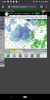
Huh?Holy poop. 18z GFS shows some nice snow over the piedmont of NC on Saturday


To be fair, not the
 worlds worst look:
Probably gonna see several CAD events pop up over the next few days, with some ice possibly, that’s just not a warm look around here given the ridge axis isn’t to our SE but to our west/southTo be fair, not the View attachment 65764worlds worst look: