Six Mile Wx
Member
May be too early to tell.Is that good or bad
May be too early to tell.Is that good or bad
MJO looping back to high amp 5 would be NOT GOOD IMO. Hopefully that is not reality.May be too early to tell.

In other words. It’s about get cold... he is saying ...English please
Sent from my iPhone using Tapatalk
Is that good or bad
Models will probably begin picking up on this more significantly and we can start seeing positive trends for the storm aspect of things regardless cold is comingEnglish please
Sent from my iPhone using Tapatalk
I’m at the 100th annual AMS conference in Boston and I had a poster presentation earlier today.Does anyone know where Eric is?
There is absolutely nothing wrong with phase 7 in January, it produces about twice as many winter storms as any other mjo phase at any time of the year. Safe to say we’re completely fineI agree fully about a pattern change coming. You make a good point there. My opinion is it isn't exactly what people want or think it is with a huge trough over the east locked in with multiple threats. Those cold models all have one thing in common, a -EPO which has been a unicorn all year and we have a strong consolidated tPV up near the pole with a +AO and +NAO. Not sure where all the love for phase 7 came from. And down below is the newest GEFS which doesn't get to 8.View attachment 30921View attachment 30922
Icon gets something going later in the run log snow in central/ eastern nc
Sent from my SM-G975U using Tapatalk

That coastal was about to go bonkers at the end of its run. Why do I get the feeling this will eventually be too far west for meIcon gets something going later in the run log snow in central/ eastern nc
Sent from my SM-G975U using Tapatalk


Yep on to the euro. That's one nice cold shot early next week though may end up with a day that stays below freezingOne thing for sure GFS not really biting on the coastal next week, yet. Trough was deeper but too far east
Sent from my SM-G950U using Tapatalk
Where do you see 37? This is the time the storm comes through. In the 50's and 60'sHighly doubtful western NC goes from the low to mid teens to 37 all rain as shown. Screams major winter storm for climo areas.

Only thing I can say is cold=dry warm=wet. And timing NEVER works out for anything except rainNo comment
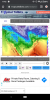
View attachment 30939
Incorrect. Try hour 240 when there is a lot of heavy precip.Where do you see 37? This is the time the storm comes through. In the 50's and 60's
I’ve pondered on this for the last month; I’m starting to think we’re going to need a weak wave to score in 2020..but that STJ is juiced up and has been for some time. I don’t think it will allow itOnly thing I can say is cold=dry warm=wet. And timing NEVER works out for anything except rain
I did. 38 in the highest elevations. Upper 40's in PiedmontIncorrect. Try hour 240 when there is a lot of heavy precip.
if you can wet bulb from 37 to below freezing with dew points in the low 40’s and quickly rising, then yes warning criteria eventIncorrect. Try hour 240 when there is a lot of heavy precip.
Guess your wrong again for both locations.I did. 38 in the highest elevations. Upper 40's in Piedmont


Like I said, I doubt climo areas warm up that quickly. My comment still stands, Winter storm potential there.No comment
if you can wet bulb from 37 to below freezing with dew points in the low 40’s and quickly rising, then yes warning criteria event
DT's latest video hinted at a polar vortex attack into Feb. It's certainly on the table as a possibility. CFS, yeah yeah, is showing big time arctic outbreak then:GFS hiniting at a more SERIOUS Arctic outbreak toward the end of the run. Will this pan out? Could there be a storm? The answer is probably no.

You’re right. It’s there. But that was not a wintry run for anyone. Lucky for everyone though it will change again in 6 hoursLike I said, I doubt climo areas warm up that quickly. My comment still stands, Winter storm potential there.