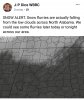
Banner Elk. Delayed rescues. 
Ober Gatlinburg is getting shellacked this AMthis may be the weekend to make my trip to gatlinburg. If I could get a cabin 3000 feet or higher I’d do just fine with a setup like that.

Local NWS WFOs are playing catch up in the mountains.

I think we will have a weather statement posted tonight if things keep looks good. Nothing crazy just a heads up kinda statement.
Sent from my iPhone using Tapatalk


I have not checked out the soundings, but those ULL could start a graupel storm as it passes overhead.
We have an obs thread for flurries folks. Jesus Christ.
i remember that im pretty sure we in Columbia got some as wellThis setup reminds me vaguely of Feb 1996 when down here had an ULL generate heavy snow showers at times with temps in the upper 30s/low 40s ... In the afternoon, had 1" accumulate in just 20 minutes with high winds on elevated surfaces and grassy areas. After that passed, sun out. Back to 41 and snow melted quickly. Huge Low topped CB moving away. Later thundersnow during the evening.
Experimental HRRR looking good for some flurries today into tomorrow. Notice the OBX as well. Still some snow showers at this frame as well.
I think we could start a thread for this flurry event to keep stuff organized. I'll let you guys decide that.
RH looks fantastic on HRRRX
Do you have a link for this? Thanks!!
Ok, so what weird conditions cause those strange 2 dimensional flakes? That is super cool!
Experimental HRRR looking good for some flurries today into tomorrow. Notice the OBX as well. Still some snow showers at this frame as well.
I think we could start a thread for this flurry event to keep stuff organized. I'll let you guys decide that.
View attachment 31520
RH looks fantastic on HRRRX
View attachment 31521
This setup reminds me vaguely of Feb 1996 when down here had an ULL generate heavy snow showers at times with temps in the upper 30s/low 40s ... In the afternoon, had 1" accumulate in just 20 minutes with high winds on elevated surfaces and grassy areas. After that passed, sun out. Back to 41 and snow melted quickly. Huge Low topped CB moving away. Later thundersnow during the evening.

yea that one was one of those great surprises we rarely getYep, same situation a few years ago with that Novemeber 1st ULL that swung htrough the Midlands. I've felt okay about coastal areas seeing something, originally thinking the precipitation would be close enough.. but now the ULL idea is more prominent versus that imo.. and they are unpredictable. They tend to quickly strengthen and throw models off.. and we are seeing hints at the "idea" of moisture being "squeezed" and in the DGZ region with it, now.
Lets put it this way: On October 31st, I went to sleep saying "it isnt going to snow with that ULL" and woke up to a very heavy snow.
Umm 12z GFS trending much better. Northern Virginia went from nothing to a big dog for this Friday. Earlier arrival may include the NC foothills and Piedmont. NC Mtns already looking much better too. This is prob our biggest threat so far this year because of the cold being here just prior and verifying.
I would say along the coast of NC/SC may get some surprises. Dew points higher along coast.take a look at this. this doesn't mean it would precipitate.. but as the ULL is really cinching down, the burst of clouds start to pop and come inland over the coast with temperatures in the lower 30s.
Just saying........ the simulated "radars" may not look too promising on the 3KM NAM, but this isn't far off:
EDIT: Dew points are quite low, so may end up with Virga.
View attachment 31526
It has trended to the point where max temp is 36 during the front end it may end up being a 100% winter event imo instead of the usual wrap around. Given it won’t take long to cool 4 degrees the wrap around should cover a much larger region than normal.The Mtns are gonna score huge because of wrap around, regardless of how front end plays out.
Still spitting snow up on Beech Mtn currently: https://www.resortcams.com/webcams/beech-parkway/

A negative JBO (Joe Bastardi Oscillation) is the best signal yet that we’re about to get cold and wintery.Sounds this morning like JB has thrown in the towel for areas south of New England for the bulk of the remaining winter, although it does look to be way below normal in April as the -NAO looks to get established smh. Looks like the EURO is taking the MJO quickly into phase 6 again
Sounds this morning like JB has thrown in the towel for areas south of New England for the bulk of the remaining winter, although it does look to be way below normal in April as the -NAO looks to get established smh. Looks like the EURO is taking the MJO quickly into phase 6 again