NWMSGuy
Member
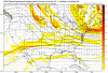
At hour 174 and forward it appears the moisture doesn't move East out of Texas. Would this be due to the strong High?
Yeah, if we get a coastal storm or even just a NW trend but not to much than the southeast including your area would be golden. I better not get on the "MBY snow" or the mod team will take over LOL!!!This could be the one for South Carolina.. I count at least 8-9 members with some type of accumulation here. Wow!

Coastal or not, gefs has been all over this southern track solution for days now maybe a week. When I see a consistent modeling for this with the ens, then that makes a believer out of me.
 it sounds odd but if we could just get a little bit of a SER that would really help out with the first wave. We need a moisture feed from the gulf and the NS just shuts it off. As everyone has been saying, just back everything W some and we are money. If there’s a trend we can always count on it’s a trend for a stronger SER. I don’t think that would be a bad thing at this point.
The signal is definitely there for places further west alsoYou guys on in the eastern carolinas could be in for a nice winter storm.....the signal is definitely there.
Yes if the Euro shows a trend of shifting the trough west, even just a little bit, it will keep my attentionThis is what I was talking about the other day...having lots of members showing something and a few showing a big dog. If you're in eastern NC, for example, you have 14 members giving you snow or having it really close to you. And you have 2 or 3 really significant or big dog events. It tells you that you'd better pay attention and that you might need to really, really pay attention. That's what you want to see. And you want to see it hold, obviously.
Holy cow major increase on almost all out west. Remember Verification is closer out west than for us, so models are starting to lock in on solution for the


One thing I’ve come to know about coastal snow storms over the years is they are somewhat immune to the NW trend in a sense they don’t run back inland. However they can, and usually do, trend closer to the coast putting the eastern Carolinas in play and really as far west as Charlotte at times.

 PV centered over the Great Lakes, it's not digging down too deep and it's a perfectly fat "U" and there's blocking (north) all around this PV. We would score at a much greater chance with a setup like this versus what is being shown at 500mb for next week. If this pattern verifies for the last week, I would be super excited!


Yes. And look at last 3 runs. It’s backing up further west and Sw

Again as so many others have said, that ridge is not the problem. You're buying into something that's really far out and discounting the thing much closer just because of one feature you believe is a problem when in reality it's helping us out. It might not mean a snowstorm for you, but for people in the Eastern carolinas it might.I'm sorry you all; it's still not looking like there would be a widespread winter storm next week. We're definitely going to get the cold. Things are still not looking good for a winter storm development next week though.
Looking at the 12z GEFS, 500mb, this is not a good look. A massive ridge into central Canada is still showing up, this massive ridge is messing things up by a lot as well as the deep Eastern trough. The combination of this massive ridge and the deep Eastern trough will cause things to be suppressed, off shore flow of the Eastern coast. A Gulf low would be very difficult to form with this setup. If any Gulf low, it would be suppressed down to Cuba/extreme Southern Florida. If this ridge was centered further west, over the PNA region, things would have been more exciting. Something will need to change fast for a winter storm development next week. But, time is closing in for this time window and there hasn't been any solid consistency for a widespread winter storm on the OP models.
View attachment 30847
A winter weather system to the west does indeed tries to develop next week, but it's going to get crushed as the ridge builds in central Canada and as the deep Eastern trough takes place. @Brent may have a quick opportunity for snowfall next week if this thing holds. Brent, if you get snow, send us some good photo's!
I'm still going ALL IN during the last week this month for a widespread southeastern winter storm to occur sometime. Using the GFS OP 500mb from today, this is what I'd like to see! Ahhh, much better!
View attachment 30852PV centered over the Great Lakes, it's not digging down too deep and it's a perfectly fat upside down "U" and there's blocking (north) all around this PV. We would score at a much greater chance with a setup like this versus what is being shown at 500mb for next week. If this pattern verifies for the last week, I would be super excited!
Exactly... this (as you obviously know) is why you look at the whole picture, especially trends, and not just one model outputYes. And look at last 3 runs. It’s backing up further west and Sw


Again as so many others have said, that ridge is not the problem. You're buying into something that's really far out and discounting the thing much closer just because of one feature you believe is a problem when in reality it's helping us out. It might not mean a snowstorm for you, but for people in the Eastern carolinas it might.