Storm5
Member
Incoming third wave day 11 /12
Sent from my iPhone using Tapatalk
Sent from my iPhone using Tapatalk

That is easily getting within the NW correctable range...Good trends here with our first trough. Notice ridge pushing west. Allowing the low pressure to come our way.
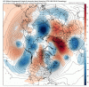
View attachment 30823View attachment 30824
Too much energy, GFS can't figure out which LP will be dominant.... had it right where we wanted it in C. Fl but then another LP forms along the NC coast. Cold air is close by and energy everywhere, we score with one of these no doubt264. Maybe a mixed bag in NC. Colder than 6z, but still not cold enough. Tracking specifics with so much happening before hand is pretty futile, but I want to see a big operational run!
")
Isn't that trough too far east? I'd think we need a more w/sw h5 flow to get our moisture to come out of the gulf.
I like the trough axis better on the GEFS, could be some money members this runDon't sleep on that Low off the SE coast. It's been trending closer with a much better trough axis. This is the first chance that some of the ensembles have been keying on.
View attachment 30825

Once the NW trend occurs watch out Carolinas?That is easily getting within the NW correctable range...
Agreed.Another nice wave forming at 231. I have a difficult time believing that all of these nice waves in Texas are going to get squashed as much as the GFS is showing considering the 500mb setup.
Should a thread be started soon?
I had almost 11 inches just nw of Huntsville, including 4 inches in 1 hour..it was awesomeThere are snow amounts for invidivual states(widespread amounts of 4-10 inches occured in Northern GA).
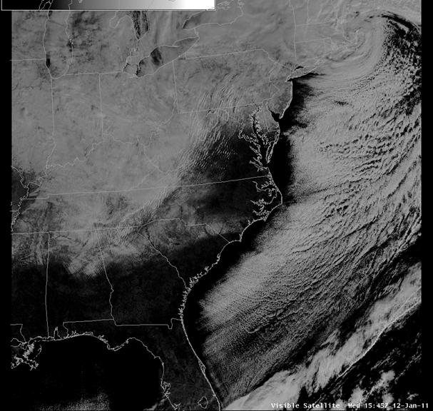
Here's a satellite view of the areas that had snowcover on January 11th, 2011.
I'm not saying this storm will be exactly like that one...it just reminds me of this storm.

Several members are closer to a nice coastal ( a few bombs) around D6-7, the one @packfan98 and @Fountainguy97 were mentioning. It's not there yet but dang close and I'll take it at this range
Yes. The trough axis has trended deeper, sharper, and further west. If that continues at least the coastal sections would be in play. I think there's room for it to turn the corner a bit.Yeah forget the rest at this point. The first has huge potential.
Totally agreeYep its close. EURO has led the way. lets see what it has to say. Also this storm has SIGNIFICANT implications for the others downstream. If this is caught and bombs out it will change up the blocking pattern to our north. Step one in this multi-wave pattern is this first wave and what does it do.


You can see the ridge tick west and steepen, looking at your gif. That is key. It will allow the northern wave to dig. I haven't looked at vort maps yet, but I assume there will be energy in the STJ. If that's true, then a digging n/s vort will have the potential to link up with it and phase somewhere over/near the SE US. The trend in the gif looks really good, and if that continues, we will see a couple of big dog solutions show up before too long.Yeah forget the rest at this point. The first has huge potential.

This could be the one for South Carolina.. I count at least 8-9 members with some type of accumulation here. Wow!
some coastals definitely showing up.
Totally agree
And you can see some snow with some of the members along the Carolina coast, a couple of nice hits, but hopefully just the beginning of continued NW shift
View attachment 30835
Several members are closer to a nice coastal ( a few bombs) around D6-7, the one @packfan98 and @Fountainguy97 were mentioning. It's not there yet but dang close and I'll take it at this range
Yes. The trough axis has trended deeper, sharper, and further west. If that continues at least the coastal sections would be in play. I think there's room for it to turn the corner a bit.
That's why we're fine with it near Bermuda at this range!Coastals just make me want to throw something most of the time. Warm nose usually ends up ruining things for the Eastern half of NC and SC. It's a very fine line we walk with the NW trend and the warm nose wins 99% of the time. The big exception for my area being the Carolina crusher, which was and is a very rare occurrence.
This is what I was talking about the other day...having lots of members showing something and a few showing a big dog. If you're in eastern NC, for example, you have 14 members giving you snow or having it really close to you. And you have 2 or 3 really significant or big dog events. It tells you that you'd better pay attention and that you might need to really, really pay attention. That's what you want to see. And you want to see it hold, obviously.