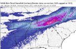
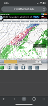
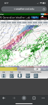
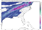
Yeah I noticed Tupelo hasn’t reported snow yetLooks like the heavy snow totals are gonna bust a little bit in northern MS with the sleet line pushing close to Memphis. Nothing wrong with a good sleet storm though.
-
Hello, please take a minute to check out our awesome content, contributed by the wonderful members of our community. We hope you'll add your own thoughts and opinions by making a free account!
You are using an out of date browser. It may not display this or other websites correctly.
You should upgrade or use an alternative browser.
You should upgrade or use an alternative browser.
Wintry January 14-16th storm potential.
- Thread starter TheBatman
- Start date
rburrel2
Member
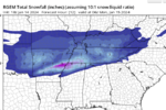
They're forecasted to have 3-5 inches by 1am tonight(see the rgem below through 1am tonight)Making up the bulk of their totals. As of right now it's mostly sleet and the sleet line appears to be stationary if not shifting north.It's just the beginning. That area should get snow through tomorrow evening.
 .
.rburrel2
Member
Light ice and 29 degrees here in New Market. Brad Travis said by tomorrow afternoon 3+ inches should fall over all the northern counties in Alabama with twice that in the western part of the state being possible
WeatherGirl205
Member
30 degree rain still where I’m at in Huntsville. ? ?
SASQUATCH
2-Time Defending SouthernWX Fantasy Football Champ
Member
2024 Supporter
2017-2023 Supporter
I'm gonna passThis is possible shaping up to be a bigger deal with ice
Chattownsnow
Member
30 degree rain still where I’m at in Huntsville.

If that’s the case I don’t see how Chattanooga isn’t rain at the start lol
Sent from my iPhone using Tapatalk
Shadypines33
Member
Sleet and
It zr and sleet here off Old Railroad Bed in Madison. My car is completely glazed. Starting to see a few flakes though, so hopefully it's headed your way!30 degree rain still where I’m at in Huntsville. ? ?
Haleyville, Tupelo, Muscle Shoals all reporting ZR
Chattownsnow
Member
Can confirm sleet in Hixson just north of Chattanooga right now
Sent from my iPhone using Tapatalk
Sent from my iPhone using Tapatalk
Freezing Rain/Sleet here. 30 degrees.
You and me both. I will not stay at work starting tomorrow night @630pm until whenever. I'll drive in the grass if I have to ?I'm gonna pass
WeatherGirl205
Member
Thank you! We’re staying off University. We drove up from Bham area hoping for some flakes! ?Sleet and
It zr and sleet here off Old Railroad Bed in Madison. My car is completely glazed. Starting to see a few flakes though, so hopefully it's headed your way!
Best look of the NAM for here. I have 36 here. Gilmer County is 41 which is very odd to me.
I think you have a shot at some snow tonight, its going to be one of those wait and see what returns you get scenarios.Best look of the NAM for here. I have 36 here. Gilmer County is 41 which is very odd to me.
I'm 39.4F/33.4 down here. Not that it matters when there is no moisture and I will be approaching 60F tomorrow.

