Mahomeless
Member
- Joined
- Oct 17, 2023
- Messages
- 900
- Reaction score
- 2,158
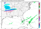
Rough look for Alabama....spotty ice here and there but almost nothing in the way of snow. It once looked promising for HSV.....not so much right now.
Rough look for Alabama....spotty ice here and there but almost nothing in the way of snow. It once looked promising for HSV.....not so much right now.

Florence is the place to be in AlabamaRough look for Alabama....spotty ice here and there but almost nothing in the way of snow. It once looked promising for HSV.....not so much right now.
Not sure if you’re serious or not. It’s one run of one modelRough look for Alabama....spotty ice here and there but almost nothing in the way of snow. It once looked promising for HSV.....not so much right now.
Same here, like rapidly today.sref plumes went way down here..not sure thats worrisome..just an observation
After many years of doing this, I hate SREF plumes and give them zero reliability.sref plumes went way down here..not sure thats worrisome..just an observation
I haven’t looked at them since February 25, 2015… the day that they gave me between 7-19” at go time and I ended up with a slushy 1”After many years of doing this, I hate SREF plumes and give them zero reliability.
Apples and oranges. The wimpy LP we're dealing with this time isn't even on the same planet as the 93 triple-phaser.Those of you who are taking snow "models" in the southeast as the gospel at 48 to 72 hours out. Are new to the game or fresh move-ins from regular weather pattern locations in other parts of the country. Watch the trends even 12 to 8 hours out these bands will shift north to south and south to north, dry to wet, wet to dry. There are a lot of factors at play. As been said many times if your in the bullseye now you're probably gonna miss out, or at least be sadly disappointed. Lows in the gulf are great for north alabama when perfectly positioned and of the right strength. To far west and it deepens to quickly, pushes WAA to far north too quickly and saturates the atmosphere with too much warmth leaving the trailing super cooled precipitation unable to cool the layers resulting in sleet/zr or typically good cold rain. If the Low forms too far south you loose the moisture influx and the front comes in drier for N Alabama and you end up with better snow further south. However, if all the pieces come together just right (For N Bama) and you can get a deepening low just off Apalachicola, FL and it move east across the panhandle, you pull cold air down quicker while moisture transport from the eastern gulf and Atlantic is thrown back over top enhancing the snowfall rates. March of 1993 would be a prime example of this environment.
All of that to say nobody knows until game time, it's fun to watch for now
But keep your emotion intact until game time. Then you'll know for sure! Cheers best of luck to us all!
Disclaimer: I am not a meteorologist and don't proclaim to be. I am however a 20 year weather weinnie who has learned as much as i could from sites like this and model watching and self educating. The above statement maybe in layman terms and not meteorological proper, but it is the way i have observed the best and worst winter events In our area for over 20 years.
Well said.Those of you who are taking snow "models" in the southeast as the gospel at 48 to 72 hours out. Are new to the game or fresh move-ins from regular weather pattern locations in other parts of the country. Watch the trends even 12 to 8 hours out these bands will shift north to south and south to north, dry to wet, wet to dry. There are a lot of factors at play. As been said many times if your in the bullseye now you're probably gonna miss out, or at least be sadly disappointed. Lows in the gulf are great for north alabama when perfectly positioned and of the right strength. To far west and it deepens to quickly, pushes WAA to far north too quickly and saturates the atmosphere with too much warmth leaving the trailing super cooled precipitation unable to cool the layers resulting in sleet/zr or typically good cold rain. If the Low forms too far south you loose the moisture influx and the front comes in drier for N Alabama and you end up with better snow further south. However, if all the pieces come together just right (For N Bama) and you can get a deepening low just off Apalachicola, FL and it move east across the panhandle, you pull cold air down quicker while moisture transport from the eastern gulf and Atlantic is thrown back over top enhancing the snowfall rates. March of 1993 would be a prime example of this environment.
All of that to say nobody knows until game time, it's fun to watch for now
But keep your emotion intact until game time. Then you'll know for sure! Cheers best of luck to us all!
Disclaimer: I am not a meteorologist and don't proclaim to be. I am however a 20 year weather weinnie who has learned as much as i could from sites like this and model watching and self educating. The above statement maybe in layman terms and not meteorological proper, but it is the way i have observed the best and worst winter events In our area for over 20 years.


Yea, I don't think the RAP is sophisticated enough to realize downsloping is going to kill gpf down here in the valley. I hope I am wrong and we get a few inches but not excited about things as they are right this second.View attachment 142106
RAP went full on weenie mode for me
No, but that is what makes it fun. It is kinda like a puzzle you have to put the pieces together.So obviously there is still a major difference between the globals and the hi-res......but has anybody been able to distinguish what the difference is?
THINKING OUTLOUD HERE FOR PURE DISCUSSION. CAUTION ALWAYS LEARNING HERE!!! I agree but they do have influence on snow in our area. In no way was I suggesting by any measure this approaching system being anywhere in the realm of 93. (My Opinion upcoming)Most decent overrunning events seem to be more successful from I-20 corridor south. It's strange but my personal observations seem to have most over running events falling short for North Alabama. There haveApples and oranges. The wimpy LP we're dealing with this time isn't even on the same planet as the 93 triple-phaser.
The way Alabama overachieves is the shallow arctic air pushes further south and east and the overrunning precip advertised winds up being underdone as is often the case. Ice baby ice save for extreme northern areas of Mississippi, Alabama, and perhaps NW Georgia.
RAP always runs very wetYea, I don't think the RAP is sophisticated enough to realize downsloping is going to kill gpf down here in the valley. I hope I am wrong and we get a few inches but not excited about things as they are right this second.
Better than the SREFRAP always runs very wet
 I am hopeful that that initial wave can get some decent moisture over the mountains though! Looking at your image and then Packfans of the euro 18z sort of shows what I think is more likely WRT how the mountains may impact gpf to the east.
Rdpssorry if thus is a dumb question but what model is rgem on pivatol?

i thought so just wasnt sure thanksRdps
Compared to 18Z it's further south.Precip band looks further north.

That's 12 hours after the original posted mapCompared to 18Z it's further south.
View attachment 142121
.png")