-
Hello, please take a minute to check out our awesome content, contributed by the wonderful members of our community. We hope you'll add your own thoughts and opinions by making a free account!
You are using an out of date browser. It may not display this or other websites correctly.
You should upgrade or use an alternative browser.
You should upgrade or use an alternative browser.
Wintry January 14-16th storm potential.
- Thread starter TheBatman
- Start date

accu35
Member

While north of me getting snow I’m getting ice and it’s increasing.
Webberweather53
Meteorologist
I’d actually be surprised if there **wasn’t** some sizable northward adjustments here, even as we approach the 0 hour.
Strong WSW-SW flow aloft over top an approaching Arctic air mass with a decent vort max rotating around the base of a SE Canada vortex supports at least a low to even moderate impact overrunning event. Biggest question is how much Arctic air gets out in front of this


Strong WSW-SW flow aloft over top an approaching Arctic air mass with a decent vort max rotating around the base of a SE Canada vortex supports at least a low to even moderate impact overrunning event. Biggest question is how much Arctic air gets out in front of this

Thanks Webb. Do you have any thoughts on the placement of the initial finger of precip on Monday over MS-AL-GA-TN? Seems to be ticking south a bit on due to PV press.I’d actually be surprised if there **wasn’t** some sizable northward adjustments here, even as we approach the 0 hour.
Strong WSW-SW flow aloft over top an approaching Arctic air mass with a decent vort max rotating around the base of a SE Canada vortex supports at least a low to even moderate impact overrunning event. Biggest question is how much Arctic air gets out in front of this
Mahomeless
Member
- Joined
- Oct 17, 2023
- Messages
- 900
- Reaction score
- 2,158
wrong threadAnother one to watch end of week
Branch
Member
Is there any good news for the Atlanta metro or are we completely out of this thing. I don’t see too many mentions of anything.
CNCsnwfan1210
Member
12z GEFS still showing a few hits Wednesday morning

Sent from my SM-A136U1 using Tapatalk

Sent from my SM-A136U1 using Tapatalk
Atl looks to be caught betwren the 2 pieces of energy.. one n and one sIs there any good news for the Atlanta metro or are we completely out of this thing. I don’t see too many mentions of anything.
accu35
Member
Twister
Member
Basically what I said to begin with850’s are an issue because the trough is too progressive not allowing for any lift to generate precip and slowing it down to allow more colder air to get in place. If the trough goes neutral tilt it will slow allowing the cold air to filter in and precip to drive dynamic cooling. The temps aren’t the issue here because they will be colder just from the slowing of the trough and precip being driven. Everything is dependent on a neutral tilted trough further west
Sent from my SM-S911U using Tapatalk
Not a storm until Webb is preaching about the underestimation of the northern extent of the precip shieldI’d actually be surprised if there **wasn’t** some sizable northward adjustments here, even as we approach the 0 hour.
Strong WSW-SW flow aloft over top an approaching Arctic air mass with a decent vort max rotating around the base of a SE Canada vortex supports at least a low to even moderate impact overrunning event. Biggest question is how much Arctic air gets out in front of this
View attachment 142022
View attachment 142017
")
(I agree)
iGRXY
Member
Okay, please tell us based on what.I believe we hit the southern limit.. they will adjust north slightly
iGRXY
Member
No not at all lol.Basically what I said to begin with
Sent from my SM-S911U using Tapatalk
Said it yesterday finger band is our best hope. Then coastal mini bloomer last second is choice number 2. Met, SD ,G vegas need the coastal attempt.
GEFS seemed to have a few more members showing the coastal precip inland. Euro ????
Iceagewhereartthou
Member
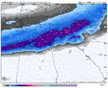
Painfully this will not be my storm but this in the outlook for Northern MS and this is dang impressive. Current point an click calls for 3-7 inches of snow with these temps. This is going to be a fun storm for you folks.

Twister
Member
I think upstate North of I85 has a pretty decent shot at seeing some winter weather early next week "If" we can get cold enough. It probably won't amount to Much but there could be some flying aroundPainfully this will not be my storm but this in the outlook for Northern MS and this is dang impressive. Current point an click calls for 3-7 inches of snow with these temps. This is going to be a fun storm for you folks.
View attachment 142025
Sent from my SM-S911U using Tapatalk
AlabamaWxWatcher
Member
Probably correct - looking more and more like I-20 may get a few hundredths of an inch of ice at best, and nothing more.Highly unlikely that every single model, including all of their Ensemble members are missing the snow that bad. If anything, maybe hwy 278 gets caught off guard in the eastern parts of AL
NBAcentel
Member
All the globals are struggling with the Strength of the TPV over Montana. Will be interesting to see how this effects the first initial batch 
rburrel2
Member
One more tick south and the upstate is in play.

accu35
Member
Looks to be a better chance of ice further towards the coast. Here in southwest Bama I’m sitting at a good spot for ice. Round 2 needs to be watch closely. Could be a bigger deal then what models are showingProbably correct - looking more and more like I-20 may get a few hundredths of an inch of ice at best, and nothing more.
NBAcentel
Member
“King” euro run trend across western sections. Runs ago it was nowhere near as moist 
Euro is a bit south again. Still waiting on more frames

NBAcentel
Member
And another tick southAll the globals are struggling with the Strength of the TPV over Montana. Will be interesting to see how this effects the first initial batch View attachment 142027

olhausen
Member
I’m putting my eggs in the short range since that’s what‘s giving me the most snow ?So Globals holding serve (maybe shifted 20 miles south or so over the past few runs), but the short range HiRes models really moving this north....I know which basket im putting my eggs in.
Euro 5 run trend ?

NBAcentel
Member
euro says I can drive a county north and find 2 inches of snow ? 
olhausen
Member


How's the coastal low on the Euro?
rburrel2
Member
Couple more shifts and you won't have to drive anywhere.euro says I can drive a county north and find 2 inches of snow ? View attachment 142033
LukeBarrette
im north of 90% of people on here so yeah
Meteorology Student
Member
2024 Supporter
2017-2023 Supporter

That early on band for yall and then this band in NRV. Now we cookin!???
NWMSGuy
Member
I believe I am sitting in a decent spot for now.Globals leaving us high and dry at the Kentucky Tennessee boarder.
View attachment 142034View attachment 142036View attachment 142037
Short range models crush the north though. Who will win? I’d take a meet up in the middle and cash out.
View attachment 142038View attachment 142039
Forevertothee
Member
The southern jog trend is evident now on the GFS and Euro. Still plenty of time to have it continue and put more of Upstate SC and CTL metro into play?euro says I can drive a county north and find 2 inches of snow ? View attachment 142033
LukeBarrette
im north of 90% of people on here so yeah
Meteorology Student
Member
2024 Supporter
2017-2023 Supporter
Not seeing much in the way of trends for the little coastal system from the Euro but if my memory serves me correctly it didn’t do well picking up the Jan 22 2022 system
Yep not digging as much, tilts too late and pretty much a whiffNot seeing much in the way of trends for the little coastal system from the Euro but if my memory serves me correctly it didn’t do well picking up the Jan 22 2022 system
JLL1973
Member
Yes you and I both are. Euro is probably a tad to south and cams are a little too far north. Split the difference and we’re goodI believe I am sitting in a decent spot for now.